
Instrumentation and Measurement Tools
Enroll to start learning
You’ve not yet enrolled in this course. Please enroll for free to listen to audio lessons, classroom podcasts and take practice test.
Interactive Audio Lesson
Listen to a student-teacher conversation explaining the topic in a relatable way.
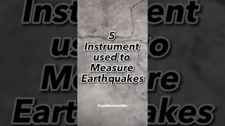
Seismographs
🔒 Unlock Audio Lesson
Sign up and enroll to listen to this audio lesson

Let's start with seismographs. Can anyone tell me what they are used for?

I think they record earthquakes.
Exactly! Seismographs are designed to detect and record seismic waves, especially P-waves, which arrive first during an earthquake. This initial data helps us locate hypocentres quickly.

How do they actually work?
Great question! Seismographs measure the motion of the ground using a mass suspended on a spring. Let’s remember that they are our ‘first responders’ in seismic analysis. We can use the acronym 'SEISMO' to recall: S for Seismic recording, E for Early detection, I for Impact assessment, S for Sensors, M for Motion tracking, and O for Origin point location.

So, they’re crucial for safety?
Absolutely! By providing real-time data, seismographs help inform emergency response efforts. So, remember, they are vital in understanding the initial phases of an earthquake!
Strong Motion Accelerographs
🔒 Unlock Audio Lesson
Sign up and enroll to listen to this audio lesson

Now, let's discuss strong motion accelerographs. Who has heard of them?

Aren't those used to measure vibrations during an earthquake?
That's correct! These instruments capture high-amplitude ground shaking, typically close to the epicentre, which is crucial for assessing how structures respond during seismic events.
Why is that important?
Understanding the intensity of shaking helps engineers design safer buildings. Think of strong motion accelerographs as the 'witnesses' on the ground during an earthquake. To remember their purpose, let’s use 'SHAKE': S for Structural monitoring, H for High amplitude, A for Assessment, K for Knowledge of effects, and E for Evaluation of resilience.
I see how they are indispensable.
Precisely! And let's not forget that data from accelerographs helps improve our predictive models for future seismic activity.
Global Positioning Systems (GPS)
🔒 Unlock Audio Lesson
Sign up and enroll to listen to this audio lesson
Next on our list, we have Global Positioning Systems, or GPS. What role do you think they play in earthquake research?
I think they track movements in the Earth's crust, right?
You're spot on! GPS is essential for studying crustal deformation near hypocentral regions, helping us track the earth’s slow movements even before an earthquake occurs.
How does that help us?
GPS data help identify stress accumulation regions. By anticipating potential faults, we can prepare better for seismic hazards. To remember their purpose, think 'ACCURATE': A for Analysis, C for Crustal monitoring, C for Change detection, U for Uplift studies, R for Risk assessment, A for Anticipation of earthquakes, T for Tracking movements, and E for Earthquake preparedness.
That makes sense! They really enhance public safety.
Borehole Seismic Arrays
🔒 Unlock Audio Lesson
Sign up and enroll to listen to this audio lesson
Finally, let's explore borehole seismic arrays. What do you think makes them special?
Are they placed underground?
Exactly! Borehole arrays are deployed deep underground to gather data about subsurface seismic activity close to fault lines, capturing detailed seismic data.
How does that differ from above-ground instruments?
Borehole arrays provide clearer signals as they are less affected by surface noise. They act as our 'subsurface spies' on seismic activity. To remember this concept, we could say 'UNDER': U for Underground location, N for Noise reduction, D for Detailed data, E for Earthquake insight, R for Real-time monitoring.
Got it! They must be very effective!
Absolutely! And the data they collect is invaluable for improving our understanding of seismic risks and enhancing building designs.
Introduction & Overview
Read summaries of the section's main ideas at different levels of detail.
Quick Overview
Standard
The section discusses various instruments essential for earthquake monitoring, including seismographs, GPS, strong motion accelerographs, and borehole seismic arrays. Each tool is crucial for capturing data on earthquake hypocentres and understanding seismic wave propagation.
Detailed
Instrumentation and Measurement Tools
This section focuses on the various tools and instruments crucial for measuring and monitoring hypocentres and seismic activities associated with earthquakes. Different types of instruments are employed to detect and gather data about seismic events, enhancing our understanding of earthquake mechanics and contributing to safety in structural design.
Key Instruments Discussed:
- Seismographs: These devices are vital for detecting and recording primary (P) waves, providing critical data for locating hypocentres.
- Strong Motion Accelerographs: These measure high-amplitude ground shaking near the epicentre, essential for assessing the intensity of seismic waves and their effects on structures.
- Global Positioning Systems (GPS): GPS tools are employed to study crustal deformations occurring in hypocentral regions, offering insights into ground movements post-earthquake.
- Borehole Seismic Arrays: These arrays provide high-quality data on subsurface seismic activity adjacent to fault lines, thereby aiding in a more detailed understanding of earthquake mechanisms.
These instruments not only help in estimating the precise location of hypocentres but are also crucial for disaster risk reduction and the planning of resilient infrastructure.
Youtube Videos


Audio Book
Dive deep into the subject with an immersive audiobook experience.
Seismographs
Chapter 1 of 4
🔒 Unlock Audio Chapter
Sign up and enroll to access the full audio experience
Chapter Content
- Seismographs: Detect and record P-waves.
Detailed Explanation
Seismographs are specialized instruments used to detect and record seismic waves, particularly the primary waves (P-waves) generated during an earthquake. They consist of a mass suspending on a spring that moves less than the ground during an earthquake, allowing the movement to be recorded on a paper or digital medium. By analyzing these recordings, seismologists can determine the time of the earthquake, its proximity, and its intensity.
Examples & Analogies
Think of a seismograph like a motion detector at a security system. Just as a motion detector picks up movements in a room and alerts you, a seismograph detects the 'movement' of seismic waves during an earthquake and helps researchers gauge how strong and damaging it might be.
Strong Motion Accelerographs
Chapter 2 of 4
🔒 Unlock Audio Chapter
Sign up and enroll to access the full audio experience
Chapter Content
- Strong Motion Accelerographs: Capture high-amplitude ground shaking near the epicentre.
Detailed Explanation
Strong Motion Accelerographs are advanced instruments designed to measure strong ground shaking during an earthquake, particularly close to the epicentre. They record the acceleration of the ground motion which is critical for understanding the forces that act on structures during a seismic event. This data is invaluable for engineers and scientists as it assists in the development of better building codes and safety measures.
Examples & Analogies
Imagine you are monitoring a busy freeway and need to observe the speed and sudden stops of cars during rush hour. A strong motion accelerograph works similarly by 'watching' how quickly the ground moves during an earthquake, which allows experts to adapt and strengthen building designs and prevent catastrophic failures.
Global Positioning Systems (GPS)
Chapter 3 of 4
🔒 Unlock Audio Chapter
Sign up and enroll to access the full audio experience
Chapter Content
- Global Positioning Systems (GPS): Used for crustal deformation studies near hypocentral regions.
Detailed Explanation
GPS technology is increasingly being used to study the Earth's crustal movements, especially in areas prone to seismic activity. By accurately measuring the position of points on the Earth's surface over time, scientists can detect subtle movements caused by tectonic processes, including those that lead to earthquakes. This data enhances the understanding of fault lines and the dynamics of tectonic plates.
Examples & Analogies
You can think of GPS in earthquake studies like how you track your favorite athlete's performance over time. Just as you would check their progress and changes in speed or direction, scientists use GPS to monitor vibrations and shifts in the Earth's crust to see how it reacts to tectonic forces.
Borehole Seismic Arrays
Chapter 4 of 4
🔒 Unlock Audio Chapter
Sign up and enroll to access the full audio experience
Chapter Content
- Borehole Seismic Arrays: Provide detailed data on subsurface seismic activity close to fault lines.
Detailed Explanation
Borehole Seismic Arrays consist of multiple sensors placed in deep boreholes to capture more detailed information about seismic activity occurring beneath the Earth's surface, particularly around fault lines. This type of data collection allows scientists to receive clearer signals than surface instruments can provide, as they are less affected by surface noise and are closer to seismic sources.
Examples & Analogies
Think of borehole seismic arrays as underwater microphones used to listen to sounds in the ocean. Just like these microphones can capture sounds from deep underwater more clearly without interference from waves or wind, borehole arrays can pick up seismic waves more distinctly from deep within the Earth, providing accurate data that enhances our understanding of seismic events.
Key Concepts
-
Seismographs: Devices that record seismic waves for locating earthquakes.
-
Strong Motion Accelerographs: Instruments that measure intense ground shaking and assess structural responses.
-
GPS: Tools that track ground movements in relation to seismic activity.
-
Borehole Seismic Arrays: Underground arrays providing detailed seismic data close to fault lines.
Examples & Applications
Seismographs are used in early warning systems to warn communities before the shaking reaches them.
Strong motion accelerographs provided data during the 2010 Haiti earthquake which helped assess building damages.
Memory Aids
Interactive tools to help you remember key concepts
Rhymes
Seismographs detect and tell, strong motion records we know so well.
Stories
Imagine a city where earthquakes strike. A seismograph listens closely, while GPS watches the ground shift like a sentinel at night.
Memory Tools
Use 'SHAKE' for strong motion: Structural monitoring, High amplitude, Assessment, Knowledge of effects, Evaluation.
Acronyms
ACCURATE for GPS
Analysis
Crustal monitoring
Change detection
Uplift studies
Risk assessment
Anticipation
Tracking
Earthquake preparedness.
Flash Cards
Glossary
- Seismograph
A device that detects and records seismic waves, especially P-waves, during an earthquake.
- Strong Motion Accelerograph
An instrument that measures and records high-amplitude ground shaking near the epicentre of an earthquake.
- Global Positioning System (GPS)
A system used for tracking crustal deformations by measuring ground movements in earthquake-prone regions.
- Borehole Seismic Array
An array of sensors placed underground to gather detailed data on subsurface seismic activity near fault lines.
Reference links
Supplementary resources to enhance your learning experience.