
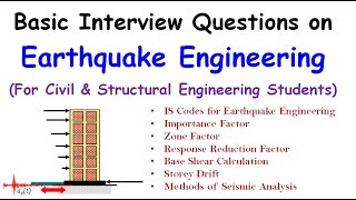
Recent Technological Advancements in Hypocentre Detection
Enroll to start learning
You’ve not yet enrolled in this course. Please enroll for free to listen to audio lessons, classroom podcasts and take practice test.
Interactive Audio Lesson
Listen to a student-teacher conversation explaining the topic in a relatable way.
Introduction to Technological Advancements
🔒 Unlock Audio Lesson
Sign up and enroll to listen to this audio lesson

Today, we will discuss how technology is reshaping our ability to detect hypocentres in seismic events. What do you think the hypocentre is?

Isn’t it the point where an earthquake starts beneath the surface?
Exactly! It's the focus of the earthquake. Now, how do you think advancements in technology can help in locating this point?

Maybe by using better equipment to measure the seismic waves?
Good point! Let's delve into how machine learning algorithms are making a difference in this area.
Machine Learning Algorithms
🔒 Unlock Audio Lesson
Sign up and enroll to listen to this audio lesson

Machine learning algorithms, trained on seismic datasets, can auto-locate hypocentres quickly. Can anyone think of why speed is important in this context?

Because faster detection can lead to quicker response times in emergencies?
Exactly! It helps us to issue early warnings to those in danger. Now, can anyone explain how these algorithms work?

They analyze previous seismic data and learn patterns to identify similar events in real-time?
That's correct! They help in making informed predictions based on past data.
Dense Seismic Arrays
🔒 Unlock Audio Lesson
Sign up and enroll to listen to this audio lesson
Let's move on to dense seismic arrays. What do you think they are and why they're essential?
Are they networks of sensors that help us track earthquakes more accurately?
Yes, networks like Hi-net and USArray allow for ultra-high resolution tracking, which even detects small seismic events. Why would this be beneficial?
Because it helps us understand more about the geological activity in those areas?
Exactly! With better data, we can improve our hazard assessments.
Satellite Remote Sensing
🔒 Unlock Audio Lesson
Sign up and enroll to listen to this audio lesson
Lastly, let's explore satellite remote sensing. Can someone explain what InSAR does?
Isn't InSAR used to detect changes in land deformation?
Correct! It helps validate rupture zones based on how the ground moves. Why is that important?
It helps us correlate what we detect on the ground with the data we get from seismic networks.
Exactly! It provides a comprehensive view of seismic events.
Introduction & Overview
Read summaries of the section's main ideas at different levels of detail.
Quick Overview
Standard
This section details how new technologies such as machine learning algorithms, dense seismic arrays, and satellite remote sensing have improved the efficiency of hypocentre location estimation. These innovations facilitate better monitoring and understanding of seismic activity, leading to improved disaster preparedness and risk mitigation.
Detailed
Recent Technological Advancements in Hypocentre Detection
This section explores the recent advancements in technology that have revolutionized hypocentre detection in the field of seismology. The hypocentre, which is the point of origin of seismic activity, is crucial for understanding earthquakes and their impact. With technological improvements, the speed and accuracy of locating hypocentres have increased significantly, enhancing our ability to monitor seismic activity effectively.
Key Advances:
- Machine Learning Algorithms: These algorithms are trained on extensive seismic datasets to detect hypocentres almost instantaneously, improving responsiveness in dense seismic networks. Their ability to auto-locate hypocentres allows for rapid assessments of seismic events.
- Dense Seismic Arrays and Nodals: Networks like Hi-net in Japan and USArray in the USA provide ultra-high resolution tracking, enabling the detection of microearthquakes and slow-slip events that were previously difficult to observe.
- Satellite Remote Sensing: Technologies such as InSAR (Interferometric Synthetic Aperture Radar) are employed to detect patterns of ground deformation, aiding in the cross-validation of rupture zones and determining the hypocentral depth.
These advancements highlight the vital role of technology in evolving earthquake research, enhancing our preparedness for seismic events and improving hazard assessment efforts.
Youtube Videos


Audio Book
Dive deep into the subject with an immersive audiobook experience.
Machine Learning Algorithms
Chapter 1 of 3
🔒 Unlock Audio Chapter
Sign up and enroll to access the full audio experience
Chapter Content
• Trained on seismic datasets to auto-locate hypocentres
• Capable of near-instantaneous detection in dense networks
Detailed Explanation
Machine learning algorithms have been developed to process vast amounts of seismic data. These algorithms are trained using existing datasets of seismic event information so that they can learn to identify patterns. When new seismic data come in, the algorithms can quickly determine where the hypocentres of earthquakes are located without human intervention. This is particularly useful in areas with dense seismic networks, allowing for rapid responses to seismic activities.
Examples & Analogies
Imagine teaching a smart assistant (like Siri or Alexa) to recognize your voice and respond to your commands. Over time, the assistant learns from the different ways you speak and can quickly understand you better each time. Similarly, machine learning algorithms learn from past earthquake data to make accurate predictions about new seismic events.
Dense Seismic Arrays and Nodals
Chapter 2 of 3
🔒 Unlock Audio Chapter
Sign up and enroll to access the full audio experience
Chapter Content
• Arrays like Hi-net (Japan) and USArray (USA) enable ultra-high resolution tracking
• Help detect microearthquakes and slow slip events
Detailed Explanation
Dense seismic arrays are networks of closely spaced seismic sensors that collect data from a wide area. These arrays provide a detailed overview of seismic activity by capturing even the smallest earthquakes, referred to as microearthquakes, and movements from slow slip events, which are gradual shifts along fault lines. This high-resolution data helps researchers understand seismic patterns better, improving earthquake monitoring and prediction.
Examples & Analogies
Think of a high-definition camera compared to a standard camera. A high-definition (HD) camera captures much more detail, allowing you to see tiny features and movements clearly. Similarly, dense seismic arrays provide a much clearer picture of what's happening underground, allowing scientists to spot even the faintest tremors.
Satellite Remote Sensing
Chapter 3 of 3
🔒 Unlock Audio Chapter
Sign up and enroll to access the full audio experience
Chapter Content
• InSAR (Interferometric Synthetic Aperture Radar) detects ground deformation patterns
• Used to cross-validate rupture zones and hypocentral depth
Detailed Explanation
Satellite remote sensing utilizes advanced radar technology to measure changes in the Earth's surface. One specific method, InSAR, allows scientists to observe how the ground deforms over time. This data can reveal patterns associated with earthquakes and, importantly, helps validate and refine the measurements of hypocentral depth. By comparing ground deformation data with expected fault movements, researchers can confirm the locations where earthquakes are likely to occur.
Examples & Analogies
Think of how a movie projector shows scenes in a film. It shines light on slides to create images on the screen, revealing details of the story. Similarly, satellite remote sensing techniques shine a metaphorical ‘light’ on ground movements, providing insights into the processes happening beneath the surface that we cannot see with the naked eye.
Key Concepts
-
Machine Learning Algorithms: Automated systems trained on seismic data that enable rapid location detection of hypocentres.
-
Dense Seismic Arrays: Advanced networks of seismic sensors that improve data resolution and detection capabilities.
-
InSAR Technology: A method of satellite remote sensing used to measure land surface motion and validate seismic data.
Examples & Applications
The use of machine learning algorithms enabled the rapid detection of hypocentres during the 2020 Crandall Canyon landslide.
Dense seismic arrays in California helped identify numerous microearthquakes, assisting in understanding coastal tectonics.
Memory Aids
Interactive tools to help you remember key concepts
Rhymes
Seismic waves from deep below, find the hypocentre, watch them go!
Stories
Imagine an earthquake. Deep within the Earth, a pressure builds until it can't anymore, and the fault breaks. The hypocentre is where this pressure release happens, and with new tech, we can see it almost instantly.
Memory Tools
Remember the term 'DIMS' for Hypocentre Detection: D for Data analysis, I for Instant detection, M for Machine Learning, S for Satellite sensing.
Acronyms
H.A.D. - Hypocentre Advances in Detection
Machine learning
Arrays
and Deformation monitoring.
Flash Cards
Glossary
- Hypocentre
The point within the Earth where an earthquake rupture initiates.
- Machine Learning
Algorithms and statistical models that enable computers to perform specific tasks without explicit instruction.
- Dense Seismic Arrays
Networks of closely spaced seismic sensors that enhance the resolution of seismic data.
- InSAR
Interferometric Synthetic Aperture Radar, a remote sensing technique used to detect ground deformation.
Reference links
Supplementary resources to enhance your learning experience.