
Recent Advancements and Digital Tools
Enroll to start learning
You’ve not yet enrolled in this course. Please enroll for free to listen to audio lessons, classroom podcasts and take practice test.
Interactive Audio Lesson
Listen to a student-teacher conversation explaining the topic in a relatable way.
Introduction to ShakeMaps
🔒 Unlock Audio Lesson
Sign up and enroll to listen to this audio lesson

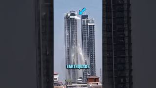
Today, we’re going to explore a critical advancement in earthquake monitoring called ShakeMaps. Can anyone explain what they think ShakeMaps are?

Are they maps that show how much the ground shakes during an earthquake?
Exactly! ShakeMaps illustrate the distribution of ground shaking across a region, indicating key metrics like Peak Ground Acceleration. This helps emergency services respond more effectively. How do you think these maps can assist during a real-time seismic event?

They can show where the shaking was strongest, helping responders prioritize where to go first.
Great insight! They indeed help in visualizing the ground effects, aiding decision-making. Remember the acronym 'PGA' for Peak Ground Acceleration as a key metric on ShakeMaps. Why do you think visualization is important?

It helps everyone understand the impact quickly!
Absolutely! Visual aids can convey complex information simply.
Mobile Apps for Seismic Intensity Measurement
🔒 Unlock Audio Lesson
Sign up and enroll to listen to this audio lesson

Now, let’s discuss the mobile applications like MyShake and LastQuake. What do you think these apps do?
Do they collect information about how people feel the earthquake?
Correct! These apps allow users to report their experiences, feeding real-time data into the system. This is crucial for assessing the seismic intensity quickly. Can anyone tell me how AI might improve these apps?
AI could analyze the incoming data to predict where the damage is most likely.
Exactly right! AI enhances our ability to estimate damage and provides insights from satellite imagery. Remember, apps like these improve public safety significantly.

So, the more users report, the better the data becomes!
Precisely! The crowd-sourced data can help create a clearer picture during emergencies.
Impact of Digital Tools on Emergency Response
🔒 Unlock Audio Lesson
Sign up and enroll to listen to this audio lesson
Let’s sum up how these advancements, like ShakeMaps and apps, are reshaping our emergency response protocols. Why do we think these digital tools are critical in disaster management?
They provide quick access to data, helping first responders act faster.
Exactly! Speed and accuracy in data analysis are key. What happens if responders are delayed?
People could be hurt or trapped longer than necessary!
Precisely! The goal is to mitigate harm. Remember, when seconds count, accurate information saved lives during past earthquakes.
Introduction & Overview
Read summaries of the section's main ideas at different levels of detail.
Quick Overview
Standard
Recent advancements in technology have significantly improved earthquake monitoring. Tools such as ShakeMaps and mobile applications allow for efficient data collection and dissemination of seismic intensity information, enhancing response efforts during seismic events.
Detailed
Recent Advancements and Digital Tools
This section highlights the latest technological innovations and digital tools that are transforming the field of earthquake monitoring and response. Among the notable advancements is the implementation of ShakeMaps, which are produced by agencies like the USGS (United States Geological Survey). ShakeMaps serve as digital representations of ground shaking distribution, showing key metrics including Peak Ground Acceleration (PGA), Peak Ground Velocity (PGV), and Modified Mercalli Intensity (MMI). These maps play a crucial role in emergency response, providing quick and accessible visual data to inform decision-making during and after an earthquake.
Moreover, the integration of Seismic Intensity Apps such as MyShake and LastQuake leverages user-based reporting to collect real-time intensity data. These applications utilize artificial intelligence (AI) tools to estimate seismic intensity and damage probabilities, incorporating satellite imagery and live data streams. The combination of these digital tools not only enhances our understanding of seismic events but also significantly improves public safety and emergency management strategies.
Youtube Videos


Audio Book
Dive deep into the subject with an immersive audiobook experience.
ShakeMaps
Chapter 1 of 2
🔒 Unlock Audio Chapter
Sign up and enroll to access the full audio experience
Chapter Content
• Produced by agencies like USGS.
• Digital maps showing ground shaking distribution (PGA, PGV, MMI).
• Useful for emergency response and communication.
Detailed Explanation
ShakeMaps are digital representations of how ground shaking was distributed across a region after an earthquake. Produced by the U.S. Geological Survey (USGS), these maps show important details such as Peak Ground Acceleration (PGA), Peak Ground Velocity (PGV), and Modified Mercalli Intensity (MMI). They are generated quickly after an earthquake strikes, making them vital tools for emergency responders to assess the situation and coordinate aid effectively.
Examples & Analogies
Imagine a teacher quickly creating a visual aid showing where students were most affected after a fire drill. Just like this visual aids helps staff respond appropriately, ShakeMaps help emergency managers know where to send rescue teams and resources, ensuring help reaches those in greatest need.
Seismic Intensity Apps and AI Tools
Chapter 2 of 2
🔒 Unlock Audio Chapter
Sign up and enroll to access the full audio experience
Chapter Content
• Mobile apps (e.g., MyShake, LastQuake) collect real-time intensity data from users.
• AI tools are being used to estimate intensities and damage probabilities using satellite imagery and real-time data.
Detailed Explanation
In recent years, mobile applications such as MyShake and LastQuake have emerged as powerful tools for collecting seismic intensity data from the general public. These apps allow users to report how strong the shaking felt in their location, providing immediate feedback that can be aggregated to understand the earthquake's impact. Additionally, artificial intelligence (AI) tools are being developed to analyze satellite imagery and real-time data, enabling quicker and more accurate estimations of intensity levels and potential damage across affected areas.
Examples & Analogies
Think of a social media platform where people can share their experiences during a storm, helping everyone understand its severity. Similarly, these apps enable citizens to act as 'informants', helping scientists and emergency services gain a clearer picture of an earthquake's actual effects, maximizing response efficiency.
Key Concepts
-
ShakeMaps: Digital representations of ground shaking, crucial for emergency responses.
-
Seismic Intensity Apps: Tools for gathering real-time data from user reports.
-
AI Tools: Enhancements in predicting damage and analyzing seismic impacts.
Examples & Applications
An example of a ShakeMap post-earthquake showing areas of heavy shaking.
Using the MyShake app during an earthquake allows users to report their experiences, contributing to a database that enhances emergency responses.
Memory Aids
Interactive tools to help you remember key concepts
Rhymes
ShakeMaps guide, showing where the quake did slide.
Stories
Imagine a city shaken by an earthquake. First responders use ShakeMaps to know which areas were hardest hit, prioritizing their help where it’s needed most.
Memory Tools
Think of 'Feelers' for apps: They gather user reports like a net catches fish.
Acronyms
SHAKE
Swift Help And Knowledge estimations through data.
Flash Cards
Glossary
- ShakeMaps
Digital maps displaying the distribution of ground shaking during an earthquake, produced by seismological agencies.
- Seismic Intensity Apps
Mobile applications that allow users to report their experiences of ground shaking to collect real-time data.
- AI Tools
Artificial intelligence technologies used to predict damage and analyze seismic intensity from various data inputs.
Reference links
Supplementary resources to enhance your learning experience.