
Future Developments in Response and Design Spectra
Enroll to start learning
You’ve not yet enrolled in this course. Please enroll for free to listen to audio lessons, classroom podcasts and take practice test.
Interactive Audio Lesson
Listen to a student-teacher conversation explaining the topic in a relatable way.
Integrating Machine Learning
🔒 Unlock Audio Lesson
Sign up and enroll to listen to this audio lesson

Today, we are exploring the integration of machine learning in response and design spectra. What do you think machine learning can bring to earthquake engineering?

Maybe it can help automate some modeling processes?
Exactly! By automating site response modeling, it can enhance accuracy and save time. Think about the efficiency—M.L. means Machine Learning!

Will it also help with predictions?
Yes, predictions will become more reliable as models improve with data. Remember, accurate predictions lead to safer designs!

Could it replace human analysts?
Not replace, but assist greatly! It's about synergy between technology and human expertise.
In summary, machine learning helps automate and improve accuracy in site response modeling!
Artificial Ground Motions
🔒 Unlock Audio Lesson
Sign up and enroll to listen to this audio lesson

Next, let's discuss artificial ground motions. Why might engineers opt for these instead of solely using historical data?

Maybe because it helps create more realistic testing environments?
Correct! They allow us to simulate various seismic scenarios that may not have been recorded yet, ensuring robust designs.
What are stochastic models?
Great question! Stochastic models predict ground motion based on statistical approaches, giving us flexibility in simulations.
So, it expands our understanding of seismic impacts?
Absolutely! It opens avenues for better preparation against potential earthquakes.
To summarize, artificial ground motions generated through stochastic models enhance testing by expanding scenarios.
Real-Time Design Spectra
🔒 Unlock Audio Lesson
Sign up and enroll to listen to this audio lesson
Now, let's explore real-time design spectra. How can early warning systems impact structural design?
They can provide immediate data that helps adapt designs on the fly!
Precisely! Real-time data allows us to generate updated design spectra instantly, promoting immediate responses and adaptations.
What advantages does this offer?
It improves safety measures and potentially reduces damage by allowing preemptive actions. Think emergency alert!
To conclude, real-time design spectra provide dynamic solutions for immediate seismic reassessment.
GIS and Remote Sensing
🔒 Unlock Audio Lesson
Sign up and enroll to listen to this audio lesson
Lastly, let's talk about GIS and remote sensing. Why are these technologies pivotal?
They can help analyze large areas for seismic impacts, right?
Exactly! They allow for regional assessments, making it easier to understand wide-ranging seismic responses.
Does this mean we can map vulnerability more precisely?
Absolutely! By coupling these technologies, we gain insights for targeted infrastructure developments.
Recall that GIS and remote sensing enhance regional seismic response knowledge significantly!
Introduction & Overview
Read summaries of the section's main ideas at different levels of detail.
Quick Overview
Standard
Future developments in response and design spectra include the integration of machine learning for automated site response modeling, utilization of artificial ground motions, real-time design spectra generation from early warning systems, and coupling with GIS and remote sensing for regional seismic response estimation.
Detailed
In the evolving field of earthquake engineering, continual advancements are crucial for improving structural resilience against seismic events. This section outlines future developments in response and design spectra, emphasizing the integration of modern technologies. These advancements include:
- Machine Learning: The potential application of machine learning algorithms will automate the modeling of site responses, thus enhancing the accuracy of predictions and reducing the time required for analysis.
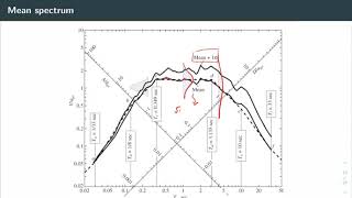
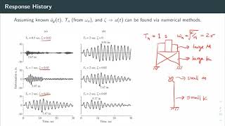
- Artificial Ground Motions: The use of artificial ground motions derived from stochastic models allows engineers to create realistic seismic scenarios for testing structural responses without relying solely on historical data.
- Real-time Design Spectra: Development of design spectra from real-time data provided by early warning systems can facilitate immediate assessments and design modifications in reaction to seismic events.
- GIS and Remote Sensing Integration: Utilizing Geographic Information Systems (GIS) and remote sensing technology will enable comprehensive regional seismic response estimations, offering valuable insights for infrastructure resilience planning and response strategies.
These advancements promise to reshape the landscape of seismic design and response, making structures safer and more adaptable to unforeseen seismic challenges.
Youtube Videos


Audio Book
Dive deep into the subject with an immersive audiobook experience.
Integration with Machine Learning
Chapter 1 of 4
🔒 Unlock Audio Chapter
Sign up and enroll to access the full audio experience
Chapter Content
Integration with Machine Learning for automated site response modeling
Detailed Explanation
This chunk discusses how machine learning can be utilized to automate the modeling of how a site will respond to seismic activity. Traditionally, the prediction of how structures respond to earthquakes involves complex calculations and manual design processes. Machine learning, by analyzing large datasets of previous earthquakes and their impacts, can learn patterns and trends, thereby providing quicker and more efficient predictions of site responses under seismic loads.
Examples & Analogies
Imagine teaching a child to recognize different types of fruits. Initially, the child might take time to learn which fruit is which. However, by showing the child many pictures and repeating the names, they gradually get better and faster at identification. Similarly, a machine learning model trains on numerous examples of earthquake data to improve its predictions over time.
Artificial Ground Motions Development
Chapter 2 of 4
🔒 Unlock Audio Chapter
Sign up and enroll to access the full audio experience
Chapter Content
Use of Artificial Ground Motions based on stochastic models
Detailed Explanation
This chunk covers the development of 'artificial ground motions', which are simulated seismic movements based on stochastic models. These artificial movements can be crucial when real seismic data is limited or not available for specific regions. By using statistical methods to simulate how ground motion behaves, engineers can create realistic earthquake scenarios that can be used to test structural responses during the design process.
Examples & Analogies
Think of how filmmakers use special effects to create scenes that wouldn't be possible to film in real life. The effects need to be realistic to maintain the story's integrity, much like artificial ground motions need to accurately mimic real seismic activity to ensure that structures can withstand potential earthquakes.
Real-Time Design Spectra Development
Chapter 3 of 4
🔒 Unlock Audio Chapter
Sign up and enroll to access the full audio experience
Chapter Content
Development of Real-time Design Spectra from early warning systems
Detailed Explanation
This part explains the creation of real-time design spectra that could arise from early earthquake warning systems. As soon as seismic activity is detected, the system can provide immediate data about expected ground motion, allowing for instant updates to design spectra. This helps in making informed decisions about safety measures or design adjustments for structures that might be affected by incoming seismic waves.
Examples & Analogies
Imagine a weather app that sends you alerts about severe weather conditions. If a storm is approaching, the app can notify you to take precautions. Similarly, real-time design spectra generated from early warning systems can alert engineers to adapt designs promptly before an earthquake strikes.
Coupling with GIS and Remote Sensing
Chapter 4 of 4
🔒 Unlock Audio Chapter
Sign up and enroll to access the full audio experience
Chapter Content
Coupling with GIS and remote sensing for regional seismic response estimation
Detailed Explanation
In this chunk, the focus is on integrating Geographic Information Systems (GIS) and remote sensing technologies into seismic response estimations. This means using spatial data and images from satellites to assess how different regions will respond to seismic activity. This coupling enables a comprehensive view of the landscape, helping to predict how geological features, urban planning, and infrastructure might affect seismic behavior.
Examples & Analogies
Consider how GPS apps provide traffic data by keeping track of all cars on the road in real time. By coupling GPS-like data with seismic analysis, engineers can get immediate feedback on how entire regions might respond to an earthquake, adjusting their designs based on real-world data, much like traffic management adjusts routes based on live traffic conditions.
Key Concepts
-
Machine Learning: Using algorithms to improve seismic response modeling.
-
Artificial Ground Motions: Simulations that help predict responses without solely relying on historical data.
-
Real-Time Design Spectra: Dynamic design spectra based on real-time information.
-
GIS and Remote Sensing: Technologies aiding in regional seismic analysis.
Examples & Applications
Using machine learning, engineers can predict building responses to various earthquake scenarios more accurately.
Artificial ground motions can produce simulation results for earthquakes that have not yet occurred but could potentially impact an area.
Memory Aids
Interactive tools to help you remember key concepts
Rhymes
Learning to assess ground shake, machine models prevent mistakes.
Stories
Once in a bustling city, engineers teamed up with smart machines that learned the patterns of ground movements, crafting designs instantly as alerts rang, saving lives before the tremors.
Memory Tools
M.A.R.G. - Machine learning, Artificial motions, Real-time spectra, GIS analyses.
Acronyms
S.E.I.S.M.I.C - Stochastic models, Enhanced designs, Integrated technologies for seismic modeling.
Flash Cards
Glossary
- Machine Learning
A branch of artificial intelligence that uses data and algorithms to imitate the way humans learn.
- Artificial Ground Motions
Synthetic seismic waveforms generated from statistical models to simulate ground movements.
- Stochastic Models
Statistical models used to predict unpredictable processes, such as seismic ground motion.
- RealTime Design Spectra
Design spectra generated dynamically using real-time data to provide immediate assessments.
- Geographic Information Systems (GIS)
Computer systems that analyze and display geographical data, which can be used for seismic planning.
- Remote Sensing
The acquisition of information about an object or area from a distance, often using satellite or aerial imagery.
Reference links
Supplementary resources to enhance your learning experience.
- Machine Learning in Structural Engineering
- Artificial Ground Motion Simulation
- Seismic Design Spectra: A Guide
- GIS in Earthquake Engineering
- Remote Sensing for Natural Disasters
- Introduction to Stochastic Modeling
- Real-Time Seismic Monitoring
- Geographic Information Systems (GIS)
- AI and Earthquake Response