
Digital Tools and Their Impact on Design
Enroll to start learning
You’ve not yet enrolled in this course. Please enroll for free to listen to audio lessons, classroom podcasts and take practice test.
Interactive Audio Lesson
Listen to a student-teacher conversation explaining the topic in a relatable way.
Understanding GIS and Its Application
🔒 Unlock Audio Lesson
Sign up and enroll to listen to this audio lesson

Today we'll be discussing Geographic Information Systems, or GIS, and how they impact our approach to design. GIS helps us visualize spatial data, making it essential for urban planning projects, especially in assessing hazards like landslides.

Can you explain how GIS helps in a real-life scenario?
Great question! For example, in urban planning, GIS allows us to analyze land use and identify areas susceptible to hazards, like flooding. Understanding these spatial relationships is crucial for effective planning.

What about scale? How does macro or micro-level application of GIS work?
Excellent point. At the macro level, we assess regions, while at the micro level, we focus on site-specific data. This transition is where many students experience challenges, so we must ensure they grasp both levels.

What kinds of projects typically use GIS?
Projects can vary from city planning to environmental assessments. GIS is incredibly versatile and can support a variety of design goals.

Can you give an example of how students get hands-on with GIS?
Certainly! During practical sessions, students might collect spatial data and create maps to inform their design proposals, bridging theory with real-world application.
In summary, GIS not only provides tools for analysis but also enhances our understanding of design problems across different scales. Make sure to reflect on how GIS connects various aspects of urban planning and design.
Hands-On Learning in Design
🔒 Unlock Audio Lesson
Sign up and enroll to listen to this audio lesson

Now, let's talk about hands-on learning experiences. I previously mentioned a project where students built a shelter quickly. Why do you think activities like this are beneficial?
They help us understand practical needs in design, like materials and time constraints.
Exactly! Learning to build a lightweight hut within hours teaches students about indigenous techniques and resourcefulness.
Does this kind of learning stick better than just reading about it?
Definitely! Experiences like these create lasting memories and insights, which are powerful learning tools.
How can these skills apply to real-life disaster scenarios?
By engaging with real communities and disaster contexts, students begin to see the bigger picture, understanding their roles and responsibilities in design.
Could we adopt similar practices in other areas of design?
Absolutely! This approach works wonders for various design disciplines—whether architecture or product design, practical experience enhances our problem-solving capabilities.
In conclusion, hands-on experiences are crucial for pushing students beyond theoretical knowledge and helping them gain applicable skills.
Synthesizing Information in Design
🔒 Unlock Audio Lesson
Sign up and enroll to listen to this audio lesson
Now let's discuss synthesizing information, an essential skill in design. How do you think we can effectively compile large amounts of information?
We could group topics and summarize key points.
Exactly! Summarizing helps distill information into manageable concepts, which is critical for comprehension.
What about using visuals?
That's an excellent idea! Creating posters or visual representations can significantly enhance retention.
What types of topics would be suitable for such projects?
Any topic relevant to our curriculum! For instance, we could explore climate conditions in different countries and trace their impact on design.
How can we apply this in groups?
Collaborative projects allow students to share insights and brainstorm. The focus should be on summarizing and integrating diverse viewpoints.
In summary, synthesizing information is a vital skill in design. It aids in effective communication and enhances understanding, particularly when working in groups.
Simulating Real-World Design Challenges
🔒 Unlock Audio Lesson
Sign up and enroll to listen to this audio lesson
Our final topic is role-playing simulations. These activities help students experience real-world challenges in design. Why are these important?
They allow us to understand different perspectives and considerations in a project.
Precisely! When assigned roles—like community planners or engineers—students learn to argue, discuss, and think critically about design solutions.
Can you give an example of a design challenge we could simulate?
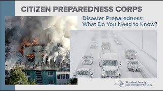
Certainly! Imagine working on a disaster recovery plan for a community affected by flooding. Each of you would play a role, tackling decisions collaboratively.
What skills does this improve?
It enhances critical thinking, teamwork, and understanding of socio-technical dynamics in design.
How can we ensure this is effective learning?
Debriefing sessions are crucial! After each simulation, discussing experiences helps students articulate what they've learned.
In summary, role-playing provides a unique window into real-world issues, fostering critical skills vital for future designers.
Introduction & Overview
Read summaries of the section's main ideas at different levels of detail.
Quick Overview
Standard
The section outlines the role of digital tools, notably Geographic Information Systems (GIS), in shaping understanding and practices in design. It emphasizes how these tools can enhance project planning at macro and micro levels, facilitate hands-on experiences, and support student learning in real-world contexts.
Detailed
Digital Tools and Their Impact on Design
This section delves into how digital tools are conditioning thought processes, understanding, and design skills among students. The emphasis is on Geographic Information Systems (GIS) and their application in projects such as urban and regional planning. These tools provide critical data, like hazard maps, which help students comprehend larger spatial contexts.
It explores the scales at which these tools operate—from macro to micro—and stresses the importance of understanding their relevance on-site. The use of practical, hands-on experiences illustrates this: examples include students constructing lightweight shelters in a short time, showcasing indigenous knowledge.
Moreover, the narrative captures the need for effective information synthesis through collaborative group projects on diverse topics, aimed at creating comprehensive reading materials. Role-playing exercises simulating real-world disaster contexts exemplify the complexity of design challenges and foster critical thinking. Finally, the section points to various geographical contexts where diverse tools have been utilized, underscoring a holistic approach to teaching design and disaster risk reduction (DRR).
Youtube Videos


Audio Book
Dive deep into the subject with an immersive audiobook experience.
The Role of Digital Tools in Design
Chapter 1 of 9
🔒 Unlock Audio Chapter
Sign up and enroll to access the full audio experience
Chapter Content
And this is where how the tools; the digital tools are also conditioning your thinking and your understanding process and also your design ability as well.
Detailed Explanation
Digital tools play a critical role in shaping how designers think and work. They influence the way designers understand problems and develop solutions, ultimately enhancing their design abilities.
Examples & Analogies
Think of digital tools like a chef's knives; just as professional-grade knives improve a chef's ability to prepare food quickly and precisely, digital design tools enhance a designer's capability to create effective and thoughtful designs.
GIS Tools in Urban Planning
Chapter 2 of 9
🔒 Unlock Audio Chapter
Sign up and enroll to access the full audio experience
Chapter Content
Now, one of the useful tools which have come up is the geographic spatial information technology; the GIS tools where you can see from one of my students work of the hazard landslip because the satellite imagery plays an important role.
Detailed Explanation
Geographic Information Systems (GIS) are vital for urban planners as they provide spatial data that helps in visualizing and understanding environmental issues, such as landslide hazards, through satellite imagery.
Examples & Analogies
Consider GIS tools as a GPS for urban planning; just as a GPS provides a route through complex road networks, GIS helps planners navigate the complexities of urban landscapes by illustrating potential hazards and resource locations.
Scaling GIS Tools
Chapter 3 of 9
🔒 Unlock Audio Chapter
Sign up and enroll to access the full audio experience
Chapter Content
Also, the GIS is one of the useful tool but one has to know what scale you have to apply and what scale, the macro-level scale to the micro-level scale, how one can understand.
Detailed Explanation
Understanding the appropriate scale of GIS data is essential. It should be applied correctly, from larger macro-level projects to specific micro-level assessments at the site level, to ensure effective outcomes.
Examples & Analogies
It's like taking a photograph. A wide-angle shot captures the entire landscape (macro), while a close-up shot shows fine details (micro). Both perspectives are important, just as different scales are crucial in design and planning.
Hands-On Learning Experiences
Chapter 4 of 9
🔒 Unlock Audio Chapter
Sign up and enroll to access the full audio experience
Chapter Content
So when we say about the psychomotor skills, we also demonstrated by with the help of Indira Gandhi Rashtriya Manav Sangrahalaya in Bhopal.
Detailed Explanation
Psychomotor skills involve coordination and physical movement. Engaging students in practical, hands-on experiences helps them not only learn skills but also fosters deeper understanding and retention of knowledge.
Examples & Analogies
Imagine a student learning to ride a bicycle; they understand the concept of balance in theory, but it’s only through practice that they become proficient. Similarly, practical sessions help students in architecture and design fully grasp concepts.
Collaboration and Community Engagement
Chapter 5 of 9
🔒 Unlock Audio Chapter
Sign up and enroll to access the full audio experience
Chapter Content
Also, when I was doing my research, I used to engage some of the B. Arch students along with me, I should take them to the villages and they used to interact with the villagers.
Detailed Explanation
Engaging students with communities allows them to gain real-world insights into the challenges faced by locals. This interaction enhances their understanding of design in context and opens their minds to various perspectives.
Examples & Analogies
This is like a travel expedition where students learn about different cultures first-hand. Just as travelers gain deep insights into a place through interaction, students learn by seeing and hearing the experiences of those who live in the environment they're studying.
Synthesizing Information Effectively
Chapter 6 of 9
🔒 Unlock Audio Chapter
Sign up and enroll to access the full audio experience
Chapter Content
And similarly, some of the things what I also developed is; we have so much of information to read but how much to read and how to synthesize it, it is a very important aspect.
Detailed Explanation
The ability to synthesize information from various sources is crucial in academic fields. Students need to learn not just to absorb information but to process and compile it effectively for better understanding.
Examples & Analogies
Think of a puzzle. Each piece provides a tiny detail, but only when all pieces are combined can the full picture be seen. Similarly, synthesizing information allows students to see the broader concepts.
Role-Playing Scenarios for Learning
Chapter 7 of 9
🔒 Unlock Audio Chapter
Sign up and enroll to access the full audio experience
Chapter Content
So, here for B plan students in SPA, Bhopal, what we did was we given them a task of a disaster context and then we made them into small groups.
Detailed Explanation
Role-playing scenarios simulate real-world situations where students can explore various roles in disaster management. This method helps them understand different perspectives and the collaborative nature of planning.
Examples & Analogies
It's akin to putting on a play; each actor must embody their character's role to tell a story. In the same way, students learn to appreciate the multifaceted nature of planning and response through role-play.
Analyzing Concepts of Build Back Better
Chapter 8 of 9
🔒 Unlock Audio Chapter
Sign up and enroll to access the full audio experience
Chapter Content
There is another concept, which I have used for teaching build back better is; I used to give them 2, 2 people in a group and then one chapter for build back better.
Detailed Explanation
Teaching the 'Build Back Better' concept involves collaborative learning where students critically analyze and summarize literature. This helps deepen their understanding and brings relevant themes to the forefront.
Examples & Analogies
Consider this process like studying for an exam in pairs. When students discuss concepts with each other, they often grasp ideas better than when studying alone. This dialogue encourages comprehension and retention.
Final Integration of Learning
Chapter 9 of 9
🔒 Unlock Audio Chapter
Sign up and enroll to access the full audio experience
Chapter Content
this is how I try to put together the various information; how they have adopted, how they have faced, what kind of tools they have used.
Detailed Explanation
Bringing together various lessons and experiences offers students a comprehensive outlook on the tools and strategies used in different geographical contexts, enhancing adaptive learning.
Examples & Analogies
It's similar to a chef creating a menu that combines different cuisines. By integrating diverse learning experiences, students develop a robust skill set that prepares them for real-world challenges in design and planning.
Key Concepts
-
Digital Tools: Technologies that aid in design processes.
-
GIS: Essential for spatial analysis in urban planning.
-
Hands-On Learning: Practical experience strengthens theoretical knowledge.
-
Synthesis of Information: Compiling and understanding diverse data.
Examples & Applications
Students using GIS to analyze land use in urban projects.
A practical exercise where students build a model shelter to study indigenous techniques.
Memory Aids
Interactive tools to help you remember key concepts
Rhymes
GIS helps us see, where hazards may be; in planning with ease, it maps like a breeze!
Stories
Imagine a group of students using GIS tools to plan a park. They find the best spot, considering flood risks, and create a beautiful design that will make life delightful!
Memory Tools
GREAT for GIS: Gather, Read, Evaluate, Apply, Test to remember steps in using GIS.
Acronyms
PRACTICE for hands-on learning
Physical
Real
Active
Collaborative
Tactical
Informative
Creative Engagement.
Flash Cards
Glossary
- Geographic Information Systems (GIS)
Digital tools for capturing, storing, analyzing, and managing spatial and geographic data.
- Urban Planning
The process of designing and regulating land use, infrastructure, and community development in urban areas.
- Psychomotor Skills
Skills that involve the coordination of physical movement and mental processing.
- Disaster Risk Reduction (DRR)
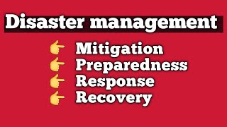
Strategies aimed at minimizing risks and impacts associated with disasters.
Reference links
Supplementary resources to enhance your learning experience.