
Learning and Reading Strategies
Enroll to start learning
You’ve not yet enrolled in this course. Please enroll for free to listen to audio lessons, classroom podcasts and take practice test.
Interactive Audio Lesson
Listen to a student-teacher conversation explaining the topic in a relatable way.
The Role of GIS in Education
🔒 Unlock Audio Lesson
Sign up and enroll to listen to this audio lesson

Today, we will discuss how Geographic Information Systems, or GIS, can play a vital role in education. Can anyone tell me what GIS is?

Isn’t it a system that helps in mapping and analyzing spatial data?
Exactly! GIS tools help visualize data through maps. For instance, when we study urban planning, GIS allows us to analyze elements like drainage layouts and hazard assessments. Why do you think that’s important?

It helps in understanding the geographical context better, right?
Correct! And integrating GIS at the B Arch level is crucial for larger projects. Let’s remember this acronym, G.I.S. - 'Geography In Synthesis'. What does that stand for, everyone?

Geography In Synthesis! It shows how we combine information to create a more comprehensive understanding.
Well done! In summary, GIS is not just a tool; it's an essential part of our educational toolkit.
Experiential Learning
🔒 Unlock Audio Lesson
Sign up and enroll to listen to this audio lesson

Hands-on experiences greatly enhance learning. Can anyone share an example of a hands-on project they've experienced?

We built that shelter in our workshop which was supposed to mimic real-life disaster scenarios.
That’s a great example! Building a shelter quickly teaches you about indigenous techniques and teamwork. Why do you think quick problem-solving is important in such scenarios?
It prepares us to think on our feet during actual disasters.
Exactly! Remember, the skills you build today will stay with you in your future careers. Let’s summarize that practical skills gained through hands-on learning improve retention and understanding!
Synthesis of Information
🔒 Unlock Audio Lesson
Sign up and enroll to listen to this audio lesson
Reading comprehension is key for synthesizing information. How do you usually approach reading academic materials?
I try to take notes, but sometimes I get lost in the details.
That’s common. A technique I suggest is summarizing the main points after reading a section. This 'Summarize First' method lets you capture key ideas, helping your understanding. Can anyone give me an example of how to apply this?
When we discussed climate conditions, I summarized the key elements in a poster format!
Great approach! Creating visuals like posters reinforces your learning. In summary, synthesizing and summarizing information enhances comprehension and retention.
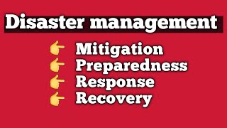
Role-Playing Disaster Scenarios
🔒 Unlock Audio Lesson
Sign up and enroll to listen to this audio lesson
We have a unique role-play exercise to simulate disaster management. What roles do you think could be involved?
Engineers, planners, and even representatives from the community!
Exactly! This role-playing mechanism allows students to explore different perspectives. Why is that beneficial?
It allows us to see the problem from various viewpoints, which is essential in real disaster scenarios.
Well said! By stepping into different shoes, we understand better how to collaborate and solve community challenges. Remember, role-playing enhances empathy and critical thinking!
Introduction & Overview
Read summaries of the section's main ideas at different levels of detail.
Quick Overview
Standard
The section emphasizes the significance of digital tools, specifically Geographic Information Systems (GIS), in shaping educational methodologies. It discusses the application of these tools in real-world scenarios and the importance of interactive, experiential learning. Additionally, the section underscores how to synthesize and effectively use information in educational contexts to enhance understanding.
Detailed
Detailed Summary
The section "Learning and Reading Strategies" introduces the role of digital tools, specifically Geographic Information Systems (GIS), in educational processes. It illustrates how these tools can condition thinking and understanding, facilitating the design process in educational contexts such as architecture and urban planning. GIS tools allow students to visualize complex information, such as hazard landslide intensity maps and drainage layouts, which contributes to better understanding for larger scale projects like city and regional planning.
Furthermore, the section discusses the importance of having hands-on training and real-world experiences to enhance learning. Examples from the author’s experiences in conducting workshops with students at various sites, including interactions with local communities and practical applications of design concepts, reinforce the need for experiential learning. By engaging in activities such as building a shelter within hours or role-playing disaster response scenarios, students learn practical skills along with theoretical knowledge.
The section emphasizes that synthesizing information is crucial for effective learning. It mentions the lack of reading materials for Disaster Risk Reduction (DRR) and the author’s initiatives to compile reading materials on various topics to enhance learning outcomes. Ultimately, these strategies aim to better equip students with practical skills and a deeper understanding of complex subjects, preparing them for real-world challenges.
Youtube Videos

Audio Book
Dive deep into the subject with an immersive audiobook experience.
Role of Digital Tools in Learning
Chapter 1 of 9
🔒 Unlock Audio Chapter
Sign up and enroll to access the full audio experience
Chapter Content
And this is where how the tools; the digital tools are also conditioning your thinking and your understanding process and also your design ability as well.
Detailed Explanation
Digital tools play a significant role in shaping how we think, understand concepts, and design projects. They provide various functionalities that enhance learning and streamline processes. For example, using software related to design can aid in visualizing ideas before implementing them in the real world.
Examples & Analogies
Think of it like using a sketches app on a tablet. Just as this app helps you see your ideas visually before they become real, digital tools in learning help clarify and organize thoughts and strategies before applying them practically.
Benefits of Geographic Information Systems (GIS)
Chapter 2 of 9
🔒 Unlock Audio Chapter
Sign up and enroll to access the full audio experience
Chapter Content
Now, the one of the useful tools which have come up with the geographic spatial information technology; the GIS tools where you can see from one of my students work of the hazard landslip because the satellite imagery plays an important role.
Detailed Explanation
Geographic Information Systems (GIS) are valuable in various fields, especially in architecture and planning. They provide spatial data, such as satellite imagery, which is essential for understanding large-scale projects, such as city or regional planning. When analyzing data from GIS, students can better comprehend the implications of their designs and understand potential hazards like landslips.
Examples & Analogies
Imagine a city planner using a map on a touchscreen. As they zoom in on the area they want to build on, they can see not only the street layouts but also the potential risk areas for landslides, which can help them design safer buildings.
Learning Through Hands-On Experience
Chapter 3 of 9
🔒 Unlock Audio Chapter
Sign up and enroll to access the full audio experience
Chapter Content
Also, the GIS is one of the useful tool but one has to know that what scale you have to apply and what scale the macro-level scale to the micro-level scale...
Detailed Explanation
Understanding how to apply tools like GIS at different scales is crucial for students. It allows them to take macro-level data and translate it to specific site-level projects. The experience enhances their psychomotor skills, which are essential for practical design and construction tasks.
Examples & Analogies
Consider a chef who needs to know both how to cook for a large event (macro) and how to prepare a single dish for an individual (micro). Similarly, students must understand how to use GIS for both large-scale planning and local site design.
Indigenous Knowledge and Rapid Construction
Chapter 4 of 9
🔒 Unlock Audio Chapter
Sign up and enroll to access the full audio experience
Chapter Content
This is a disaster of shelter which has been built by yerukula tribe in 3 hours’ time...
Detailed Explanation
The ability to create a lightweight shelter in a short period demonstrates indigenous knowledge and skills. By engaging in practical demonstrations (like constructing a hut in three hours), students not only learn about techniques but also appreciate the cultural significance of such practices.
Examples & Analogies
Imagine campers who, after learning how to quickly set up a tent can enjoy their outdoor experience more. Similarly, by learning rapid construction techniques, students can apply these skills practically and efficiently in future projects.
Interacting with Local Communities
Chapter 5 of 9
🔒 Unlock Audio Chapter
Sign up and enroll to access the full audio experience
Chapter Content
Also, when I was doing my research, I used to engage some of the B. Arch students along with me, I should take them to the villages...
Detailed Explanation
Engagement with local communities offers students an invaluable learning experience. By interacting with villagers and witnessing their challenges directly, students gain a deeper understanding of socio-economic contexts and develop empathy, which is crucial for effective planning and architecture.
Examples & Analogies
It’s like a student learning about wildlife only from books versus one who has been on a safari. The latter not only understands the animal but appreciates its environment and behaviors firsthand, leading to a richer understanding.
Synthesizing Reading Materials
Chapter 6 of 9
🔒 Unlock Audio Chapter
Sign up and enroll to access the full audio experience
Chapter Content
And similarly, some of the things what I also developed is; we have so much of information to read but how much to read and how to synthesize...
Detailed Explanation
Given the vast amount of information available, teaching students how to gather and synthesize relevant reading materials is essential. This not only aids in their understanding but helps them to consolidate knowledge effectively, which can later be presented as summarized material.
Examples & Analogies
Consider a student preparing for a big exam; instead of memorizing every book page, they focus on key concepts and summaries to retain information better. This strategy makes studying more efficient and effective.
Collaborative Role-playing for DRR
Chapter 7 of 9
🔒 Unlock Audio Chapter
Sign up and enroll to access the full audio experience
Chapter Content
So, here for B plan students in SPA, Bhopal, what we did was we given them a task of a disaster context...
Detailed Explanation
Creating a simulated disaster context where students take on different roles (such as engineers, planners, or community members) encourages collaborative learning and decision-making. This experiential learning approach deepens their understanding of real-world applications in Disaster Risk Reduction (DRR) by encouraging them to consider multiple perspectives.
Examples & Analogies
Think of a school play where students enact various characters in a story. Each student learns not just their lines but also gains insights into the overall narrative and characters, applying this understanding to real-life contexts.
Critical Analysis of Literature
Chapter 8 of 9
🔒 Unlock Audio Chapter
Sign up and enroll to access the full audio experience
Chapter Content
There is another concept, which I have used for teaching build back better is; I used to give them 2, 2 people in a group and then one chapter for the build back better...
Detailed Explanation
Assigning students to analyze literature related to building back better encourages critical thinking. By focusing on key terms and summarizing discussions instead of rote memorization, students engage actively with the material, enhancing retention and understanding.
Examples & Analogies
It’s similar to a book club where each member reads a book, then discusses and debates its themes and characters. This interactive approach leads to a deeper appreciation and understanding of the material.
Incorporating Global Perspectives
Chapter 9 of 9
🔒 Unlock Audio Chapter
Sign up and enroll to access the full audio experience
Chapter Content
So, and more importantly, I try to cover different geographical positions like Kenya, Pakistan, Australia or Turkey, China...
Detailed Explanation
Incorporating case studies from different regions allows students to understand diverse approaches to similar problems. By studying how various countries tackle challenges, they can adopt best practices and expand their global knowledge base.
Examples & Analogies
Imagine a student participating in an international science fair, where they learn not just about their project but also observe how peers from other countries approach scientific problems. This exposure broadens their horizons and impacts their own methodologies.
Key Concepts
-
GIS Tools: Enhance learning by visualizing and analyzing spatial data.
-
Experiential Learning: Learning through hands-on activities promotes knowledge retention.
-
Synthesis of Information: Critical for effective comprehension and application.
-
Role-Playing: Engages students in learning by simulating real-world scenarios.
Examples & Applications
Using GIS to map hazard landslide intensity to understand risk areas in urban planning.
Conducting a workshop where students build a shelter quickly to learn indigenous building techniques.
Memory Aids
Interactive tools to help you remember key concepts
Rhymes
When data's in maps, GIS is the game, It helps us analyze and learn in the same!
Stories
Imagine a group of students who used GIS to map their neighborhood for a school project. They found areas prone to floods and presented their findings using beautiful maps!
Memory Tools
Remember the acronym G.I.S. – 'Get Informed Spatially' to recall GIS's purpose.
Acronyms
E.L. stands for 'Experiential Learning,' emphasizing hands-on experience!
Flash Cards
Glossary
- Geographic Information Systems (GIS)
A system designed to capture, store, manipulate, analyze, manage, and present spatial or geographic data.
- Experiential Learning
A learning process through which students develop knowledge and skills from direct experiences outside a traditional academic setting.
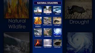
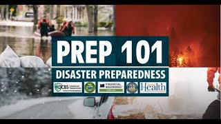
- Disaster Risk Reduction (DRR)
Efforts to reduce the damage caused by natural hazards like earthquakes, floods, and droughts.
- Synthesis of Information
The process of combining different ideas, influences, or objects into a coherent whole.
- Roleplaying
An activity where participants assume roles in a particular scenario to explore a situation or analyze behavior.
Reference links
Supplementary resources to enhance your learning experience.