
Airborne and Terrestrial Laser Scanning
Enroll to start learning
You’ve not yet enrolled in this course. Please enroll for free to listen to audio lessons, classroom podcasts and take practice test.
Interactive Audio Lesson
Listen to a student-teacher conversation explaining the topic in a relatable way.
Basics of Laser Scanning
🔒 Unlock Audio Lesson
Sign up and enroll to listen to this audio lesson

Laser scanning, also known as LiDAR, is a technology that captures spatial data by using laser pulses. Can anyone tell me what happens when these pulses hit an object?

I think it measures the distance based on how long it takes for the pulse to return.
Exactly! This is how we create 3D point clouds. Remember, LiDAR stands for Light Detection and Ranging. Can you repeat that?

LiDAR, Light Detection and Ranging.
Good! Now, can anyone explain what a point cloud is?

It’s a set of data points representing a 3D shape or surface!
Correct! Point clouds are essential for understanding the spatial representation captured through laser scanning.
Airborne Laser Scanning (ALS)
🔒 Unlock Audio Lesson
Sign up and enroll to listen to this audio lesson

Airborne Laser Scanning, or ALS, is mounted on aircraft and is useful for scanning large areas. What are some of the components used in an ALS system?

A laser scanner, GNSS for positioning, and an IMU for motion, right?
Yes! Each component plays a critical role in obtaining accurate data. Can anyone think of an advantage of ALS?
It can cover vast areas quickly.
Exactly! But what about its limitations?
It can be costly, and weather conditions can affect its performance.
Correct! Understanding these trade-offs is crucial when planning projects using ALS.
Terrestrial Laser Scanning (TLS)
🔒 Unlock Audio Lesson
Sign up and enroll to listen to this audio lesson
Now, let’s talk about Terrestrial Laser Scanning, or TLS. What do you think makes TLS different from ALS?
TLS is ground-based, while ALS is airborne?
Exactly! Since TLS operates from a stationary position, it can capture more detailed data of smaller areas. What types of TLS scanners can we find?
There are time-of-flight and phase-based scanners.
Great job! Each type has its own advantages and disadvantages. Could anyone share an application of TLS?
It’s often used in building surveying and historical site documentation!
Correct! And its applications continue to expand with new technology.
Data Processing and Applications
🔒 Unlock Audio Lesson
Sign up and enroll to listen to this audio lesson
After capturing data through ALS or TLS, we need to process it. What are some preprocessing steps you think are involved?
Maybe noise removal and registration of multiple scans?
Right! Clearing noise and aligning scans is critical for accurate outputs. What kind of outputs do you think we can generate?
We can create digital elevation models and 3D city models.
Exactly! These outputs help in various fields, from urban planning to disaster management.
Emerging Trends
🔒 Unlock Audio Lesson
Sign up and enroll to listen to this audio lesson
Finally, let’s explore some of the emerging trends in laser scanning. What do you think mobile laser scanning refers to?
Maybe using laser scanners mounted on vehicles?
Yes! It’s an effective way to survey roadways and corridors. Can you think of another integration?
UAV-based lasers, which are more cost-effective for smaller projects?
Exactly! Combining ALS with drones allows us to reach difficult areas.
What about AI applications?
Great question! AI is enhancing point cloud analysis, making automated classification and object detection possible. Keep an eye on these new developments!
Introduction & Overview
Read summaries of the section's main ideas at different levels of detail.
Quick Overview
Standard
The chapter provides a comprehensive overview of Airborne and Terrestrial Laser Scanning, detailing the fundamental concepts such as LiDAR, point clouds, and their operational workflow. It highlights the distinct applications and limitations of both techniques, along with evolving trends in the field.
Detailed
Airborne and Terrestrial Laser Scanning
This chapter delves into Airborne and Terrestrial Laser Scanning (LiDAR) technologies that transform spatial data acquisition in civil engineering and geospatial studies. By utilizing high-precision laser pulses to collect three-dimensional data, these technologies enable critical applications such as digital elevation modeling, urban planning, construction monitoring, and disaster assessment.
9.1 Basics of Laser Scanning
Laser scanning functions by emitting laser pulses to capture high-resolution spatial data, converting the time-of-flight of these pulses into measurable distances to create 3D point clouds. Key terms associated with this technology include LiDAR, point clouds, range, scan rate, and the field of view.
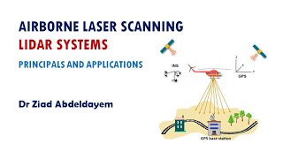
9.2 Airborne Laser Scanning (ALS)
ALS systems are mounted on aircraft to scan vast areas. The components include a laser scanner, GNSS for positioning, an IMU for orientation, and data storage units. ALS offers rapid data acquisition, high accuracy, and the ability to penetrate vegetation but faces limitations like high costs and reduced effectiveness in urban environments.
9.3 Terrestrial Laser Scanning (TLS)
TLS, on the other hand, involves ground-based scanners and is widely applied in surveying and structural documentation. The types of TLS scanners include time-of-flight, phase-based, and structured light scanners. While TLS provides high accuracy and real-time visualization, it is limited by range and environmental factors.
9.4 Data Processing and Point Cloud Analysis
This section outlines the characteristics of point clouds, preprocessing steps, and generation of outputs such as digital elevation models and 3D city models.
9.5 Comparison between ALS and TLS
The differences between ALS and TLS are highlighted, particularly in coverage, accuracy, and application areas.
9.6 Emerging Trends
These include mobile laser scanning, UAV applications, and integration with technologies like photogrammetry and artificial intelligence, fostering advancements in data acquisition and visualization.
9.7 Specialized Applications in Civil Engineering
Applications span structural health monitoring, road mapping, tunnel inspection, progress tracking, and heritage documentation, showcasing the versatility of laser scanning technologies.
Overall, a solid understanding of both Airborne and Terrestrial Laser Scanning opens avenues for applications across various sectors, emphasizing the importance of continual learning and adaptation of emerging technologies.
Youtube Videos


Audio Book
Dive deep into the subject with an immersive audiobook experience.
Introduction to Laser Scanning
Chapter 1 of 33
🔒 Unlock Audio Chapter
Sign up and enroll to access the full audio experience
Chapter Content
Laser scanning, also referred to as LiDAR (Light Detection and Ranging), has revolutionized spatial data acquisition in civil engineering and geospatial studies. It enables rapid, high-precision, three-dimensional data collection of terrains, infrastructures, vegetation, and buildings. In Geo-Informatics, understanding airborne and terrestrial laser scanning technologies is crucial, as they support applications such as digital elevation modeling, urban planning, construction monitoring, and disaster assessment. This chapter delves deep into the principles, components, operations, and applications of both Airborne Laser Scanning (ALS) and Terrestrial Laser Scanning (TLS).
Detailed Explanation
This introductory section discusses the significance of laser scanning technology, specifically LiDAR, in gathering spatial data. It highlights how this technology has transformed practices in civil engineering and geospatial research by allowing fast and accurate 3D data collection. Additionally, it notes its utility in various fields, including urban planning and disaster management, indicating that understanding both Airborne Laser Scanning (ALS) and Terrestrial Laser Scanning (TLS) is important for professionals in these areas.
Examples & Analogies
Imagine being an architect tasked with designing a new city park. Instead of manually measuring the terrain and existing structures, laser scanning allows you to capture the entire area in a matter of hours, providing you a detailed 3D map to work with. Just as a camera turns a scene into a photograph, LiDAR transforms a physical space into a digital model.
Basics of Laser Scanning
Chapter 2 of 33
🔒 Unlock Audio Chapter
Sign up and enroll to access the full audio experience
Chapter Content
9.1 Basics of Laser Scanning
9.1.1 Definition and Concept
Laser scanning is a method for capturing high-resolution spatial data by emitting laser pulses and measuring the time it takes for the pulses to return after hitting an object. The distance is calculated based on the speed of light, enabling the creation of 3D point clouds.
9.1.2 Key Terminologies
- LiDAR: Light Detection and Ranging
- Point Cloud: A set of data points in space produced by laser scanners.
- Range: Distance between the sensor and the target.
- Scan Rate: Number of laser pulses emitted per second.
- Field of View (FoV): Angular extent of the scanning area.
Detailed Explanation
In this section, we cover the fundamentals of laser scanning, beginning with its definition. Laser scanning uses laser pulses to measure distances accurately—when the pulse hits an object and returns, the time taken to return is used to calculate the distance. This process creates a 'point cloud,' a collection of points in a 3D space that reflects the scanned area. Understanding key terms is essential to grasp how laser scanning works; terms like LiDAR, point cloud, range, scan rate, and field of view are introduced to make clear the essential components of the technology.
Examples & Analogies
Think of laser scanning like a game of echolocation played by bats. Just as bats emit sound waves and listen for the echoes that return to understand their surroundings, laser scanners send out light pulses and measure how long they take to bounce back, creating a detailed map of everything around them.
Airborne Laser Scanning (ALS)
Chapter 3 of 33
🔒 Unlock Audio Chapter
Sign up and enroll to access the full audio experience
Chapter Content
9.2 Airborne Laser Scanning (ALS)
9.2.1 Overview
ALS systems are mounted on aircraft (usually fixed-wing or helicopters) and used to scan large areas. The laser scanner points downward and records ground and surface data over wide areas, making it suitable for topographic mapping and forest analysis.
9.2.2 System Components
- Laser Scanner: Emits laser pulses and detects returns.
- GNSS (Global Navigation Satellite System): Provides precise positioning.
- IMU (Inertial Measurement Unit): Measures the orientation and motion of the aircraft.
- Data Storage Unit: Records laser and position/orientation data for processing.
Detailed Explanation
This section introduces Airborne Laser Scanning (ALS), describing it as a system mounted on aircraft to cover extensive areas like forests or large landscapes. The laser scanner is pointed downwards to gather data about the surface below. Key components of the ALS system include the laser scanner itself, GNSS for accurate positioning, IMU for measuring the aircraft’s orientation, and data storage units for capturing and processing the data collected.
Examples & Analogies
Imagine you are a bird soaring above a forest. With a special camera that can take pictures of everything below, you can capture vast landscapes in one sweep. This is similar to what ALS does; it rapidly collects detailed information from above, making it invaluable for researchers and planners who need to analyze large areas swiftly.
Working Principle of ALS
Chapter 4 of 33
🔒 Unlock Audio Chapter
Sign up and enroll to access the full audio experience
Chapter Content
9.2.3 Working Principle
- Laser pulses are emitted towards the ground.
- Reflected signals are captured by the receiver.
- GNSS and IMU data are integrated to calculate the precise 3D coordinates.
- The result is a geo-referenced point cloud dataset.
Detailed Explanation
This part explains how Airborne Laser Scanning functions in practice. It starts with the lasing pulse being emitted to the ground, where it hits various surfaces and reflects back. The scanner then captures these reflections and, with the help of GNSS and IMU data, computes accurate 3D coordinates, resulting in a point cloud dataset that represents the scanned area in a spatially referenced manner.
Examples & Analogies
Think about throwing a ball against a wall and listening for the sound as it bounces back. Just like you can estimate how far away the wall is based on the time it takes for the sound to return, laser scanners determine distances by measuring how long it takes for the light to bounce back to the sensor, creating an accurate map of the surroundings.
Data Acquisition Parameters for ALS
Chapter 5 of 33
🔒 Unlock Audio Chapter
Sign up and enroll to access the full audio experience
Chapter Content
9.2.4 Data Acquisition Parameters
- Flying altitude: Affects the point density and coverage.
- Pulse frequency: Determines how many points per second are recorded.
- Scan angle: Influences coverage and shadow effects.
- Swath width: The width of the ground area scanned in one pass.
Detailed Explanation
In this section, we look at the various parameters that influence data acquisition in ALS. Flying altitude plays a crucial role—higher altitudes cover more area but might offer less detail, while lower altitudes provide denser point clouds. Pulse frequency affects how quickly data is collected, and the angle at which the scanner operates can create shadows or gaps in data. Additionally, swath width defines how wide the area scanned is in a single pass, impacting the overall efficiency of the data acquisition process.
Examples & Analogies
It's like adjusting the zoom on your camera while taking pictures. If you zoomed out too far, you'd capture a lot of the scenery but miss fine details; if you zoomed in too close, you'd see the details but lose the overall context. Similarly, flying height, pulse frequency, and scan angles need to be balanced in ALS so that the scanner captures both area coverage and detail effectively.
Advantages and Limitations of ALS
Chapter 6 of 33
🔒 Unlock Audio Chapter
Sign up and enroll to access the full audio experience
Chapter Content
9.2.5 Advantages of ALS
- Rapid acquisition over large and inaccessible areas.
- High point density and accuracy.
- Penetration through vegetation, useful for bare-earth modeling.
9.2.6 Limitations of ALS
- High operational cost.
- Limited by weather conditions and flight regulations.
- Reduced effectiveness in urban canyons and steep terrain due to occlusions.
Detailed Explanation
This section discusses both the advantages and limitations of Airborne Laser Scanning. The benefits include the ability to gather data quickly across extensive and challenging landscapes, providing high-density and accurate information, even penetrating vegetation for bare-earth data. However, ALS comes with limitations, including high costs, restrictions based on weather and regulatory challenges, and difficulties in urban environments where buildings can block signals.
Examples & Analogies
Consider ALS like a high-speed train: it can cover vast distances quickly and efficiently, but it may face delays due to bad weather or need to follow specific routes (like regulatory restrictions). While the train's speed and efficiency make it an excellent choice for long trips, it can’t always navigate every area smoothly, just like ALS's effectiveness can wane in certain environments.
Terrestrial Laser Scanning (TLS)
Chapter 7 of 33
🔒 Unlock Audio Chapter
Sign up and enroll to access the full audio experience
Chapter Content
9.3 Terrestrial Laser Scanning (TLS)
9.3.1 Overview
TLS involves ground-based laser scanners that capture 3D data of objects, structures, and terrain from a stationary position. It is widely used in surveying buildings, bridges, tunnels, archaeological sites, and heritage documentation.
9.3.2 Types of TLS Scanners
- Time-of-Flight (ToF) Scanners: Measure the time taken by a pulse to return.
- Phase-based Scanners: Measure phase difference between emitted and received signal for higher precision but shorter range.
- Structured Light Scanners: Project patterns and detect deformation to generate 3D data.
Detailed Explanation
This section provides an overview of Terrestrial Laser Scanning (TLS), which involves fixed-position scanners that collect 3D data from the ground. TLS is particularly useful for detailed surveys of smaller structures, such as buildings and bridges. There are different types of TLS scanners, including Time-of-Flight scanners that measure how long it takes for a pulse to return, Phase-based scanners that use variations in phase for precise measurements, and Structured Light scanners that utilize projected patterns to gather data about surfaces.
Examples & Analogies
Think of TLS as a photographer capturing scenes by standing still in one spot. Just like they use different lenses to capture detailed shots of a building or a piece of art, TLS utilizes different technologies to focus on capturing exact details of structures in 3D, ensuring that every corner and edge is represented accurately.
Operational Workflow of TLS
Chapter 8 of 33
🔒 Unlock Audio Chapter
Sign up and enroll to access the full audio experience
Chapter Content
9.3.3 Operational Workflow
- Setup and Calibration: Install and level the scanner on site.
- Scan Planning: Determine locations and settings for optimal coverage.
- Data Collection: Perform multiple scans to cover occlusions and blind spots.
- Registration: Align and merge multiple scans using reference points or cloud-matching.
- Post-Processing: Generate 3D models, CAD drawings, or other outputs.
Detailed Explanation
This section outlines the workflow for operating Terrestrial Laser Scanning systems. It begins with setting up and calibrating the scanner to ensure accurate data capture, followed by careful planning to determine where scans should be taken for complete coverage. Data collection involves conducting multiple scans to address areas that may be occluded or overlooked, and registration is the process of aligning these scans for a cohesive dataset. Finally, post-processing converts the collected data into usable formats, like 3D models or CAD drawings.
Examples & Analogies
Think about setting up a photo booth at a party. You need to place it in the right spot (setup and calibration), decide the best angles for photos (scan planning), take numerous pictures to capture everyone (data collection), piece together the best shots into a photo album (registration), and finally, create a printed book of memories (post-processing) that everyone can treasure.
Applications of TLS
Chapter 9 of 33
🔒 Unlock Audio Chapter
Sign up and enroll to access the full audio experience
Chapter Content
9.3.5 Applications of TLS
- Structural deformation monitoring
- 3D modeling of historical sites
- Indoor scanning for Building Information Modeling (BIM)
- Tunnel and bridge inspection
- Construction progress monitoring
Detailed Explanation
This section covers various applications of Terrestrial Laser Scanning, showcasing its versatility. TLS is widely used for monitoring structural changes, allowing for precise tracking of deformations in buildings or bridges. It’s also essential in 3D modeling historical sites, offering a digital preservation method. Additional applications include indoor scanning for BIM, inspecting tunnels and bridges for safety, and assisting in construction progress monitoring to ensure projects adhere to design specifications.
Examples & Analogies
Just like a doctor uses different diagnostic tools to monitor a patient's health—like X-rays or MRIs—engineers use TLS to examine the health of structures. Whether checking if a bridge has shifted or a historical site needs preservation, TLS provides a thorough view and accurate data, helping to maintain safety and integrity.
Advantages and Limitations of TLS
Chapter 10 of 33
🔒 Unlock Audio Chapter
Sign up and enroll to access the full audio experience
Chapter Content
9.3.6 Advantages of TLS
- High accuracy and resolution for small to medium-scale objects.
- Real-time data visualization.
- Non-contact and non-destructive measurement.
9.3.7 Limitations of TLS
- Limited range compared to ALS.
- Requires multiple setups for full coverage.
- Heavily affected by environmental conditions (e.g., fog, dust, sunlight).
Detailed Explanation
This section contrasts the advantages and limitations of Terrestrial Laser Scanning. Notably, TLS offers high accuracy and detail for smaller structures and the benefit of visualizing data in real-time. It also allows for non-destructive measurements, preserving the integrity of the object being scanned. However, TLS has its drawbacks, such as its limited range compared to ALS, the need for several setups to achieve full coverage of an area, and vulnerability to various environmental factors that can affect data quality.
Examples & Analogies
Consider TLS like a high-end camera that captures stunning detail. While it excels at close-ups and in controlled environments (like studio shots), it can struggle in bright sunlight or when trying to shoot across long distances. Similarly, TLS can provide incredible data for small-scale projects but faces challenges with range and environmental conditions.
Data Processing and Point Cloud Analysis
Chapter 11 of 33
🔒 Unlock Audio Chapter
Sign up and enroll to access the full audio experience
Chapter Content
9.4 Data Processing and Point Cloud Analysis
9.4.1 Point Cloud Characteristics
- XYZ coordinates: Each point has a position in 3D space.
- Intensity values: Measure the reflectivity of the surface.
- Color attributes: Some scanners record RGB values from integrated cameras.
Detailed Explanation
This section delves into how the data collected from laser scanning is processed and analyzed, focusing on point clouds. Each point in the point cloud has a coordinate (XYZ) that gives its position in 3D space. Additionally, intensity values indicate how reflective a surface is, while some advanced scanners also capture color information (RGB) to enrich the data, making it not only numerically informative but visually rich as well.
Examples & Analogies
Think of a 3D point cloud as a digital version of a mosaic made up of tiny tiles. Each tile (point) has specific coordinates, represents how bright or dark it is (intensity), and might even have a color (RGB) associated with it. Just as you can piece together a beautiful picture by understanding the individual tiles, you can analyze and recreate a represented space through point clouds.
Point Cloud Processing Steps
Chapter 12 of 33
🔒 Unlock Audio Chapter
Sign up and enroll to access the full audio experience
Chapter Content
9.4.2 Preprocessing Steps
- Noise removal
- Outlier filtering
- Data thinning or decimation
- Registration of scans
Detailed Explanation
This section addresses the steps needed to prepare point cloud data for analysis. Preprocessing is essential to ensure the data's accuracy, beginning with noise removal (removing random errors), outlier filtering (discarding points that are far from the expected data), and data thinning (reducing the number of points for efficiency). Lastly, registration of scans involves aligning different point clouds from multiple scans to create a cohesive dataset.
Examples & Analogies
Think of preprocessing like cleaning up a messy room before a big party. You have to remove unnecessary clutter (noise), sort through items that don’t belong (outliers), and perhaps rearrange the furniture to make it more functional (data thinning). Once the room is tidy, all guests feel more comfortable, similar to how clean, accurate data makes analysis more effective.
Point Cloud Classification
Chapter 13 of 33
🔒 Unlock Audio Chapter
Sign up and enroll to access the full audio experience
Chapter Content
9.4.3 Point Cloud Classification
- Segmentation of features like ground, vegetation, buildings.
- Machine learning and rule-based algorithms are used for automated classification.
Detailed Explanation
In this section, we explore how point clouds are classified to extract meaningful information. Features within the point cloud, such as ground, trees, and buildings, are segmented to help organize the data. Advanced algorithms, including those from machine learning, automate this classification process, enhancing efficiency and accuracy in identifying different elements in the scanned area.
Examples & Analogies
Imagine sorting through a basket of mixed fruits—you’d want to group apples together, bananas in another spot, and so on. Similarly, point cloud classification organizes all data points into categories (like ground vs. vegetation) to clarify what you’re looking at and make analysis easier.
Outputs from Point Cloud Analysis
Chapter 14 of 33
🔒 Unlock Audio Chapter
Sign up and enroll to access the full audio experience
Chapter Content
9.4.4 Generation of Outputs
- Digital Elevation Models (DEM)
- 3D city models
- Cross-sections and profiles
- Mesh models and CAD integration
Detailed Explanation
This section describes the various outputs generated from processed point clouds. Common outputs include Digital Elevation Models (DEMs), which indicate the terrain's shape; 3D city models that present urban environments; cross-sections that slice through the data for detailed views; and mesh models that provide a rendered visual representation, often integrated into CAD software for engineering applications.
Examples & Analogies
Think of the outputs like different products you can create from a single batch of dough. From the dough, you can shape it into cookies (3D city models), rolls (cross-sections), or sculpt it into intricate shapes like 3D art (mesh models). Each output utilizes the same base data but serves different purposes, just like your dough can become various delicious treats.
Comparison between ALS and TLS
Chapter 15 of 33
🔒 Unlock Audio Chapter
Sign up and enroll to access the full audio experience
Chapter Content
9.5 Comparison between ALS and TLS
| Feature | Airborne Laser Scanning (ALS) | Terrestrial Laser Scanning (TLS) |
|---|---|---|
| Platform | Aerial (aircraft/helicopter) | Ground-based (tripod or mobile) |
| Area Coverage | Large-scale | Small to medium-scale |
| Accuracy | Moderate to High | Very High |
| Point Density | Medium | High to Very High |
| Applications | Topography, Forest mapping | Structural scanning, BIM |
| Occlusion Issues | Less in open areas | High in complex structures |
Detailed Explanation
This section offers a side-by-side comparison of Airborne Laser Scanning (ALS) and Terrestrial Laser Scanning (TLS) across several parameters. ALS is designed for large-scale aerial surveys, generally providing moderate to high accuracy and medium point density, while TLS excels in small to medium-scale surveys with very high accuracy and point density. Occlusion issues are also addressed, with ALS being less affected by obstruction in open areas, whereas TLS experiences high occlusion challenges in complex structures like dense urban environments.
Examples & Analogies
Consider ALS like a drone capturing overhead views of a vast landscape, perfect for mapping out everything in a huge park quickly, while TLS is like a detailed artist sketching each building in a city block. The drone can cover more area with less detail, and the artist can zoom in on every feature, depicting them with high accuracy but needing more time to cover the same distance.
Emerging Trends in Laser Scanning
Chapter 16 of 33
🔒 Unlock Audio Chapter
Sign up and enroll to access the full audio experience
Chapter Content
9.6 Emerging Trends in Laser Scanning
9.6.1 Mobile Laser Scanning (MLS)
- Mounted on vehicles or backpacks.
- Ideal for corridor mapping (roads, railways).
9.6.2 UAV-based Laser Scanning
- Combines ALS with drone technology.
- Cost-effective for small and medium projects.
9.6.3 Integration with Other Technologies
- Photogrammetry: For colorizing point clouds.
- SLAM (Simultaneous Localization and Mapping): Real-time navigation and mapping without GPS.
- AI/ML for Automation: Automated classification and object detection.
Detailed Explanation
This section highlights recent developments in laser scanning technology, such as Mobile Laser Scanning (MLS) that can be mounted on vehicles or carried in backpacks for flexible mapping, particularly useful in corridor situations like roads or railways. UAV-based Laser Scanning combines drone technology with ALS, making it more accessible and affordable for smaller projects. Integration with other technologies, like photogrammetry for color enhancement and advanced AI for automation, is also discussed, underscoring the evolution and improvement of data collection methods.
Examples & Analogies
Imagine if your phone not only took pictures but also automatically recognized and labeled what’s in them. This is what new technologies in laser scanning are doing—they’re becoming smarter and more versatile, allowing for rapid assessments that integrate various information sources, similar to how modern smartphones have integrated cameras and powerful image processing.
Specialized Applications of Laser Scanning
Chapter 17 of 33
🔒 Unlock Audio Chapter
Sign up and enroll to access the full audio experience
Chapter Content
9.7 Specialized Applications of Laser Scanning in Civil Engineering
9.7.1 Structural Health Monitoring
Laser scanning provides millimeter-level accuracy for monitoring structural deformation, cracks, and settlements in buildings, bridges, dams, and towers. Periodic scanning allows the generation of temporal datasets for comparison over time to detect changes.
Detailed Explanation
This section discusses specialized applications of laser scanning in civil engineering, specifically for structural health monitoring. By using high-accuracy laser scanning, engineers can track minute changes in structures, such as deformations and cracks, which could indicate potential failures. Regular scans help build datasets that show how a structure changes over time, aiding in timely maintenance and safety assessments.
Examples & Analogies
Think of this as a fitness tracker for buildings. Just like a tracker keeps tabs on your activity levels and health data over time to prevent issues, laser scanning captures detailed structural data regularly to ensure that buildings and bridges remain safe and sound by monitoring any signs of distress before they become serious problems.
Road and Highway Corridor Mapping
Chapter 18 of 33
🔒 Unlock Audio Chapter
Sign up and enroll to access the full audio experience
Chapter Content
9.7.2 Road and Highway Corridor Mapping
TLS and Mobile Laser Scanning (MLS) are widely used in highway and urban road mapping:
- Captures features like curbs, pavements, poles, and signage.
- Generates digital terrain models (DTMs) for design and maintenance.
- Enables automated extraction of lane markings and roadside furniture.
Detailed Explanation
This part highlights the critical role of TLS and MLS in mapping roads and highways. These technologies enable comprehensive data capture of all necessary features like curbs, pavements, and traffic signs, which is essential for accurate planning and maintenance. Digital Terrain Models (DTMs) created from this data provide vital insights for engineers, and automation capabilities enhance efficiency by quickly identifying important features such as lane markings.
Examples & Analogies
Think of this as creating a detailed map for a new video game. Just as game designers need to know every obstacle and feature in their game's world for proper design, engineers use laser scanning to build accurate maps of roads, ensuring they have all the details they need for construction and maintenance. This way, nothing important gets overlooked.
Tunnel and Subway Inspection
Chapter 19 of 33
🔒 Unlock Audio Chapter
Sign up and enroll to access the full audio experience
Chapter Content
9.7.3 Tunnel and Subway Inspection
Laser scanning is deployed in underground structures where GNSS is not available. Benefits include:
- Cross-sectional analysis of tunnel linings.
- Detection of surface deformations.
- Mapping utilities and embedded elements in subways.
Detailed Explanation
This section addresses the utility of laser scanning for inspecting tunnels and subways, areas where GNSS signals may be unreliable. Laser scanners can accurately analyze tunnel linings and detect deformations while also mapping out hidden utilities and structures, ensuring that engineers can maintain and assess these hard-to-reach areas more effectively.
Examples & Analogies
It’s similar to using a smartphone to navigate in a basement where GPS may not work. Just as the phone’s internal sensors help you find your way in the dark, laser scanners can penetrate deep underground to provide critical data about tunnels and subways, ensuring they are safe for public use.
Construction Progress Tracking
Chapter 20 of 33
🔒 Unlock Audio Chapter
Sign up and enroll to access the full audio experience
Chapter Content
9.7.4 Construction Progress Tracking
By performing regular scans during the construction phase:
- Contractors can validate as-built models.
- Compare planned vs. actual dimensions.
- Resolve disputes through scan-to-BIM integration.
Detailed Explanation
This section discusses how laser scanning can be leveraged to track construction progress. By regularly scanning the construction site, contractors can compare the actual structure with the planned design, validating models and ensuring compliance. Furthermore, this technology helps resolve disputes, providing concrete data that assists in decision-making when disagreements arise regarding construction quality.
Examples & Analogies
Imagine building a LEGO set by following a guide. As you build, you constantly check your structure against the picture in the guide. If something doesn’t match up, you can quickly identify where the mistake is. Similarly, laser scanning helps builders confirm that their construction matches the design—catching mistakes before they become costly fixes.
Heritage and Archaeological Documentation
Chapter 21 of 33
🔒 Unlock Audio Chapter
Sign up and enroll to access the full audio experience
Chapter Content
9.7.5 Heritage and Archaeological Documentation
Laser scanning plays a major role in cultural heritage:
- Preserves fragile sites digitally.
- Enables virtual walkthroughs.
- Allows restoration planning using 3D modeling.
Detailed Explanation
This section outlines the importance of laser scanning in preserving cultural heritage. By documenting sites digitally, especially fragile ones, valuable history can be safeguarded for future generations. The technology allows for virtual walkthroughs that enhance public accessibility and understanding, along with supporting restoration efforts through detailed 3D models.
Examples & Analogies
Think of laser scanning as a digital time capsule for historical sites. Just as a treasure chest preserves artifacts for future exploration, laser scanning captures detailed records of important sites, allowing historians and restorers to maintain and reconstruct them accurately, ensuring that our heritage remains alive.
Data Fusion and Integration
Chapter 22 of 33
🔒 Unlock Audio Chapter
Sign up and enroll to access the full audio experience
Chapter Content
9.8 Data Fusion and Integration
Laser scanning becomes significantly more powerful when combined with other geospatial technologies.
9.8.1 LiDAR + Photogrammetry
- Enhances visual realism by applying color (RGB) to point clouds.
- Improves surface texture interpretation.
- Fuses geometry from LiDAR with texture from images.
Detailed Explanation
This section emphasizes the enhanced capability of laser scanning when integrated with other technologies like photogrammetry. By combining LiDAR data with photographic images, we can add color and texture to the point clouds, improving their visual realism and surface interpretation. This fusion results in more informative and meaningful data representations.
Examples & Analogies
Imagine a blueprint of a house that’s just black and white—helpful for basic understanding. Now, what if you add color to it, showing the actual wall paint and flooring? By integrating photogrammetry with laser scanning, the same concept applies: the result is not just a model, but a vivid visual representation that helps everyone understand the space better.
LiDAR + GNSS + IMU Integration
Chapter 23 of 33
🔒 Unlock Audio Chapter
Sign up and enroll to access the full audio experience
Chapter Content
9.8.2 LiDAR + GNSS + IMU
Especially relevant in ALS and Mobile Laser Scanning:
- GNSS provides global position.
- IMU captures roll, pitch, and yaw.
- Laser data is geo-referenced in real-time or post-processed.
Detailed Explanation
This section discusses how integrating GNSS and IMU with LiDAR makes data collection more accurate and reliable, particularly in ALS applications. GNSS provides precise global positioning, while the IMU helps track the specific orientation of the scanner, ensuring that the laser data captured is accurately geo-referenced in real time or during post-processing.
Examples & Analogies
Consider a GPS in your car that tells you your exact location on a map. Just as GPS works with other sensors to guide you accurately, the combination of GNSS and IMU works with LiDAR to provide precise spatial data, helping engineers accurately map areas even while they are on the move.
Integration with BIM and GIS
Chapter 24 of 33
🔒 Unlock Audio Chapter
Sign up and enroll to access the full audio experience
Chapter Content
9.8.3 Integration with BIM and GIS
- BIM software imports TLS data to maintain accuracy in structural models.
- GIS software uses ALS data for terrain analysis, land use planning, and disaster simulations.
Detailed Explanation
This section addresses the integration of laser scanning data with Building Information Modeling (BIM) and Geographic Information Systems (GIS). BIM utilizes TLS data to enhance the accuracy of structural models, while GIS employs ALS data for analyzing terrains, land use planning, and simulating potential disasters, demonstrating how laser scanning enhances infrastructure and urban planning.
Examples & Analogies
Think of it as combining the blueprints of a building with a detailed landscape map. Just as these blueprints and maps work together to help an architect design a space effectively, integrating laser scanning data with BIM and GIS helps professionals design and assess their projects more accurately and efficiently.
Legal, Ethical, and Regulatory Considerations
Chapter 25 of 33
🔒 Unlock Audio Chapter
Sign up and enroll to access the full audio experience
Chapter Content
9.9 Legal, Ethical, and Regulatory Considerations
9.9.1 Data Privacy and Surveillance
Laser scanners can unintentionally capture sensitive information:
- Faces, license plates, or private property.
- Operators must follow privacy laws such as GDPR (in Europe) or India's IT Rules.
Detailed Explanation
This section highlights the legal and ethical challenges associated with laser scanning, particularly regarding data privacy. Laser scanners can inadvertently collect identifiable information, such as faces or vehicle license plates. Therefore, operators of these technologies have a legal obligation to comply with privacy laws, ensuring that data collected respects individuals' rights and adheres to legal standards.
Examples & Analogies
Imagine you’re taking photographs at a public event. While you might capture a beautiful crowd shot, some faces could appear in your photos without their consent. Similarly, laser scanners can pick up sensitive details, bringing into question the need to navigate privacy laws to avoid issues while still capturing needed data.
Airspace Regulations for ALS and UAVs
Chapter 26 of 33
🔒 Unlock Audio Chapter
Sign up and enroll to access the full audio experience
Chapter Content
9.9.2 Airspace Regulations for ALS and UAVs
- Requires permissions from aviation authorities (e.g., DGCA in India).
- Flight corridors, altitude, and sensor use may be restricted.
Detailed Explanation
This part explains the regulatory considerations for using Airborne Laser Scanning (ALS), particularly concerning airspace regulations. Laser scanning conducted from aerial platforms requires approval from aviation authorities, which may impose restrictions related to flight paths, altitude, and sensor usage, highlighting the complexities involved in airborne data collection.
Examples & Analogies
Think of it like needing a permit to set off fireworks in your neighborhood. Just as there are specific laws and approvals that govern where and how to set them off, aerial laser scanning regulations exist to ensure safety and accountability in airspace while conducting data collection tasks.
Data Ownership and Licensing
Chapter 27 of 33
🔒 Unlock Audio Chapter
Sign up and enroll to access the full audio experience
Chapter Content
9.9.3 Data Ownership and Licensing
- Define data rights in contracts (who owns raw scans vs. processed outputs).
- Government-funded scans may be publicly accessible under open-data policies.
Detailed Explanation
In this section, we address data ownership and licensing agreements linked to laser scanning outputs. It's crucial to define data rights in contracts, determining who holds ownership of raw scanning data and any processed outputs. Additionally, if scans are funded by the government, there may be regulations that require them to be made publicly accessible, an important aspect for transparency and public use.
Examples & Analogies
Consider when you order custom art from an artist. The artist may agree that you own the painting, but the sketch or digital drafts remain their creative property. Similarly, understanding ownership in scanned data helps clarify who can use or share the results while maintaining intellectual control.
Standards and Accuracy Specifications
Chapter 28 of 33
🔒 Unlock Audio Chapter
Sign up and enroll to access the full audio experience
Chapter Content
9.10 Standards and Accuracy Specifications
Laser scanning outputs are subject to global accuracy standards for use in civil and surveying applications.
9.10.1 ASPRS LAS Format
- Widely accepted format for storing and exchanging LiDAR data.
- Supports classification, RGB, intensity, GPS time, and other metadata.
Detailed Explanation
This section covers the standards and accuracy specifications relevant to laser scanning outputs, particularly concerning the ASPRS LAS format. It’s crucial for efficiently storing and sharing LiDAR data, as this format supports various attributes, such as classification and intensity, along with essential metadata like GPS time. Adhering to such standards ensures that data is compatible and maintains integrity across different applications and usages.
Examples & Analogies
Imagine a universal charging cable that can connect your phone to any outlet—making it easy to share or power up your device anytime, anywhere. Similarly, the ASPRS LAS format acts like a universal connector for LiDAR data, ensuring that it’s accessible and useful across various applications, promoting efficient sharing and collaboration.
Accuracy Classes of Laser Scanning
Chapter 29 of 33
🔒 Unlock Audio Chapter
Sign up and enroll to access the full audio experience
Chapter Content
9.10.3 Accuracy Classes
- Classified as per scanning method, range, and application.
- Class I: Engineering surveys (±2–5 mm).
- Class II: General topographic surveys (±10–15 cm).
- Class III: Reconnaissance or vegetation mapping (±0.5–1 m).
Detailed Explanation
This section explains how laser scanning outputs are categorized into accuracy classes based on the scanning method and intended use. Class I pertains to precision engineering surveys with very tight tolerances of ±2 to 5 mm, while Class II and Class III offer lesser precision suitable for broader applications like topographic surveys and vegetation mapping.
Examples & Analogies
Think of these accuracy classes like different levels of measuring tools in carpentry. A micrometer (Class I) provides extreme precision for high-stakes tasks, a standard ruler (Class II) is sufficient for most DIY projects, and a yardstick (Class III) may be used for broader measures in larger spaces. Knowing which tool to use ensures the right level of precision for the job.
Future Prospects in Laser Scanning
Chapter 30 of 33
🔒 Unlock Audio Chapter
Sign up and enroll to access the full audio experience
Chapter Content
9.11 Future Prospects in Laser Scanning
9.11.1 LiDAR-on-a-Chip
- Miniaturized LiDAR sensors for integration into smartphones, autonomous vehicles, and wearable devices.
- Promises consumer-grade 3D scanning for mass applications.
Detailed Explanation
This section touches upon future developments in laser scanning technology, notably miniaturizing LiDAR sensors into compact forms suitable for everyday devices like smartphones and wearables. This transformation could open doors for widespread consumer-level 3D scanning, making the technology accessible to a larger audience for various applications.
Examples & Analogies
Think about how smartphones have evolved from basic calling devices into powerful mini-computers that capture high-quality photos and videos. Similarly, the evolution of LiDAR technology into small chips could lead to consumers being able to scan their environments with ease, just as they take selfies, empowering everyone with the ability to create rich 3D models swiftly.
AI-Powered Point Cloud Analytics
Chapter 31 of 33
🔒 Unlock Audio Chapter
Sign up and enroll to access the full audio experience
Chapter Content
9.11.2 AI-Powered Point Cloud Analytics
- Object recognition, change detection, and classification using deep learning.
- Drastically reduces human effort in post-processing.
Detailed Explanation
This section outlines the integration of artificial intelligence with point cloud analysis, where AI can facilitate tasks like object recognition and change detection using deep learning. This technological advancement significantly reduces the manual effort needed during post-processing by automating many steps involved in cleaning and analyzing data.
Examples & Analogies
Picture having a personal assistant who can instantly analyze your emails and highlight the most important messages. Similarly, AI in point cloud analytics acts as a powerful assistant, managing the vast amount of data captured and streamlining analysis, allowing professionals to focus on decisions rather than getting bogged down in data.
Cloud-Based LiDAR Platforms
Chapter 32 of 33
🔒 Unlock Audio Chapter
Sign up and enroll to access the full audio experience
Chapter Content
9.11.3 Cloud-Based LiDAR Platforms
- SaaS platforms for remote data access, visualization, and collaboration.
- On-demand computing power for terabyte-scale point clouds.
Detailed Explanation
This part discusses the trend towards cloud-based platforms that provide Software as a Service (SaaS) for managing LiDAR data. These platforms enable users to access, visualize, and collaborate on large datasets remotely, leveraging on-demand computing power to handle extensive point clouds without needing specialized hardware.
Examples & Analogies
Think of cloud-based LiDAR platforms as virtual studios where artists collaborate from different locations. Like artists sharing a canvas, engineers and scientists can work together on large datasets instantly, making it easier to collaborate on projects regardless of their physical location.
Integration with Digital Twin Technology
Chapter 33 of 33
🔒 Unlock Audio Chapter
Sign up and enroll to access the full audio experience
Chapter Content
9.11.4 Digital Twin Integration
- Laser scans used to build dynamic, real-time digital replicas of infrastructure.
- Supports lifecycle management, predictive maintenance, and smart city planning.
Detailed Explanation
This section highlights the evolution of laser scanning technology into creating digital twins, which are real-time digital counterparts of physical structures. Laser scanning data feeds into these digital models to enable better lifecycle management of infrastructure, facilitating planning for maintenance and development in smart cities.
Examples & Analogies
Imagine having a precise model of a city that updates in real-time based on new developments—like a video game that changes as players add new buildings. This digital twin technology allows city planners to visualize changes over time and proactively manage urban environments, adapting to needs as they arise.
Key Concepts
-
LiDAR: A technology that uses laser pulses to measure distances and capture data.
-
Point Cloud: A data structure consisting of numerous points in 3D space, typically used in geographic information systems.
-
ALS vs. TLS: Highlights the differences in operational environments, applications, and limitations in data gathering techniques.
Examples & Applications
Example 1: ALS is utilized in forestry to measure tree heights and biomass.
Example 2: TLS is often used in construction to monitor structural integrity during building processes.
Memory Aids
Interactive tools to help you remember key concepts
Rhymes
LiDAR in the sky, catches data as it flies.
Stories
Imagine a laser beam traveling from a plane, down to the earth, measuring distances without pain.
Acronyms
L-A-S-E to remember
for LiDAR
for Airborne
for Scanning
for Efficiency.
L-I-D-A-R
Luminous Insights via Data And Ranging.
Flash Cards
Glossary
- LiDAR
Light Detection and Ranging, a technology used for capturing spatial data using laser pulses.
- Point Cloud
A collection of data points in space created by laser scanners to represent 3D shapes or surfaces.
- Range
The distance measured between the laser sensor and the target object.
- Scan Rate
The number of laser pulses emitted per second by the scanner.
- Field of View (FoV)
The angular extent of the scanning area that can be captured by the laser scanner.
- Global Navigation Satellite System (GNSS)
A system that provides precise positioning information, critical for georeferencing in laser scanning.
- Inertial Measurement Unit (IMU)
A device used to measure the orientation and motion of the aircraft or scanner.
Reference links
Supplementary resources to enhance your learning experience.