
Terrestrial Laser Scanning (TLS)
Enroll to start learning
You’ve not yet enrolled in this course. Please enroll for free to listen to audio lessons, classroom podcasts and take practice test.
Interactive Audio Lesson
Listen to a student-teacher conversation explaining the topic in a relatable way.
Overview of TLS
🔒 Unlock Audio Lesson
Sign up and enroll to listen to this audio lesson

Today, we’ll explore Terrestrial Laser Scanning, or TLS for short. Who can tell me what they think TLS entails?

I think it's about using lasers to scan things on the ground.
Exactly! TLS involves collecting 3D data of surfaces and structures from a stationary position. It's essential in applications like surveying buildings and archaeological sites. Can anyone tell me how this method might be advantageous?

It seems like it could give very detailed results!
Great observation! TLS offers high accuracy and resolution for capturing small to medium-scale objects. Now, what comes to mind about its limitations?

Maybe it can't scan really large areas?
That's correct! The range is limited compared to other systems like Airborne Laser Scanning. To remember that, think about 'TLS for Tiny Levels of Scale.'
So, to sum up, TLS is great for detailed scanning but is limited in range. Let's dig deeper into the types of scanners used!
Types of TLS Scanners
🔒 Unlock Audio Lesson
Sign up and enroll to listen to this audio lesson

Now, can anyone name the different types of TLS scanners we can use?

I know one is Time-of-Flight scanners!
Yes! ToF scanners measure how long it takes for a laser pulse to return, which helps calculate distance. What about other types?
What about Phase-based scanners? They sound familiar.
Spot on! Phase-based scanners measure the phase difference between emitted and received signals and offer higher precision at shorter ranges. And what about Structured Light scanners?
They project patterns to create the 3D shapes, right?
Correct! They can detect surface deformations efficiently. So remember: ToF measures time, Phase-based measures phase, and Structured Light projects patterns. Can anyone summarize what we learned so far?
TLS includes different types of scanners that specialize in different ways of capturing data.
Excellent summary!
Operational Workflow of TLS
🔒 Unlock Audio Lesson
Sign up and enroll to listen to this audio lesson
What would you think are the basic steps required for a successful TLS scan?
Setting it up and calibrating first, right?
That's correct! Setup and calibration ensure the scanner is correctly positioned. The second step is scan planning; why do you think that’s important?
To know where to scan for the best coverage?
Exactly! It's critical to ensure optimal coverage and avoid blind spots. What follows data collection?
Registration to align all the scans together?
Yes! During registration, we align multiple scans using reference points. Lastly, post-processing leads to the outputs—like 3D models or CAD drawings. Overall, remember: Setup, Plan, Collect, Register, and Process, or SPCRP for short!
That sounds helpful to remember the steps!
Absolutely! This structured workflow is crucial to effective TLS operation.
Introduction & Overview
Read summaries of the section's main ideas at different levels of detail.
Quick Overview
Standard
TLS uses stationary laser scanners to collect detailed 3D data of objects and structures, allowing for applications in architecture, construction, archaeology, and more. This method effectively documents spatial details with high accuracy while overcoming challenges often found in complex urban environments.
Detailed
Terrestrial Laser Scanning (TLS)
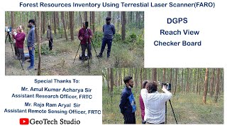
Terrestrial Laser Scanning (TLS) refers to the technique of collecting high-resolution three-dimensional data of physical objects and terrains from a stationary position using ground-based laser scanners. TLS allows surveying professionals to capture detailed geometric information for various applications, including building surveys, infrastructure monitoring, archaeological documentation, and heritage preservation.
Key Points Covered:
- Types of TLS Scanners: Includes Time-of-Flight (ToF) scanners for measuring time intervals, Phase-based scanners for improved precision, and Structured Light scanners for capturing surface details.
- System Components: Discusses crucial parts of a TLS setup, such as the laser scanner unit, control software, target markers for georeferencing, and support mechanisms.
- Operational Workflow: Outlines the steps involved in TLS, from setup and calibration to data collection and post-processing, ensuring systematic capturing and usage of the scanned data.
- Applications of TLS: Heavy emphasis on its use for structural deformation monitoring, creating 3D models, and inspecting infrastructure.
- Advantages and Limitations: Highlights high accuracy and real-time visualization while also noting the limitations in range compared to airborne systems, as well as environmental constraints.
In summary, TLS is integral for precise documentation and analysis, providing significant value in civil engineering and related fields.
Youtube Videos


Audio Book
Dive deep into the subject with an immersive audiobook experience.
Overview of TLS
Chapter 1 of 7
🔒 Unlock Audio Chapter
Sign up and enroll to access the full audio experience
Chapter Content
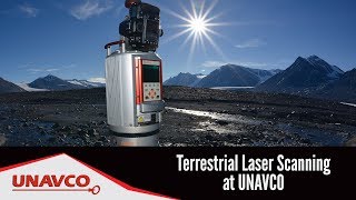
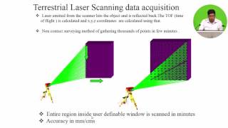
TLS involves ground-based laser scanners that capture 3D data of objects, structures, and terrain from a stationary position. It is widely used in surveying buildings, bridges, tunnels, archaeological sites, and heritage documentation.
Detailed Explanation
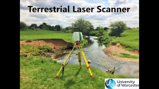
Terrestrial Laser Scanning (TLS) is a method used to collect three-dimensional data from the ground level. Unlike Airborne Laser Scanning, which uses equipment mounted on aircraft, TLS uses stationary laser scanners that gather data from one location. This makes TLS particularly effective for detailed surveys of objects like buildings, bridges, and archaeological sites. The point clouds formed from this data can present a highly accurate representation of the scanned objects or terrains.
Examples & Analogies
Imagine trying to photograph a sculpture from various angles to capture its details. Just like how taking multiple photos from different sides gives a complete view, TLS captures detailed 3D data that provides a thorough representation of structures or landscapes.
Types of TLS Scanners
Chapter 2 of 7
🔒 Unlock Audio Chapter
Sign up and enroll to access the full audio experience
Chapter Content
• Time-of-Flight (ToF) Scanners: Measure the time taken by a pulse to return.
• Phase-based Scanners: Measure phase difference between emitted and received signal for higher precision but shorter range.
• Structured Light Scanners: Project patterns and detect deformation to generate 3D data.
Detailed Explanation
There are different types of TLS scanners, each with its own method of data collection. Time-of-Flight scanners calculate distance based on how long it takes for the laser pulse to return after hitting an object. Phase-based scanners determine distance by measuring the phase shift of reflected light signals, which allows for precise measurements but at a shorter range. Structured light scanners project light patterns onto objects and measure the deformation of these patterns to create 3D models. Each type offers specific advantages depending on the operational requirements.
Examples & Analogies
Think of it like different tools in a toolbox. A hammer may be great for nails, but a screwdriver is necessary for screws. Similarly, each scanner type has its unique strengths for various scanning tasks. Time-of-Flight is like a stopwatch measuring how long it takes to run a race, while phase-based scanning is like a very precise timer that counts every fraction of a second.
System Components of TLS
Chapter 3 of 7
🔒 Unlock Audio Chapter
Sign up and enroll to access the full audio experience
Chapter Content
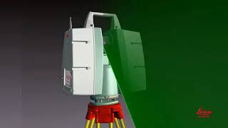
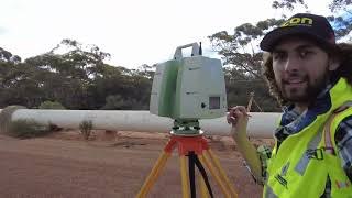
• Laser Scanner Unit: Emits and receives laser beams.
• Control Unit/Software: Controls scanning parameters and stores data.
• Target Markers/Reflectors: Used for georeferencing and registration.
• Tripod or Mobile Platform: Supports the scanner at survey locations.
Detailed Explanation
The TLS system consists of several important components. The laser scanner unit is the core element that sends out and detects laser beams. The control unit or software is responsible for managing how the scanning is performed and for recording the collected data. Target markers, which can be reflective surfaces, are often placed at different points to help in aligning the data accurately. Finally, the scanner needs to be stable, so it is generally mounted on a tripod or mobile platform to maintain position during scanning.
Examples & Analogies
Imagine a professional photographer preparing for a photo shoot. They need a camera (the laser scanner), a computer to adjust settings and store photos (the control unit), special lights or reflectors for better images (target markers), and a sturdy stand to hold the camera steady (the tripod). Each of these components plays a crucial role in producing quality results.
Operational Workflow
Chapter 4 of 7
🔒 Unlock Audio Chapter
Sign up and enroll to access the full audio experience
Chapter Content
- Setup and Calibration: Install and level the scanner on site.
- Scan Planning: Determine locations and settings for optimal coverage.
- Data Collection: Perform multiple scans to cover occlusions and blind spots.
- Registration: Align and merge multiple scans using reference points or cloud-matching.
- Post-Processing: Generate 3D models, CAD drawings, or other outputs.
Detailed Explanation
The operational workflow of TLS is critical for successful data collection. Initially, the scanner must be set up and calibrated to ensure accurate measurements. This involves leveling it so that it captures data correctly. Next, planning where and how to scan is essential for obtaining comprehensive data coverage—this means considering where shadows or obstructions might occur. During data collection, multiple scans are often needed to ensure thoroughness, particularly in spots that may be hard to reach. After collecting the scans, they need to be registered, which means aligning and merging the data from various scans into a single coherent model. Finally, post-processing involves creating usable outputs, such as detailed 3D models for further analysis or designs.
Examples & Analogies
Think about how you would take a group photo at a family reunion. First, you set up the camera on a tripod to ensure stability (setup and calibration). Then, you decide where to stand to get everyone in the shot (scan planning). You take several photos to catch everyone’s good side (data collection). Afterward, you organize those photos into an album, ensuring they flow well together (registration), and finally, you create the photo book to share with family (post-processing).
Applications of TLS
Chapter 5 of 7
🔒 Unlock Audio Chapter
Sign up and enroll to access the full audio experience
Chapter Content
• Structural deformation monitoring
• 3D modeling of historical sites
• Indoor scanning for Building Information Modeling (BIM)
• Tunnel and bridge inspection
• Construction progress monitoring
Detailed Explanation
TLS has a variety of applications across different fields. It is often used for monitoring the structural integrity of buildings and bridges, as it can detect even small changes over time. In archaeology and preservation, TLS provides accurate layouts of historical sites to aid in restoration efforts. In construction, TLS can assist in creating detailed indoor models that are integrated into Building Information Modeling (BIM) workflows, which help in planning and executing building projects. Additionally, it is valuable for inspecting tunnels and bridges, and for monitoring the progress of construction by comparing planned designs with actual builds.
Examples & Analogies
Consider a doctor conducting regular check-ups on a patient. Just as the doctor monitors health changes over time to prevent more serious issues, TLS monitors structures to catch any deformation that may require repairs. Similarly, a historian using TLS to scan an ancient ruin can preserve the site digitally, much like a photographer encapsulates moments in time in a photo album.
Advantages of TLS
Chapter 6 of 7
🔒 Unlock Audio Chapter
Sign up and enroll to access the full audio experience
Chapter Content
• High accuracy and resolution for small to medium-scale objects.
• Real-time data visualization.
• Non-contact and non-destructive measurement.
Detailed Explanation
TLS offers several key advantages. One of the most significant is its high accuracy and resolution, which is beneficial for measuring small to medium-sized objects or spaces. It allows for real-time data visualization, meaning that operators can see the data being collected as it happens, which aids in making immediate decisions on-site. Finally, because it is a non-contact method, TLS does not physically interact with the objects being measured, which means it won’t cause any damage or disturbance.
Examples & Analogies
Imagine using a high-definition camera to capture intricate details of a small sculpture. Just like that camera can reveal every fine line and shade, TLS provides detailed measurements of objects without altering them. Additionally, it’s a bit like a doctor using an ultrasound; they can see inside the body without touching it, ensuring that no harm is done while gathering important information.
Limitations of TLS
Chapter 7 of 7
🔒 Unlock Audio Chapter
Sign up and enroll to access the full audio experience
Chapter Content
• Limited range compared to ALS.
• Requires multiple setups for full coverage.
• Heavily affected by environmental conditions (e.g., fog, dust, sunlight).
Detailed Explanation
While TLS has numerous advantages, it does also have its limitations. One key limitation is that it has a shorter range than Airborne Laser Scanning (ALS), meaning it may not be suitable for large-scale surveying tasks that require extensive coverage. Additionally, to capture a wider area with TLS, multiple setups may be necessary, which can be time-consuming and resource-intensive. Furthermore, its effectiveness can be significantly reduced due to environmental conditions like fog, dust, or bright sunlight, all of which can interfere with the laser signals.
Examples & Analogies
Think of TLS like a magnifying glass. While it allows you to see small details up close, you can only view a small area at a time. If you want to see a huge wall, you’d need to move that glass around a lot. Similarly, if it’s foggy, the magnifying glass can’t focus clearly, just like TLS struggles in adverse weather to capture accurate data.
Key Concepts
-
Terrestrial Laser Scanning (TLS): A technique for capturing 3D data from a stationary position.
-
Types of TLS Scanners: Includes Time-of-Flight, Phase-based, and Structured Light scanners.
-
Operational Workflow of TLS: Involves setup, scan planning, data collection, registration, and post-processing.
Examples & Applications
An architect using TLS to monitor the stability of a building over time.
An archaeologist employing TLS to document a historical site without causing physical disruption.
Memory Aids
Interactive tools to help you remember key concepts
Rhymes
When scanning the land, don’t be bland; TLS will help your work stand!
Stories
Imagine an archaeologist using TLS to carefully document a fragile site while keeping the integrity intact.
Memory Tools
Remember SPCRP: Setup, Plan, Collect, Register, Post-Process!
Acronyms
Take note of TLS for Terrific Laser Scanning.
Flash Cards
Glossary
- Terrestrial Laser Scanning (TLS)
A method for capturing high-resolution 3D data of objects and structures from a stationary position using ground-based laser scanners.
- TimeofFlight (ToF) Scanner
A type of TLS scanner that measures the time it takes for a laser pulse to return after hitting an object to calculate distance.
- Phasebased Scanner
A TLS scanner that measures phase differences between emitted and received laser signals to achieve higher precision but shorter range.
- Structured Light Scanner
A TLS scanner that projects patterns (or light) onto a surface to collect 3D shape information, often used for scanning deformations.
- Registration
The process of aligning and merging multiple scans together using reference points or cloud-matching techniques.
- PostProcessing
The actions taken after data collection to generate usable outputs like 3D models or drawings from the collected data.
Reference links
Supplementary resources to enhance your learning experience.