
Career and Research Prospects in GNSS for Civil Engineers
Enroll to start learning
You’ve not yet enrolled in this course. Please enroll for free to listen to audio lessons, classroom podcasts and take practice test.
Interactive Audio Lesson
Listen to a student-teacher conversation explaining the topic in a relatable way.
Career Roles in GNSS
🔒 Unlock Audio Lesson
Sign up and enroll to listen to this audio lesson

Today, we're going to discuss career roles in GNSS. Can anyone tell me some potential career paths for civil engineers interested in GNSS?

I think they can work as survey engineers, especially with RTK technology.
Exactly! Survey Engineers often specialize in RTK surveys and construction layouts. What other roles can you think of?

What about geospatial analysts? They work with GIS and spatial decision-making, right?
Yes! Geospatial Analysts play a critical role in integrating GNSS data into various projects. Now, let's consider UAV surveyors. What do they do?

They use drones for terrain modeling and surveying!
Great point! UAV surveyors utilize GNSS for high-accuracy modeling in projects. Remember the acronym 'SGU', which stands for Survey Engineer, Geospatial Analyst, and UAV Surveyor, to recall these roles. Let's summarize the key career paths: Survey Engineers, Geospatial Analysts, and UAV Surveyors. Does anyone have any questions about these roles?
Research Opportunities in GNSS
🔒 Unlock Audio Lesson
Sign up and enroll to listen to this audio lesson

Now that we’ve covered career roles, let’s talk about research prospects in GNSS. What are some areas engineers might explore academically?

How about studying error correction algorithms?
Excellent! Error correction algorithms are crucial for enhancing GNSS accuracy. Any other ideas?
Integrating GNSS data with AI/ML could also be a fascinating area of research.
Exactly! The integration of GNSS with AI can optimize various processes. Let's also think about smart city planning — how GNSS can influence asset tracking and mobility infrastructure.
That seems really important for urban development!
Absolutely! Urban planners are beginning to see the value of real-time GNSS data in infrastructure management.
So to recap, research opportunities include error correction algorithms, GNSS integration with AI/ML, and smart city applications. Great discussion!
Introduction & Overview
Read summaries of the section's main ideas at different levels of detail.
Quick Overview
Standard
The section highlights potential career paths such as Survey Engineer, Geospatial Analyst, UAV Surveyor, and opportunities in academic research and smart city planning. It emphasizes the importance of GNSS in enhancing civil engineering projects and urban development.
Detailed
Career and Research Prospects in GNSS for Civil Engineers
This section focuses on the expanding career and research opportunities available within the field of Global Navigation Satellite Systems (GNSS) for civil engineers. As GNSS technology continues to evolve, professionals who specialize in this area are highly sought after in a variety of roles that leverage positioning, navigation, and timing data.
Key Career Prospects
- Survey Engineer: Specializing in Real-Time Kinematic (RTK) surveys, construction layouts, and cadastral surveys.
- Geospatial Analyst: Engaging in GIS/GNSS integration and spatial decision-making across various projects.
- UAV Surveyor: Using GNSS in drone technology for accurate terrain modeling, which is crucial for planning and development.
Research Opportunities
Academics can explore GNSS signal modeling, error correction algorithms, and the integration of GNSS with Artificial Intelligence/Machine Learning (AI/ML) for enhanced functionality.
Moreover, with the focus on smart cities, there is a growing demand for engineers to utilize GNSS for real-time asset tracking and mobility infrastructure planning, demonstrating significant relevance in urban management and logistics.
The importance of GNSS in civil engineering not only enhances the efficiency and precision of engineering works but also plays a vital role in urban planning, infrastructure development, and safety management.
Youtube Videos


Audio Book
Dive deep into the subject with an immersive audiobook experience.
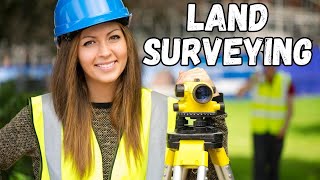
Survey Engineer
Chapter 1 of 5
🔒 Unlock Audio Chapter
Sign up and enroll to access the full audio experience
Chapter Content
• Survey Engineer – Specialized in RTK surveys, construction layout, cadastral surveys.
Detailed Explanation
A Survey Engineer focuses on the application of GNSS technology, particularly Real-Time Kinematic (RTK) surveys, which allow for precise measurements during construction projects. They ensure that buildings and other structures are accurately positioned according to design specifications. Cadastral surveys are another key area, where Survey Engineers define property boundaries using GNSS data.
Examples & Analogies
Imagine a Survey Engineer as a modern-day treasure map maker. Just like the map guides you to the treasure, a Survey Engineer uses GNSS technology to find the exact location where a construction site should be placed, ensuring that everything fits perfectly within the landscape.
Geospatial Analyst
Chapter 2 of 5
🔒 Unlock Audio Chapter
Sign up and enroll to access the full audio experience
Chapter Content
• Geospatial Analyst – Working in GIS/GNSS integration and spatial decision-making.
Detailed Explanation
Geospatial Analysts focus on integrating GNSS data with Geographic Information Systems (GIS) to analyze and visualize spatial data. Their role involves studying geographical patterns and making informed decisions based on satellite positioning data, which helps in urban planning, resource management, and environmental monitoring.
Examples & Analogies
Think of a Geospatial Analyst like a puzzle master. They have pieces of information from various sources, including GNSS, and they need to fit these pieces together to create a clear picture of the environment, much like completing a puzzle to see the full image.
UAV Surveyor
Chapter 3 of 5
🔒 Unlock Audio Chapter
Sign up and enroll to access the full audio experience
Chapter Content
• UAV Surveyor – Using GNSS for drone-based terrain modeling.
Detailed Explanation
UAV Surveyors utilize drones equipped with GNSS technology to capture aerial imagery and terrain data. This data is essential for creating 3D models of the landscape, which can be used for topographical mapping, assessing land use, and planning new developments. The GNSS ensures accurate positioning of the drone during surveys.
Examples & Analogies
Picture a UAV Surveyor as a bird’s-eye view artist. They fly drones high in the sky to get a complete view of the land below, just like an artist steps back to capture a large landscape scene, ensuring every detail is in the right place.
Academic Research
Chapter 4 of 5
🔒 Unlock Audio Chapter
Sign up and enroll to access the full audio experience
Chapter Content
• Academic Research – GNSS signal modeling, error correction algorithms, integration with AI/ML.
Detailed Explanation
Academic researchers in the field of GNSS explore complex topics such as signal modeling and error correction algorithms that improve the accuracy and reliability of GNSS systems. Additionally, they investigate how artificial intelligence (AI) and machine learning (ML) can enhance GNSS applications, leading to innovative solutions in positioning and navigation.
Examples & Analogies
Consider academic researchers as detectives in a tech mystery. They dig deep into data and algorithms, seeking out ways to solve the puzzles of GNSS inaccuracies, much like a detective meticulously gathers clues to uncover the truth behind a case.
Smart City Planning
Chapter 5 of 5
🔒 Unlock Audio Chapter
Sign up and enroll to access the full audio experience
Chapter Content
• Smart City Planning – GNSS-based real-time asset tracking and mobility infrastructure.
Detailed Explanation
In the context of Smart City Planning, GNSS technology is used to track assets in real time, such as vehicles, public transport systems, and urban infrastructure. This data supports the development of efficient mobility solutions, enhances traffic management, and aids in resource allocation to improve urban living conditions.
Examples & Analogies
Imagine Smart City Planning as orchestrating a complex dance performance. GNSS acts like the conductor, ensuring that every movement, like vehicles and public services, is synchronized in real time to create a seamless flow throughout the city.
Key Concepts
-
Survey Engineer: A specialized role focused on GNSS applications in surveying.
-
Geospatial Analyst: Engages in integrating spatial data into decision-making processes.
-
UAV Surveyor: Utilizes drone technology to conduct surveys using GNSS.
-
Smart City Planning: Involves using GNSS for mobility and infrastructure management.
Examples & Applications
A Survey Engineer may work on a construction project that requires precise RTK surveys to ensure that the layout is accurate.
A Geospatial Analyst could analyze GPS data to inform city planners about traffic patterns and assist in urban development.
An UAV Surveyor may use GNSS-equipped drones to create 3D models of geological surveys for mining.
Memory Aids
Interactive tools to help you remember key concepts
Rhymes
Survey, Analyze, Survey again, GNSS jobs for every friend!
Stories
In a bustling city, a Survey Engineer mapped areas using GNSS while a Geospatial Analyst designed travel routes, all helped by UAVs flying overhead, showcasing how every role plays a part in urban harmony.
Memory Tools
Remember 'SGU' for Survey Engineer, Geospatial Analyst, and UAV Surveyor.
Acronyms
GNSS
Global Navigation Satellite System
vital tool for modern civil engineering.
Flash Cards
Glossary
- Survey Engineer
A professional specializing in surveying techniques, often using technologies like GNSS for improved accuracy.
- Geospatial Analyst
An expert that integrates and analyzes spatial data, including GNSS data, for decision-making.
- UAV Surveyor
A professional who utilizes drones equipped with GNSS for terrain modeling and data collection.
- AI/ML
Artificial Intelligence and Machine Learning; technologies that can enhance GNSS applications through data analysis.
- Smart City
Urban areas that use digital technologies, including GNSS, to enhance performance and well-being.
Reference links
Supplementary resources to enhance your learning experience.