
Future Trends in GNSS Surveying
Enroll to start learning
You’ve not yet enrolled in this course. Please enroll for free to listen to audio lessons, classroom podcasts and take practice test.
Interactive Audio Lesson
Listen to a student-teacher conversation explaining the topic in a relatable way.
Multi-GNSS Receivers
🔒 Unlock Audio Lesson
Sign up and enroll to listen to this audio lesson

Today, we are going to start with multi-GNSS receivers. Can anyone tell me why using multiple satellite systems could be beneficial?

I think it would provide more accurate data because it has more satellites to choose from.
Exactly! More satellites mean better positioning accuracy and availability. Remember the acronym 'MAP': More satellites mean Accuracy and Precision.

What about environments where signals might be blocked, like cities?
Great question! Multi-GNSS systems can help mitigate those issues through redundancy. In complex environments, having access to multiple constellations increases the chances of receiving signals.

Does this mean our devices will work better in these areas?
Yes! It increases reliability and performance by reducing the chances of signal loss. Always consider alternative navigational aids too.
To summarize, multi-GNSS receivers improve accuracy and availability by accessing multiple satellite constellations, benefiting users in various environments.
Integration with UAVs
🔒 Unlock Audio Lesson
Sign up and enroll to listen to this audio lesson

Next, let's talk about how drones, or UAVs, are changing the field of surveying. Why do you think drones could be useful in this context?

Drones can survey large areas quickly and reach places that are hard for humans to access!
Absolutely! This capability enables faster data collection and can improve the quality of mapping and 3D models. Remember 'FAST': Fly Aerial Surveilling Technology.
What kinds of surveys can drones perform?
Drones can be used for topographic and volumetric surveys, agricultural monitoring, and even disaster response mapping. Their versatility is key!
To summarize, UAVs enhance surveying by allowing for quick access and data collection, leading to better planning and resource management.
GNSS and INS Integration
🔒 Unlock Audio Lesson
Sign up and enroll to listen to this audio lesson
Now let's look at the integration of GNSS with Inertial Navigation Systems, or INS. Who can explain what INS does?
INS helps in tracking the position of a vehicle when the GNSS signals are not available, right?
Correct! This combination is vital in places like tunnels where GPS signals may drop. Think of 'TRACK': Tunnels Require Accurate Continual Knowledge.
That sounds really important for safety too.
Yes, it is! The integration ensures continuity of data collection and enhances safety, especially in navigation and emergency responses.
To summarize, integrating GNSS and INS provides uninterrupted positioning in environments where GNSS signals might be unavailable.
Crowdsourced GNSS Data
🔒 Unlock Audio Lesson
Sign up and enroll to listen to this audio lesson
Let's now talk about crowdsourcing in GNSS data collection. How do you think this could benefit urban areas?
It allows for real-time data to be gathered from many users.
Exactly! Crowdsourced data helps in creating more detailed geographical maps and supports smart city initiatives. Remember 'SMART': Statistical Maps Are Real-Time.
How reliable is this data compared to traditional methods?
While it may vary, when managed well, crowdsourced data can complement traditional data collection methods, providing a richer dataset for analysis.
In summary, crowdsourced GNSS data is promising for modernization and enhancement of urban planning and infrastructure management.
5G Integration with GNSS
🔒 Unlock Audio Lesson
Sign up and enroll to listen to this audio lesson
Finally, let’s explore how 5G technology can enhance GNSS applications. What do you think 5G brings to the table?
5G provides faster communication, right? So it should help with real-time GNSS data.
Absolutely! The increased data speeds and lower latency can enhance accuracy in real-time applications. Think of 'FAST COMM': Faster Accurate Spatial Technology - Communication.
Could this be important for autonomous vehicles as well?
Exactly! With improved accuracy and response times, 5G will significantly benefit autonomous navigation and critical mission scenarios.
To wrap up, 5G integration with GNSS can drastically enhance real-time positioning, supporting advancements in smart infrastructure and autonomous systems.
Introduction & Overview
Read summaries of the section's main ideas at different levels of detail.
Quick Overview
Standard
The section highlights future trends in GNSS surveying, such as the use of multi-GNSS receivers for accuracy, integration with UAVs for enhanced mapping, and the potential of crowdsourced data and 5G technology to enhance real-time communication and positioning accuracy.
Detailed
Future Trends in GNSS Surveying
The future of GNSS surveying is set to be transformed by a variety of emerging trends and technologies. Key advancements include:
- Multi-GNSS Receivers: The development and utilization of receivers that can access multiple GNSS constellations—such as GPS, GLONASS, Galileo, and BeiDou—are expected to vastly improve the accuracy and availability of positioning data. This multi-constellation capability allows for redundancy and better performance in various environments.
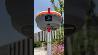
- Integration with UAVs/Drones: The incorporation of unmanned aerial vehicles (UAVs) equipped with GNSS technology is paving the way for innovative aerial surveys and 3D mapping capabilities. This integration enhances the efficiency of data collection, especially in challenging terrain and inaccessible areas.
- GNSS + Inertial Navigation System (INS): Combining GNSS with INS technologies can facilitate uninterrupted positioning in environments where GNSS signals are weak or obstructed, like urban canyons or tunnels, ensuring continuous data and accuracy.
- Crowdsourced GNSS Data: The trend towards crowdsourced data collection presents an opportunity for real-time geographic information systems (GIS) data aggregation. This method will enable cities to develop smarter infrastructures, leveraging citizens' data input for urban planning and management.
- 5G Integration: The integration of 5G technology with GNSS is set to enhance the speed and reliability of real-time data communication. This development can lead to improved accuracy in GNSS applications, supporting critical tasks such as autonomous driving and disaster management.
Youtube Videos


Audio Book
Dive deep into the subject with an immersive audiobook experience.
Multi-GNSS Receivers
Chapter 1 of 5
🔒 Unlock Audio Chapter
Sign up and enroll to access the full audio experience
Chapter Content
Using multiple constellations for better accuracy and availability.
Detailed Explanation
Multi-GNSS receivers are devices that can connect to multiple Global Navigation Satellite Systems (GNSS) such as GPS, GLONASS, Galileo, and BeiDou at the same time. This enhances the user's ability to determine their position more accurately and reliably because they are not limited to signals from just one system. The more satellites a receiver can communicate with, the more precise the position calculations will be.
Examples & Analogies
Imagine trying to find your friend's house using a map. If you had a map with many landmarks and details (like a multi-GNSS receiver), you could easily locate it regardless of obstacles. But with just one limited view (like a receiver tied to a single constellation), you might miss key paths or directions.
Integration with UAVs/Drones
Chapter 2 of 5
🔒 Unlock Audio Chapter
Sign up and enroll to access the full audio experience
Chapter Content
For aerial surveys and 3D mapping.
Detailed Explanation
The integration of GNSS technology with Unmanned Aerial Vehicles (UAVs), commonly known as drones, is revolutionizing surveying and mapping practices. Drones equipped with GNSS systems can capture high-resolution aerial imagery and geospatial data swiftly and precisely. This technology is used for various applications, including creating topographic maps, agricultural surveys, and urban planning.
Examples & Analogies
Think of drones as modern-day, high-tech birds that can fly over vast areas to take pictures and gather information. Just like a photographer using a camera to capture beautiful landscapes, these drones collect detailed data, but with the added precision of GNSS for exact positioning.
GNSS + Inertial Navigation System (INS)
Chapter 3 of 5
🔒 Unlock Audio Chapter
Sign up and enroll to access the full audio experience
Chapter Content
For uninterrupted positioning in tunnels or urban canyons.
Detailed Explanation
Combining GNSS with Inertial Navigation Systems (INS) allows for continuous tracking of position, even in environments where GNSS signals might be weak or unavailable, such as tunnels or crowded urban areas. While GNSS provides precise location data when available, INS can estimate position using sensors that measure movement. This combination ensures that vehicles or devices can maintain accurate positioning without interruption.
Examples & Analogies
Consider how a compass (the INS) can guide you through a dark tunnel where GPS signals fail. While you may not see your exact location on a map, the compass keeps track of your direction, allowing you to move steadily until you re-emerge where you can once again see the sun (the GNSS).
Crowdsourced GNSS Data
Chapter 4 of 5
🔒 Unlock Audio Chapter
Sign up and enroll to access the full audio experience
Chapter Content
Real-time, large-scale data collection for smart cities.
Detailed Explanation
Crowdsourcing GNSS data involves collecting location information from multiple users and devices to create comprehensive and updated maps or databases. This data helps in urban planning, traffic management, and infrastructure development by providing real-time insights into the movement and behavior of people and vehicles within a city.
Examples & Analogies
Imagine a giant digital community map where everyone contributes by marking construction spots, traffic jams, or new parks. Just like people sharing their experiences on social media helps others decide where to eat or visit, crowdsourced GNSS data provides vital information for managing a city's facilities and services efficiently.
5G Integration
Chapter 5 of 5
🔒 Unlock Audio Chapter
Sign up and enroll to access the full audio experience
Chapter Content
Enhancing real-time accuracy and communication.
Detailed Explanation
The integration of 5G technology with GNSS enhances data transmission speed and communication reliability. This advancement allows for quicker processing of positioning data and enables applications requiring real-time responsiveness, like autonomous vehicles, precision agriculture, and smart city solutions. The faster data flow means that positioning corrections can be communicated instantaneously, increasing accuracy and usability.
Examples & Analogies
Think of 5G as a super-fast express train that transports data at lightning speed. If GNSS is the train station that provides the correct information on where you are, the 5G network ensures that information is sent and received promptly, allowing for seamless travel through the digital landscape.
Key Concepts
-
Multi-GNSS Receivers: Improve accuracy by using multiple satellite systems.
-
UAV Integration: Enhances surveying by allowing for rapid and remote data collection.
-
INS Role: Provides reliable positioning in GNSS-challenged environments.
-
Crowdsourcing Data: Enables real-time data utilization for urban planning.
-
5G Impact: Significantly enhances communication speed and GNSS performance.
Examples & Applications
Using a drone equipped with multi-GNSS receivers to map a rugged landscape accurately.
Crowdsourcing traffic data from mobile devices to adjust urban traffic management systems in real-time.
Memory Aids
Interactive tools to help you remember key concepts
Rhymes
Multi-GNSS, accuracy's best, UAVs fly, and put us to the test. INS guides where signals hide, 5G helps data glide.
Stories
Imagine a future where surveyors use a drone to map out a city. The drone, equipped with multi-GNSS and 5G capabilities, can quickly gather accurate data, even in the most challenging urban environments with tall buildings. This means safer and more efficient surveys than ever before, thanks to integrating these technologies.
Memory Tools
Remember 'MUGS' for the future of GNSS surveying: Multi-GNSS, UAVs, GNSS + INS, and 5G.
Acronyms
’’SMART’’ for crowdsourced GNSS
Statistical Maps Are Real-Time.
Flash Cards
Glossary
- MultiGNSS Receivers
Receivers capable of accessing multiple GNSS constellations for improved positioning accuracy.
- UAVs/Drones
Unmanned Aerial Vehicles that facilitate aerial surveys and data collection.
- Inertial Navigation System (INS)
A navigation aid that determines position based on motion sensors, especially in GNSS-deprived environments.
- Crowdsourced GNSS Data
Real-time GNSS data collected from multiple users to improve urban planning and management.
- 5G Technology
The fifth generation of mobile network technology that provides faster speeds and lower latency communications.
Reference links
Supplementary resources to enhance your learning experience.