
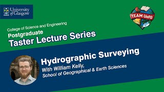
Modern Trends in Hydrographic Surveying
Enroll to start learning
You’ve not yet enrolled in this course. Please enroll for free to listen to audio lessons, classroom podcasts and take practice test.
Interactive Audio Lesson
Listen to a student-teacher conversation explaining the topic in a relatable way.
Introduction to ASVs and USVs
🔒 Unlock Audio Lesson
Sign up and enroll to listen to this audio lesson

Let's talk about Autonomous Surface Vehicles and Unmanned Surface Vehicles. ASVs and USVs are changing how we collect hydrographic data, especially in hazardous areas. Can anyone tell me what these vehicles are useful for?

Are they safer options for collecting data since humans don’t have to go into dangerous areas?
Exactly! They're especially beneficial for shallow or hazardous regions, minimizing risk. They can also cover larger areas quickly. Remember the acronym ASV - 'A Safe Vehicle.'

Do they operate without any human supervision at all?
Good question! They are remotely operated but can also be programmed for autonomous operations. Great engagement, everyone!

Can you use them in really deep waters?
Typically, they are optimized for shallow areas, but advancements may lead to broader applications. Let's wrap up: ASVs and USVs enhance safety and efficiency.
Satellite-Derived Bathymetry
🔒 Unlock Audio Lesson
Sign up and enroll to listen to this audio lesson

Next, let's delve into Satellite-Derived Bathymetry. This technology allows us to survey large areas in shallow waters. Who can guess how it works?

Is it like using satellites to see the water surface from above?
Yes, excellent! By analyzing light penetration and reflection, we can interpret underwater features without extensive fieldwork. Give yourself a star for understanding how SDB works!
So, can SDB replace traditional methods?
Not entirely. SDB is great for initial assessments, but traditional methods still have their place for detailed surveys. Key takeaway: think of SDB as a 'first look' tool.
AI in Data Processing
🔒 Unlock Audio Lesson
Sign up and enroll to listen to this audio lesson
Now, let’s focus on Artificial Intelligence in data processing. AI helps automate the extraction and classification of hydrographic data. What do you think are the benefits of using AI?
It probably makes data analysis faster, right?
Absolutely! It reduces the time taken to process complex datasets significantly. Remember: 'AI is A Quick Interpretation'.
But is AI always accurate?
Great point! While AI increases efficiency, human oversight is essential for accuracy. Recap: AI aids, but we still need human judgement.
Real-Time Hydrography
🔒 Unlock Audio Lesson
Sign up and enroll to listen to this audio lesson
Finally, let's discuss real-time hydrography. This allows for live-streaming data via the cloud. Why is this important?
It helps make decisions immediately when conducting surveys?
Exactly! Immediate access to data enhances operational efficiency and safety. Think: 'Data on Demand.'
How does it actually work to stream data?
Data collected by sensors in the field is transmitted in real time to analysts. It creates a responsive environment for surveying. To summarize: Real-time access improves decision-making.
Introduction & Overview
Read summaries of the section's main ideas at different levels of detail.
Quick Overview
Standard
Modern trends in hydrographic surveying reveal significant advancements such as the use of Autonomous Surface Vehicles (ASVs) for remote data collection, Satellite-Derived Bathymetry for large-scale surveys, and the integration of Artificial Intelligence to automate data processing. Additionally, real-time hydrography is becoming increasingly important for efficient operations.
Detailed
Modern Trends in Hydrographic Surveying
In contemporary hydrographic surveying, technological advancements are transforming the methods and processes involved. This section outlines several key modern trends:
1. Autonomous Surface Vehicles (ASVs) and Unmanned Surface Vehicles (USVs)
These remotely operated vehicles are particularly beneficial for surveying in shallow or hazardous areas. They reduce the need for human presence in potentially dangerous waters and enable data collection over larger areas with increased efficiency.
2. Satellite-Derived Bathymetry (SDB)
SDB utilizes remote sensing technologies to conduct large-scale surveys in shallow water environments, allowing hydrographers to map underwater terrain without traditional extensive fieldwork. This technology is especially useful for rapid assessments of water bodies.
3. Artificial Intelligence in Data Processing
AI is revolutionizing how hydrographic data is processed. Automated feature extraction and classification streamline the analysis, significantly reducing the time required to interpret complex datasets.
4. Real-Time Hydrography
Real-time hydrography refers to the capability of live-streaming hydrographic survey data to the cloud, making it available for immediate use. This enables faster decision-making and enhances operational efficiency during projects.
These trends point towards a future where hydrographic surveying incorporates advanced technologies to improve accuracy, efficiency, and safety.
Youtube Videos

Audio Book
Dive deep into the subject with an immersive audiobook experience.
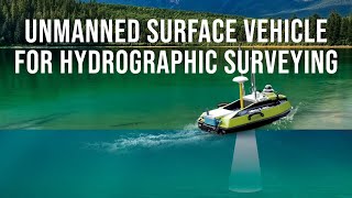
Autonomous Surface Vehicles (ASVs) and Unmanned Surface Vehicles (USVs)
Chapter 1 of 4
🔒 Unlock Audio Chapter
Sign up and enroll to access the full audio experience
Chapter Content
- Autonomous Surface Vehicles (ASVs) and Unmanned Surface Vehicles (USVs)
- Remotely operated for shallow or hazardous areas.
Detailed Explanation
Autonomous Surface Vehicles (ASVs) and Unmanned Surface Vehicles (USVs) are being increasingly used in hydrographic surveying. These vehicles can operate without direct human control, allowing them to navigate and collect data in areas that might be too dangerous or difficult for traditional survey boats. They are particularly beneficial in shallow waters, where submerged hazards could pose significant risks to crewed vessels.
Examples & Analogies
Imagine sending a drone to explore underwater caves that are too risky for divers. Similarly, ASVs and USVs allow surveyors to gather important data without putting anyone at risk, ensuring safety while expanding the reach of hydrographic surveys.
Satellite-Derived Bathymetry (SDB)
Chapter 2 of 4
🔒 Unlock Audio Chapter
Sign up and enroll to access the full audio experience
Chapter Content
- Satellite-Derived Bathymetry (SDB)
- Remote sensing for large-scale shallow water surveys.
Detailed Explanation
Satellite-Derived Bathymetry (SDB) is a technique that uses satellite images to estimate the depth of water in shallow coastal areas. By analyzing how light behaves as it travels through water and reflects off the seabed, scientists can map underwater features without having to physically measure them. This method is particularly useful for covering large areas efficiently, employing advanced algorithms and processing techniques.
Examples & Analogies
Think of how a camera can capture a clear image of a mountain from far away, showing its shape and features. In the same way, SDB uses satellite imagery to "see" the underwater landscape, making it easier to gather information about large regions of water without expensive and time-consuming fieldwork.
Artificial Intelligence in Data Processing
Chapter 3 of 4
🔒 Unlock Audio Chapter
Sign up and enroll to access the full audio experience
Chapter Content
- Artificial Intelligence in Data Processing
- Automated feature extraction and classification.
Detailed Explanation
Artificial Intelligence (AI) is increasingly being integrated into hydrographic surveying to enhance data processing. AI algorithms can automatically identify and classify underwater features, such as shipwrecks or reefs, from large datasets collected by sonar and other instruments. This automation speeds up the analysis and reduces human error, allowing surveyors to focus on more complex tasks.
Examples & Analogies
Consider how Netflix recommends shows based on your viewing history. Similar technology is used in hydrographic surveys, where AI analyzes vast amounts of data to highlight important features, helping scientists and surveyors make faster and more informed decisions—like choosing the best spots for marine conservation.
Real-Time Hydrography
Chapter 4 of 4
🔒 Unlock Audio Chapter
Sign up and enroll to access the full audio experience
Chapter Content
- Real-Time Hydrography
- Cloud-based, live-streaming of survey data for immediate use.
Detailed Explanation
Real-Time Hydrography refers to the ability to collect, process, and share hydrographic survey data instantly through cloud technology. This means that as survey data is gathered from vessels, it can be uploaded and accessed immediately by teams on land, allowing for prompt decision-making and adjustments during surveying. This capability enhances operational efficiency and allows for real-time collaboration.
Examples & Analogies
Think of a live sports broadcast where viewers can see every play in real-time. Real-Time Hydrography works similarly, providing instant access to datasets as they are collected, ensuring that all stakeholders are updated quickly and can respond to dynamic conditions.
Key Concepts
-
ASVs and USVs: Enhancements in data collection methods.
-
Satellite-Derived Bathymetry: Efficiency in surveying large shallow areas.
-
AI in Data Processing: Automation improves accuracy and speed.
-
Real-Time Hydrography: Immediate data access enhances operational efficiency.
Examples & Applications
The use of ASVs to map the seabed of challenging areas like coral reefs where human divers cannot go.
Satellite-Derived Bathymetry enabling quick assessments of coastal zones for hazard mapping.
Memory Aids
Interactive tools to help you remember key concepts
Rhymes
ASVs are clever vessels, exploring the sea, fetching data safely, oh what glee!
Stories
Imagine a ship that sails the waters alone, guided by technology, it collects data on its own, helping scientists help the ocean and ensure it's well known.
Memory Tools
Remember SDB: 'Satellites Detect Bottoms'.
Acronyms
AI - 'Automated Insights for Hydrographers'.
Flash Cards
Glossary
- Autonomous Surface Vehicles (ASVs)
Remotely operated vessels designed for hydrographic surveys, especially in shallow or hazardous areas.
- SatelliteDerived Bathymetry (SDB)
A method of using satellite technology to measure underwater features in shallow waters.
- Artificial Intelligence (AI)
Machine learning systems that automate data processing and improve analysis efficiency.
- RealTime Hydrography
Live-streaming hydrographic survey data for immediate use and analysis.
Reference links
Supplementary resources to enhance your learning experience.