
Safety Considerations in Hydrographic Surveying
Enroll to start learning
You’ve not yet enrolled in this course. Please enroll for free to listen to audio lessons, classroom podcasts and take practice test.
Interactive Audio Lesson
Listen to a student-teacher conversation explaining the topic in a relatable way.
Marine Safety Measures
🔒 Unlock Audio Lesson
Sign up and enroll to listen to this audio lesson

Today, we are diving into the critical safety measures we must follow during hydrographic surveys. Why do you think wearing life jackets is important for survey teams?

Because it helps keep us afloat if something goes wrong, right?
Exactly! Life jackets provide buoyancy. Other than that, why else should we have communication devices like VHF radios onboard?

They keep us connected and allow us to call for help if we need to.
That's correct! Constant communication is essential for safety. Can anyone remember what we need to monitor to ensure we're safe while surveying?

Weather conditions and tide forecasts?
Right! Monitoring these factors helps us avoid hazardous situations. Let's summarize: life jackets for flotation, VHF radios for communication, and monitoring weather. Very good!
Emergency Response Planning
🔒 Unlock Audio Lesson
Sign up and enroll to listen to this audio lesson

Now, let's talk about emergency evacuation plans. Why do you think having a plan is crucial?

In case of an emergency, it tells us how to respond quickly.
That's right! Quick response can save lives. What steps can we take to prepare our crew for emergencies?
They should be trained and know where the emergency exits are.
Excellent point! Training on the emergency protocol ensures everyone knows their role in a crisis. Can someone give an example of an emergency situation we might encounter?
Maybe a sudden storm or someone falling overboard?
Exactly. Those are real possibilities. Summarizing: we need to plan and train for emergencies, and ensure everyone knows exit routes and protocols. Great discussion!
Data Security and Confidentiality
🔒 Unlock Audio Lesson
Sign up and enroll to listen to this audio lesson
Now, let's shift our focus to data security. Why is maintaining confidentiality of survey data so important?
Because some data can be sensitive and related to national security.
Correct! Sensitive information must be kept secure to prevent misuse. What roles do authorities like the navy play in this context?
They help ensure that any coastal surveys are approved and handled properly.
Exactly! Clearance from authorities is essential for projects that involve national security. Can anyone think of a situation where a breach in data confidentiality might occur?
If someone accidentally shares data without authorization.
Great example! Summarizing, we need to ensure all data is classified and handled according to security protocols to maintain integrity and protect sensitive information.
Introduction & Overview
Read summaries of the section's main ideas at different levels of detail.
Quick Overview
Standard
The safety considerations in hydrographic surveying focus on marine safety measures and data security. Proper adherence to safety protocols ensures the well-being of survey crews while maintaining data integrity, especially for sensitive projects. Observing weather conditions, employing life-saving equipment, and adhering to classification protocols is crucial.
Detailed
Safety Considerations in Hydrographic Surveying
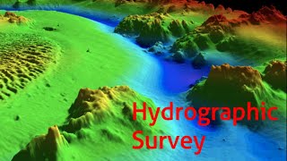
Hydrographic surveys are often conducted in challenging and potentially hazardous marine environments. Due to these conditions, safety precautions are not just recommended but mandatory for all personnel involved in surveying activities. The section outlines several key safety measures:
1. Marine Safety Measures
- Life Jackets: Each crew member is required to wear a life jacket, which provides buoyancy and aids in flotation in case of an emergency.
- VHF Radios: Communication devices are essential on survey vessels for constant communication, especially during emergencies.
- Monitoring Weather Conditions: Surveying teams must constantly monitor weather forecasts and tide levels to avoid hazardous conditions.
- Safe Navigation: Utilizing marine radar and GPS ensures the vessel's safe navigation through potentially dangerous waters.
- Emergency Evacuation Plans: Having a well-practiced emergency evacuation plan is critical; crew members should be trained to respond quickly in emergencies.
2. Data Security and Confidentiality
- For surveys related to national security or defense, data classification and security measures are enforced rigorously. All survey data is handled according to strict security protocols, often requiring clearance from relevant authorities such as the navy for coastal surveys.
These safety considerations are essential not only for the protection of the survey teams but also for the integrity and reliability of the hydrographic data collected. This highlights the importance of implementing these protocols as a fundamental aspect of hydrographic surveying.
Youtube Videos


Audio Book
Dive deep into the subject with an immersive audiobook experience.
Marine Safety Measures
Chapter 1 of 2
🔒 Unlock Audio Chapter
Sign up and enroll to access the full audio experience
Chapter Content
• Use of life jackets, VHF radios, distress signals.
• Monitoring of weather conditions and tide forecasts.
• Ensuring safe navigation using marine radar and GPS.
• Emergency evacuation plans and trained crew.
Detailed Explanation
When conducting hydrographic surveys in challenging marine environments, safety is paramount. Survey teams must wear life jackets to enhance their buoyancy and reduce the risk of drowning in case of an emergency. Communication tools like VHF radios are essential to maintain contact with surface vessels or coastal stations, especially during adverse weather conditions. Additionally, monitoring weather forecasts and tide conditions helps surveyors anticipate changing scenarios and avoid dangerous situations. Navigation aids such as marine radar and GPS assist in plotting safe routes, while emergency plans must be established and practiced to ensure personnel can evacuate safely in any crisis.
Examples & Analogies
Imagine you are sailing on a boat in a stormy sea. Just like a captain must wear a life jacket and have a reliable radio to call for help, hydrographic survey teams must prepare similarly. They check weather forecasts like pilots check air traffic, ensuring they can navigate safely and respond swiftly if things go wrong.
Data Security and Confidentiality
Chapter 2 of 2
🔒 Unlock Audio Chapter
Sign up and enroll to access the full audio experience
Chapter Content
• For defense-related surveys, data is highly classified.
• Survey data handling must comply with national security protocols (e.g., clearance from Indian Navy for coastal surveys).
Detailed Explanation
When conducting hydrographic surveys, especially those related to defense, the confidentiality of the data collected is crucial. This information can often be sensitive, influencing national security matters. Therefore, strict protocols govern how this data is processed and stored. Typically, surveyors need special clearance before they can handle or publish any findings, especially if these surveys take place in coastal areas where security is a concern. This ensures that sensitive information does not fall into the wrong hands, protecting both national interests and the safety of maritime operations.
Examples & Analogies
Think of it like having a secret recipe in a restaurant. Just as the chef must ensure the recipe remains confidential and share it only with trusted staff, hydrographic surveyors must be careful with sensitive data, especially when the information can affect national security.
Key Concepts
-
Marine Safety Measures: Essential protocols and equipment required for safe hydrographic surveying.
-
Emergency Evacuation Plan: A structured plan outlining the procedures to follow in case of emergencies.
-
Data Security: Importance of protecting sensitive hydrographic survey data from unauthorized access.
Examples & Applications
Example of using VHF radios during a storm to communicate with a support vessel.
Illustration of an emergency evacuation plan demonstrating the route onboard a survey vessel.
Memory Aids
Interactive tools to help you remember key concepts
Rhymes
When waters are wild and waves are high, wear your life jacket, give it a try! VHF radios to call for help, keep you safe within your belt.
Stories
Imagine a crew of marine surveyors planning a big survey. They meet on their boat, life jackets snug, radios buzzing. They rehearse their emergency plan, ensuring everyone knows where to go if disaster strikes.
Memory Tools
Remember 'SAFE' for safety: S for Safety gear, A for Alertness to weather, F for Fellow communication, E for Emergency plans.
Acronyms
CAPS for safety measures
- Communication devices
- Alerts to weather
- Personal flotation devices
- Security for data.
Flash Cards
Glossary
- Marine Safety Measures
Protocols and equipment to ensure the safety of personnel in marine environments.
- Emergency Evacuation Plan
A predefined procedure for safely evacuating personnel in case of emergencies.
- Data Security
Protocols to protect sensitive data from disclosure or unauthorized access.
- VHF Radio
A high-frequency communication device commonly used in marine environments.
Reference links
Supplementary resources to enhance your learning experience.