
Drone-Based Sensing Platforms
Enroll to start learning
You’ve not yet enrolled in this course. Please enroll for free to listen to audio lessons, classroom podcasts and take practice test.
Interactive Audio Lesson
Listen to a student-teacher conversation explaining the topic in a relatable way.
Introduction to UAVs in Civil Engineering
🔒 Unlock Audio Lesson
Sign up and enroll to listen to this audio lesson

Today, we are diving into an exciting topic: Drone-Based Sensing Platforms. Can anyone tell me what a UAV is?

Is it an Unmanned Aerial Vehicle?
Exactly! UAVs are key to our discussion. They allow us to collect data efficiently. What are some advantages of using drones for surveying?

Drones can cover large areas quickly!

And they can access hard-to-reach places!
Great points! Their ability to collect high-resolution data makes them invaluable. Let's use the acronym 'DATA' — Drones Access Tough Areas. This helps us remember their key feature. Now, why is this ability significant?

It improves safety and reduces risks for surveyors.
Exactly! Reducing risks is vital in civil engineering. Let's summarize: UAVs are efficient, safe, and valuable for data collection.
Applications of Drone-Based Sensing
🔒 Unlock Audio Lesson
Sign up and enroll to listen to this audio lesson

Now, let's discuss applications. What can UAVs with sensors do for terrain mapping?
They can create detailed maps of topographical features!
Correct! By integrating sensors such as LiDAR, drones provide precise data that aids project planning. Can someone think of another application?
They can inspect bridges and towers for maintenance issues.
Absolutely! Drones enhance our ability to conduct thorough inspections. 'MAP' can help remember — it stands for Maintain, Assess, and Project. Now, why does this matter for structural safety?
Because it can prevent future structural failures.
Exactly! Early detection is key. To summarize, drones improve data collection in both mapping and inspection.
Safety and Efficiency Benefits of UAVs
🔒 Unlock Audio Lesson
Sign up and enroll to listen to this audio lesson
Let's dive deeper into how drones improve safety and efficiency. Why is direct access to construction sites with drones important?
It minimizes the need for workers to be in hazardous locations.
Exactly! Safety is a top priority. Let's look at how efficiency plays a role. How do drones save time during inspections?
They can cover more ground in a shorter time than humans can.
Right! They simplify tasks that would take much longer manually. Remember the mnemonic 'SAFE' for Safety and Efficiency with Drones. Let's summarize: UAVs enhance both safety and efficiency, making them indispensable in modern civil engineering.
Introduction & Overview
Read summaries of the section's main ideas at different levels of detail.
Quick Overview
Standard
This section highlights the use of Unmanned Aerial Vehicles (UAVs) equipped with various sensors for applications like terrain mapping and structural inspections, improving efficiency and safety in civil engineering tasks.
Detailed
Drone-Based Sensing Platforms
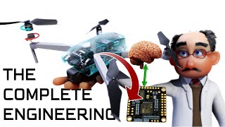
In the realm of civil engineering, the integration of Drone-Based Sensing Platforms has emerged as a transformative innovation. These platforms combine Unmanned Aerial Vehicles (UAVs) with advanced sensing technologies, allowing for improved efficiency and accuracy in various applications. The primary uses include:
- Terrain Mapping: Drones equipped with LiDAR and other sensors can swiftly map topographical features over large areas, providing high-resolution data that facilitates planning and design.
- Structural Inspections: UAVs can be utilized for inspecting hard-to-reach structures such as bridges and towers. By combining visual imaging with other sensor data, engineers can spot potential issues early, enhancing safety and maintenance processes.
Through these applications, drone-based sensing not only aids in traditional engineering tasks but also revolutionizes the way data is collected, analyzed, and applied in real-world projects.
Youtube Videos


Audio Book
Dive deep into the subject with an immersive audiobook experience.
Overview of Drone-Based Sensing Platforms
Chapter 1 of 1
🔒 Unlock Audio Chapter
Sign up and enroll to access the full audio experience
Chapter Content
Integration of sensors with UAVs (Unmanned Aerial Vehicles) for:
– Terrain mapping
– Structural inspections (bridges, towers)
Detailed Explanation
In this chunk, we discuss how drones, also known as Unmanned Aerial Vehicles (UAVs), are combined with various sensors to perform specific tasks in civil engineering. The first task mentioned is terrain mapping, which involves capturing the physical features of a land area using sensors that gather data about elevation, vegetation, and other geographical features. The second task is structural inspections, where drones are used to examine the condition of structures like bridges and towers. This integration allows engineers to quickly assess the safety and functionality of infrastructure from an aerial perspective.
Examples & Analogies
Imagine using a camera on your smartphone to take a picture of a large park to understand its layout. Similarly, drones equipped with cameras and sensors can capture extensive data about large terrains, making it easier for engineers to visualize and plan land use effectively. Furthermore, you could think of a bird flying over a bridge, inspecting it for cracks or wear without having to climb up, thus saving time and ensuring safety.
Key Concepts
-
Integration of UAVs: Drones equipped with sensors for diverse civil engineering applications.
-
Terrain Mapping: Efficient collection of topographical data to aid in planning.
-
Structural Inspections: Enhancing the safety and effectiveness of evaluating infrastructure.
Examples & Applications
Using drones to map a construction site, allowing for real-time updates in planning.
Conducting inspections on bridges safely using UAVs to avoid worker exposure in dangerous areas.
Memory Aids
Interactive tools to help you remember key concepts
Rhymes
Drones in the sky, mapping with ease, keeping us safe from dangerous breeze.
Stories
Imagine a construction site where workers avoid risks by sending drones to inspect hard-to-reach areas. This boosts safety and speeds up necessary mapping!
Memory Tools
MAP — Maintain, Assess, and Project for drone inspections.
Acronyms
DATA — Drones Access Tough Areas.
Flash Cards
Glossary
- UAV (Unmanned Aerial Vehicle)
A drone or aircraft that operates without a human pilot onboard.
- LiDAR
A remote sensing method that uses light in the form of a pulsed laser to measure distances to the Earth.
- Terrain Mapping
The process of creating maps that represent the surface features of an area.
- Structural Inspections
Evaluations performed to assess the integrity and safety of physical structures.
Reference links
Supplementary resources to enhance your learning experience.