
Automation and Real-Time Surveying
Enroll to start learning
You’ve not yet enrolled in this course. Please enroll for free to listen to audio lessons, classroom podcasts and take practice test.
Interactive Audio Lesson
Listen to a student-teacher conversation explaining the topic in a relatable way.
Real-Time Kinematic (RTK) Surveying
🔒 Unlock Audio Lesson
Sign up and enroll to listen to this audio lesson

Today, we'll discuss Real-Time Kinematic, or RTK surveying. RTK is a GNSS technique that provides very accurate positioning data, down to centimeters!

How exactly does RTK achieve such high accuracy?
Great question! RTK works by using a base station and a rover unit. The base station receives GNSS signals and transmits corrections to the rover, ensuring accurate positioning.

What kinds of projects typically use RTK surveying?
RTK is widely used in road alignments, machine control during excavation, and even in pavement placements. It greatly enhances efficiency and accuracy.

So, it's especially beneficial for large or complex projects?
Exactly! It's all about reducing errors and saving time in the workflow. To remember RTK, think 'Real-Time Kinetic precision.'

That’s a helpful mnemonic!
Alright, let's recap. RTK surveying utilizes a base station and rover for high precision in construction tasks, especially in alignment. It's an essential tool in modern construction!
Robotic Total Stations
🔒 Unlock Audio Lesson
Sign up and enroll to listen to this audio lesson

Next, let's dive into robotic total stations. These instruments track a prism automatically, making surveying more efficient.
How does that work? Does it require skilled operators?
Robotic total stations can be operated by a single person, simplifying the surveying process significantly. You'll use a remote control for intuitive operation.
Are they easier to use in crowded construction sites?
Absolutely! They’re perfect for high-rise or congested environments where manual tracking would be challenging. This means faster workflows and less labor required!
So, they’re both efficient and labor-saving?
Yes, indeed! To remember this, think of 'Robots Take Tracking.' Recap: Robotic total stations allow one-person operation, increasing efficiency.
Machine Control and Guidance Systems
🔒 Unlock Audio Lesson
Sign up and enroll to listen to this audio lesson
Finally, let’s talk about machine control and guidance systems. These integrate GNSS and robotic total stations with heavy machinery.
How do these systems actually help?
They enable real-time control of machinery like bulldozers and graders, ensuring precise blade levels and excavation depths.
Does that mean less need for manual staking?
Exactly, it minimizes manual input. To aid memory, think 'Machinery Guides Speed.'
That’s cool! So automation is changing how we do construction?
Right! Automation and real-time data collection improve efficiency and accuracy in construction surveying significantly.
Introduction & Overview
Read summaries of the section's main ideas at different levels of detail.
Quick Overview
Standard
In this section, the advancements in automation and real-time surveying technologies are explored. Key techniques such as Real-Time Kinematic (RTK) surveying provide high precision, while robotic total stations enhance productivity through automated tracking. The integration of these technologies with machine control systems allows for precise alignment and monitoring of construction activities, significantly improving efficiency and accuracy in the field.
Detailed
Automation and Real-Time Surveying
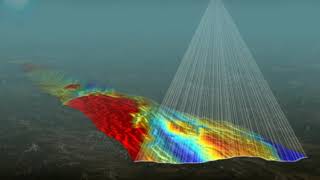
In the evolving field of construction surveying, automation techniques and real-time data collection have revolutionized how surveys are conducted. The use of Real-Time Kinematic (RTK) surveying enables unprecedented centimeter-level accuracy in obtaining GNSS positions, which is essential for various applications, notably in road alignments and machine control systems during excavation and pavement placement.
Robotic total stations mark another significant advancement, allowing a single operator to track prisms automatically, which streamlines workflows and enhances measurement continuity. This is exceptionally useful in complex construction environments such as high-rises or congested sites. Additionally, the integration of GNSS with construction machinery through machine control systems facilitates real-time operational guidance, improving blade levels and excavation depths with minimal manual intervention.
These advancements not only boost the speed and precision of construction surveying but also support better planning and execution of construction projects, making it an essential consideration in modern construction practices.
Youtube Videos


Audio Book
Dive deep into the subject with an immersive audiobook experience.
Real-Time Kinematic (RTK) Surveying
Chapter 1 of 3
🔒 Unlock Audio Chapter
Sign up and enroll to access the full audio experience
Chapter Content
RTK is a satellite navigation technique used to enhance the precision of GNSS positions.
Offers centimeter-level accuracy for layout and alignment tasks.
Widely used in road alignments, machine control systems in excavation, and pavement placement.
Detailed Explanation
Real-Time Kinematic (RTK) surveying is a method that utilizes satellite signals from GNSS to achieve very high accuracy in localization, often down to the centimeter level. This accuracy is crucial during tasks such as laying out road designs or managing excavation projects, where even slight misalignments can lead to significant problems. RTK works by using a base station that sends corrections to a rover unit, allowing for real-time adjustments as work progresses.
Examples & Analogies
Imagine you're trying to shoot an arrow at a distant target. If you only have an old map, your shot might be off by several feet. But if you use a smart device that tells you exactly where the target is, your aim improves drastically. Similarly, RTK surveying allows construction workers to pinpoint their location with great accuracy, ensuring that everything is built exactly as planned.
Robotic Total Stations
Chapter 2 of 3
🔒 Unlock Audio Chapter
Sign up and enroll to access the full audio experience
Chapter Content
One-person operated total stations that automatically track the prism.
Allow for faster workflows, continuous measurement, and reduced labor requirements.
Ideal for high-rise and congested construction environments.
Detailed Explanation
Robotic total stations are advanced surveying instruments that enable a single operator to perform tasks that would typically require a team. By using a motorized theodolite that automatically tracks a reflective prism, these devices streamline the measurement process and increase efficiency in the field. This is particularly useful in complex construction sites, like skyscrapers, where space is limited and quick adjustments are necessary.
Examples & Analogies
Think of a robotic vacuum cleaner that navigates around your home while you relax. Instead of needing someone to guide it around, it learns its environment and cleans on its own. Similarly, robotic total stations take the burden off laborers by handling much of the surveying work automatically, saving both time and effort.
Machine Control and Guidance Systems
Chapter 3 of 3
🔒 Unlock Audio Chapter
Sign up and enroll to access the full audio experience
Chapter Content
Integration of GNSS and robotic total stations with construction machinery (e.g., bulldozers, graders).
Enables real-time control of blade levels, excavation depths, and alignment paths.
Reduces reliance on manual staking and increases speed and accuracy.
Detailed Explanation
Machine control and guidance systems are technologies that connect surveying instruments like GNSS and robotic total stations with construction equipment. This integration allows for precise control of machinery, such as bulldozers, ensuring that operations like grading and excavating are carried out accurately. The real-time feedback helps operators stay on target without the constant need for manual measurement or adjustments, which can save both time and reduce errors.
Examples & Analogies
Consider how GPS in cars has changed the way we drive. Instead of stopping to check a map every few minutes, the GPS gives continuous updates on where to go next. Similarly, machine control systems act like a GPS for heavy construction machines, guiding them precisely to ensure they are performing tasks correctly and efficiently.
Key Concepts
-
RTK Surveying: Achieves centimeter-level precision for construction tasks.
-
Robotic Total Stations: Enhance productivity with automatic tracking of prisms.
-
Machine Control Systems: Allow for real-time integration of surveying data with construction machinery.
Examples & Applications
Using RTK for precise road alignment when constructing highways.
Implementing robotic total stations in a high-rise project for quick data collection and tracking.
Memory Aids
Interactive tools to help you remember key concepts
Rhymes
RTK brings precision, no need for revision, in construction work, it’s the right decision.
Stories
Imagine a construction site where a robot helps the surveyor track all measurements, allowing them to finish faster than ever before. This robot, the total station, becomes the firm’s best friend.
Memory Tools
To remember the benefits of RTK: R for Real, T for Time, K for Kinetic precision.
Acronyms
R-T-S
for Robotic
for Total
for Station
capturing data in a flash!
Flash Cards
Glossary
- RealTime Kinematic (RTK)
A satellite navigation technique that enhances GNSS positions to provide centimeter-level accuracy.
- Robotic Total Station
An automated surveying instrument that tracks a prism to allow for one-person operation and increased productivity.
- Machine Control Systems
Technologies that integrate GNSS and robotic total stations with construction equipment for real-time operational guidance.
Reference links
Supplementary resources to enhance your learning experience.