
Monitoring and Deformation Surveys
Enroll to start learning
You’ve not yet enrolled in this course. Please enroll for free to listen to audio lessons, classroom podcasts and take practice test.
Interactive Audio Lesson
Listen to a student-teacher conversation explaining the topic in a relatable way.
Introduction to Monitoring Needs
🔒 Unlock Audio Lesson
Sign up and enroll to listen to this audio lesson

Today, we will dive into monitoring and deformation surveys. Let's start with the fundamental question: Why do we need monitoring for large structures such as dams or bridges?

I think it’s to ensure they remain safe under dynamic loads.
Exactly! We need to ensure that large structures can handle dynamic loads and any potential settlement. Can anyone think of a situation where neglecting this could lead to serious consequences?

A bridge collapsing due to unseen wear and tear?
Exactly right! Regular monitoring helps prevent such tragedies. Remember that monitoring is crucial for maintaining structural integrity.
Methods of Monitoring
🔒 Unlock Audio Lesson
Sign up and enroll to listen to this audio lesson

Now moving on to methods used in monitoring. Who can name some of the common methods for deformation surveys?

I read about Automated Total Stations and GNSS!
Exactly! Automated Total Stations help us take precise measurements continuously. What about GNSS systems, can anyone explain their role?

They provide real-time positioning data, right?
Correct! They enable us to track movement over time. These methods combined ensure reliable data collection for structural health monitoring.
Data Interpretation in Monitoring
🔒 Unlock Audio Lesson
Sign up and enroll to listen to this audio lesson
Let’s talk about the interpretation of data collected during monitoring. What can we derive from the deformation vectors?
They help us visualize how much and in what direction the structure is moving?
Exactly! Deformation vectors are crucial for assessing the level of movement. Can anyone guess why setting up alert systems is vital?
So we can react quickly if something goes wrong?
Precisely. Early warnings allow engineers to address potential issues before they escalate into more severe problems.
Introduction & Overview
Read summaries of the section's main ideas at different levels of detail.
Quick Overview
Standard
These surveys are essential in tracking the health of significant structures throughout their lifecycle. They utilize various methods such as GNSS observation and Automated Total Stations to monitor deformation. Data interpretation involves generating deformation vectors and setting up alert systems for any discrepancies beyond set limits.
Detailed
Monitoring and Deformation Surveys
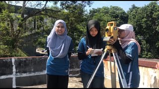
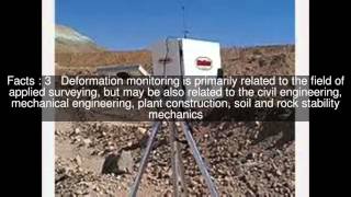
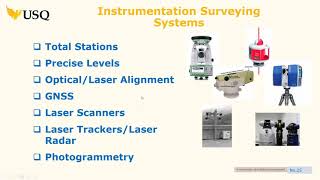
Monitoring and deformation surveys serve a critical role in the safety and integrity of large structures such as dams, bridges, and towers. These surveys are specifically conducted to assess the effects of dynamic loads and aggregate different variables affecting structural stability, including settlement and alignment. The key methods for monitoring include periodic GNSS observations, automated total station monitoring, and the use of specialized instruments such as inclinometers and strain gauges.
In addition to tracking displacements, these surveys generate deformation vectors which help in visualizing movements in terms of magnitude and direction. They are also crucial for establishing alert systems designed to notify engineers of displacement exceeding predetermined thresholds. The importance of these surveys lies in their ability to provide continuous data that helps in proactive maintenance and safety assessments for large construction projects.
Youtube Videos


Audio Book
Dive deep into the subject with an immersive audiobook experience.
Need for Monitoring
Chapter 1 of 3
🔒 Unlock Audio Chapter
Sign up and enroll to access the full audio experience
Chapter Content
• For large structures like dams, towers, bridges under dynamic load or settlement.
Detailed Explanation
Monitoring is essential for large structures such as dams, towers, and bridges. These structures experience dynamic loads (like wind, vehicles, or earthquakes) that can cause stresses and potential movement over time. Therefore, regular monitoring helps identify any changes that may indicate structural problems, ensuring safety and longevity.
Examples & Analogies
Think of monitoring a bridge like keeping an eye on a long-distance runner. Just as the runner needs to be watched for signs of fatigue or injury to prevent a fall, the bridge needs ongoing observation to ensure it's structurally sound and hasn't developed any issues that could lead to serious consequences.
Methods of Monitoring
Chapter 2 of 3
🔒 Unlock Audio Chapter
Sign up and enroll to access the full audio experience
Chapter Content
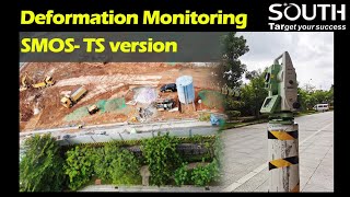
• Periodic GNSS observation of control points.
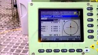
• Automated Total Station (ATS) monitoring.
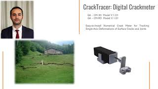
• Inclinometers, strain gauges, and remote sensors.
Detailed Explanation
There are several methods used for monitoring construction structures. Periodic GNSS observation involves using satellite-based positioning to track control points consistently. Automated Total Station (ATS) monitoring uses advanced instruments that can continuously measure and record changes. Additionally, tools like inclinometers can detect tilts, strain gauges measure stresses within the material, and remote sensors gather data from afar, all contributing to a comprehensive monitoring system.
Examples & Analogies
Imagine a smart health monitor for a person. It continuously measures heart rate, sleep patterns, and activity levels. In a similar way, structures like bridges use various instruments to check their 'health,' alerting engineers when something isn’t quite right, which helps prevent bigger problems down the line.
Data Interpretation
Chapter 3 of 3
🔒 Unlock Audio Chapter
Sign up and enroll to access the full audio experience
Chapter Content
• Generation of deformation vectors.
• Alert systems for structural movement beyond threshold limits.
Detailed Explanation
Once the data from monitoring methods is collected, it is analyzed to produce deformation vectors. These vectors show how much and in which direction a structure is moving. Furthermore, alert systems are set up to notify engineers if movement exceeds predefined limits, indicating potential problems that require immediate attention.
Examples & Analogies
It's like using a smoke detector in your home. If smoke is detected, an alarm triggers to alert you of danger. Similarly, the monitoring systems installed in structures act as 'smoke detectors' for engineers, alerting them of movements or deformations that could signal trouble.
Key Concepts
-
Monitoring: Tracking structural integrity throughout the lifecycle of a construction.
-
Instruments: Tools like GNSS and ATS that facilitate precise measurements.
-
Deformation Vector: The output of monitoring which indicates structural movement.
Examples & Applications
Using GNSS to monitor a dam's stability over time during water level changes.
Employing ATS on a bridge to continuously track any deflection due to traffic loads.
Memory Aids
Interactive tools to help you remember key concepts
Rhymes
To keep buildings strong and bright, watch them move, day and night.
Stories
Imagine a vigilant engineer named Peter who makes sure every bridge remains steady, watching over them with GNSS like a guardian angel.
Memory Tools
REMEMBER: R(ewatch) E(valuate) M(onitor) E(ngage) - important steps in deformation monitoring.
Acronyms
G.A.M.E
GNSS
ATS
Measurement
Evaluation.
Flash Cards
Glossary
- Deformation Vector
A graphical representation showing the magnitude and direction of the structural movement.
- Automated Total Station (ATS)
A surveying instrument that automatically measures angles and distances.
- GNSS
Global Navigation Satellite System, a satellite-based system for determining geographic locations.
- Inclinometers
Sensors used to measure the angle of slope or tilt of a structure.
- Strain Gauge
A device that measures the amount of deformation experienced by an object.
Reference links
Supplementary resources to enhance your learning experience.