
Integration with GIS and BIM
Enroll to start learning
You’ve not yet enrolled in this course. Please enroll for free to listen to audio lessons, classroom podcasts and take practice test.
Interactive Audio Lesson
Listen to a student-teacher conversation explaining the topic in a relatable way.
GIS for Construction Surveying
🔒 Unlock Audio Lesson
Sign up and enroll to listen to this audio lesson

Today, we will explore GIS and its role in construction surveying. To start, what do you think GIS does in this context?

Isn’t GIS used for mapping and analyzing geographical data?
Exactly! GIS allows for real-time visualization of survey data on digital maps. This helps teams interpret spatial information better. It can also assist in asset tagging. Can anyone tell me what asset tagging might involve?

It likely refers to marking or identifying assets or resources used in construction, right?
Correct! Asset tagging makes managing components easier. Additionally, GIS allows for geospatial queries to access relevant data promptly. Why do you think this feature is beneficial during construction?

It would help in making quicker decisions based on accurate data.
Great point! Quick access to information facilitates better decision-making throughout a project. To summarize, GIS enhances visualization, asset management, and data retrieval in construction.
BIM Integration
🔒 Unlock Audio Lesson
Sign up and enroll to listen to this audio lesson

Now, let’s shift our focus to BIM integration. How do you think survey data plays a role in BIM models?

I think it’s used to ensure that all measurements and placements in the model are accurate.
Absolutely! Integrating survey data allows for precise planning and can help in clash detection. What do we mean by clash detection?
It’s when two elements of a project conflict with each other, like pipes and structural beams overlapping.
Spot on! Identifying potential clashes early can save a lot of time and resources. Can anyone share how enhanced coordination in teams might look when using BIM?
Teams could collaborate better on designs and changes, ensuring everyone is on the same page.
Precisely! Improved coordination leads to smoother workflows in construction. To sum up, BIM integration with survey data enhances planning accuracy and fosters teamwork across engineering disciplines.
Introduction & Overview
Read summaries of the section's main ideas at different levels of detail.
Quick Overview
Standard
This section highlights how GIS provides real-time visualization of survey data, asset tagging, and geospatial queries, while BIM integration allows for input of survey data into models for planning and clash detection, thereby improving collaboration among engineering teams.
Detailed
Integration with GIS and BIM
The integration of Geographic Information Systems (GIS) and Building Information Modeling (BIM) offers significant advancements in construction surveying practices. This section elaborates on two primary aspects of this integration:
1. GIS for Construction Surveying
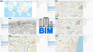
- Real-time Visualization: GIS enhances construction surveying by enabling the visualization of survey data on digital maps. This allows for easier interpretation and analysis of spatial information.
- Asset Tagging: With GIS, asset tagging becomes seamless, enabling rapid identification and management of construction components and resources.
- Geospatial Query: GIS facilitates spatial queries, allowing stakeholders to access relevant data quickly and efficiently for informed decision-making during construction processes.
2. BIM Integration
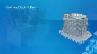
- Data Input to BIM Models: Integrating survey data into BIM models is crucial for precise planning. This allows engineers to identify potential clashes early in the project, facilitating efficient workflows.
- Enhanced Coordination: BIM integration promotes better collaboration among different engineering teams, ensuring that all stakeholders are aligned with the project’s goals and specifications.
In summary, the collaboration between GIS and BIM technology streamlines construction processes, enhances accuracy, and fosters teamwork across various construction disciplines.
Youtube Videos


Audio Book
Dive deep into the subject with an immersive audiobook experience.
GIS for Construction Surveying
Chapter 1 of 2
🔒 Unlock Audio Chapter
Sign up and enroll to access the full audio experience
Chapter Content
• Real-time visualization of survey data on digital maps.
• Asset tagging and geospatial query.
Detailed Explanation
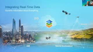
In this chunk, we focus on how Geographic Information Systems (GIS) are used in construction surveying. GIS allows surveyors to visualize data in real-time through digital maps. This means that they can see where they collected data and how that data relates to other geographic features. Furthermore, asset tagging is a feature that allows surveyors to label specific points or items in their surveys, making it easy to retrieve and query data later. Geospatial queries enable users to ask questions about the data (like 'what is the nearest construction site to my current location?'), making GIS a powerful tool for effective project management and decision-making.
Examples & Analogies
Imagine you're using a map app on your phone, like Google Maps. When you look for a restaurant, you can see your current position and all nearby options highlighted on the map. In construction, GIS works similarly by showing survey data on maps, helping teams locate and manage assets or areas of interest in real-time.
BIM Integration
Chapter 2 of 2
🔒 Unlock Audio Chapter
Sign up and enroll to access the full audio experience
Chapter Content
• Survey data input to BIM models for planning and clash detection.
• Enhancing coordination among different engineering teams.
Detailed Explanation
This chunk discusses Building Information Modeling (BIM) and its integration with survey data. BIM is a digital representation of the physical and functional characteristics of a building. By integrating survey data into BIM models, engineers can visualize construction plans in a comprehensive way. This integration helps in planning by allowing teams to identify potential clashes between various systems (like plumbing and structural components) before construction begins. By enhancing coordination, different engineering teams can work together more efficiently, ensuring that everyone is on the same page and issues are resolved early.
Examples & Analogies
Think of creating a large jigsaw puzzle. When each team works on their piece separately without seeing the others, it’s easy to create mismatches. Integrating survey data into BIM is like sharing a completed section of the puzzle with the entire team, ensuring everyone knows how their pieces connect and helping to avoid mistakes before they happen.
Key Concepts
-
Real-time Visualization: Helps in analyzing and interpreting survey data effectively.
-
Asset Tagging: Facilitates resource management and identification during construction.
-
Geospatial Queries: Allow for efficient data retrieval and decision making.
-
Clash Detection: Identifies conflicts in designs to avoid issues during construction.
Examples & Applications
Using GIS software, a construction team visualizes the site layout, identifying environmental features that could affect planning.
A BIM model incorporates actual site survey data to ensure that plumbing and electrical systems do not interfere with structural elements.
Memory Aids
Interactive tools to help you remember key concepts
Rhymes
In GIS we trust, visual clues are a must.
Stories
Imagine a builder using maps from GIS that light up their project like a rainbow, guiding every step with insight.
Memory Tools
Remember G for Geographic, I for Information, S for Systems - that’s GIS!
Acronyms
BIM
Build
Integrate
Manage!
Flash Cards
Glossary
- GIS
Geographic Information Systems; technology that captures, stores, analyzes, and presents spatial or geographic data.
- BIM
Building Information Modeling; a digital representation of physical and functional characteristics of a facility.
- Realtime Visualization
The ability to view and analyze data as it is collected and processed instantly.
- Asset Tagging
Assigning labels or identifiers to assets for easy tracking and management.
- Clash Detection
The process of identifying potential conflicts within a design model before actual construction.
Reference links
Supplementary resources to enhance your learning experience.