
Pre-Construction Survey Activities
Enroll to start learning
You’ve not yet enrolled in this course. Please enroll for free to listen to audio lessons, classroom podcasts and take practice test.
Interactive Audio Lesson
Listen to a student-teacher conversation explaining the topic in a relatable way.
Reconnaissance Survey
🔒 Unlock Audio Lesson
Sign up and enroll to listen to this audio lesson

Today, we're discussing the reconnaissance survey, which is a preliminary investigation of the construction site. Can someone tell me why this survey is important?

I believe it helps identify potential issues before the work starts, right?
Exactly! It helps surveyors plan their methodology by studying site conditions. We should remember it like this: 'Prep and Plan'. What does that mean?

It means we need to prepare ourselves and plan for what we might encounter!
That's right! A reconnaissance survey is all about getting ready for everything ahead. Can anyone think of some factors that might be identified during this survey?

What if there are environmental hazards or existing structures that we need to account for?
Great points! Deciding on methods based on these discoveries is crucial. To summarize, reconnaissance surveys help us get a clear picture from the start.
Control Point Establishment
🔒 Unlock Audio Lesson
Sign up and enroll to listen to this audio lesson

Next, let's discuss the establishment of control points. Who can tell me what they are?

They are fixed points used to ensure accuracy in measurements, right?
Exactly! Control points help us maintain horizontal and vertical control during surveys. We do this using permanent markers. Does anyone know how GNSS comes into play here?
GNSS helps georeference those control points to ensure they’re accurate according to global standards.
Spot on! Remember the mnemonic 'GPS for Control'? It denotes how GNSS aids in establishing these reference points. Why is it essential to get these control points right?
If they're wrong, the whole construction might end up misplaced!
Exactly! Control points are foundational for accurate execution. Always ensure these are established early in the process.
Base Mapping
🔒 Unlock Audio Lesson
Sign up and enroll to listen to this audio lesson
Lastly, we have base mapping. Can anyone explain what base mapping entails?
It involves creating maps that accurately depict the land features and contour lines using aerial techniques, right?
Correct! Aerial photogrammetry or LiDAR techniques are often used. What role do you think GIS plays in base mapping?
GIS helps in organizing and analyzing spatial data, making it easier to access later.
Exactly! 'Map and Manage' is an easy way to remember this relationship: maps are created for effective management of spatial information. Why's this important during the construction phase?
Because accurate maps help contractors know exactly what’s on the ground before starting work.
That’s absolutely right! Base mapping is essential for smooth operations and planning in any construction project.
Introduction & Overview
Read summaries of the section's main ideas at different levels of detail.
Quick Overview
Standard
This section outlines the key pre-construction survey activities, including reconnaissance surveys, control point establishment, and base mapping, which are crucial for implementing accurate construction processes.
Detailed
Pre-Construction Survey Activities
Pre-construction survey activities serve as the foundation for effective construction practices. These activities include three main components:
- Reconnaissance Survey: This involves a preliminary field investigation that helps surveyors plan the methodology for upcoming surveys by studying the existing conditions of the site. It is crucial for identifying potential challenges and site-specific factors before starting construction.
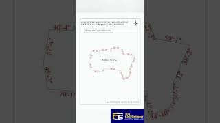
- Control Point Establishment: In this phase, permanent survey markers are used to establish both horizontal and vertical controls. This step often relies on benchmarks and traverse stations for accuracy, along with geo-referencing control points utilizing GNSS technology, ensuring that the layout aligns precisely with design coordinates.
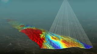
- Base Mapping: The final aspect includes the creation of base maps that accurately represent the terrain and features of the construction site, accomplished through techniques like aerial photogrammetry or LiDAR. Base maps are critical as they serve as spatial databases integrated with Geographic Information Systems (GIS), which facilitate better data management and decision-making throughout the construction process.
Overall, these activities ensure that construction projects are grounded in precise data and trends, detailing the exact specifications needed for a successful build.
Youtube Videos


Audio Book
Dive deep into the subject with an immersive audiobook experience.
Introduction to Pre-Construction Survey Activities
Chapter 1 of 4
🔒 Unlock Audio Chapter
Sign up and enroll to access the full audio experience
Chapter Content
Pre-construction surveys are crucial for planning and organizing construction activities. They set the groundwork for the surveys that will be conducted during the actual construction phase, allowing for a better understanding of site conditions and requirements.
Detailed Explanation
Pre-construction survey activities involve a series of preliminary assessments and plans that take place before the actual construction begins. These activities are vital to ensure that the construction is based on accurate data about the site and its conditions. They help in identifying potential challenges, planning the necessary approaches, and setting up frameworks for further surveys during the construction process.
Examples & Analogies
Think of pre-construction surveys as the 'blueprint' for a well-planned vacation. Just as you would research your destination, book accommodations, and plan your itinerary, pre-construction surveys enable engineers to gather essential information about the site, ensuring that everything goes smoothly once the construction starts.
Reconnaissance Survey
Chapter 2 of 4
🔒 Unlock Audio Chapter
Sign up and enroll to access the full audio experience
Chapter Content
A preliminary field investigation to study the area and plan the survey methodology.
Detailed Explanation
The reconnaissance survey is the first step in the pre-construction survey activities. This survey involves a preliminary investigation of the construction site. Surveyors and engineers visit the location to collect initial data about the terrain, existing structures, accessibility, and other physical attributes. This information helps in planning the overall survey methodology that will be needed for accurate and effective construction.
Examples & Analogies
Consider a detective going to the scene of a crime before starting the investigation. They examine the location for clues, talk to witnesses, and gather information to understand the situation better. Similarly, reconnaissance surveys help construction teams gather essential details that guide further surveys and help avoid potential pitfalls during the construction.
Control Point Establishment
Chapter 3 of 4
🔒 Unlock Audio Chapter
Sign up and enroll to access the full audio experience
Chapter Content
• Establishing horizontal and vertical control using permanent survey markers. • Use of benchmarks and traverse stations. • Geo-referencing control points with GNSS.
Detailed Explanation
Control point establishment involves setting fixed reference points in the construction area that are used to maintain accuracy throughout the construction process. This includes both horizontal control (positioning) and vertical control (elevation). Permanent survey markers, benchmarks, and traverse stations are established on-site, and the Global Navigation Satellite System (GNSS) is employed to geo-reference these points, ensuring their precision and reliability for all subsequent measurements.
Examples & Analogies
Think of control point establishment like marking a start and finish line in a race. Just as racers need reliable reference points to measure their distances and times accurately, construction professionals use established control points to ensure all aspects of the construction align correctly and are built to the right specifications.
Base Mapping
Chapter 4 of 4
🔒 Unlock Audio Chapter
Sign up and enroll to access the full audio experience
Chapter Content
• Preparation of base maps with accurate contouring and features using aerial photogrammetry or LiDAR. • Integration with GIS for spatial database development.
Detailed Explanation
Base mapping is the process of creating detailed maps that provide an accurate representation of the land contours and features of the construction site. This can be done through methods like aerial photogrammetry (taking images from the air) or LiDAR (Light Detection and Ranging) technology, which uses lasers to create precise 3D maps. Additionally, these maps can be integrated with Geographic Information Systems (GIS) to develop a spatial database that allows for better data analysis and visualization.
Examples & Analogies
Imagine you are trying to build a sandcastle on a beach. Before you start, you would probably map out your area — figuring out where the sand is wet and easy to mold versus where it is dry. Similarly, base mapping provides construction teams with a detailed overview of the landscape, which is essential for effective planning and execution of the construction work.
Key Concepts
-
Reconnaissance Survey: A field investigation to plan for surveying.
-
Control Points: Fixed reference points needed for accurate survey measurements.
-
Base Mapping: Creating detailed maps using advanced technologies.
Examples & Applications
An example of reconnaissance surveying would be assessing a site for environmental assessment before construction.
Control points can be established with survey markers visible from multiple angles, ensuring their accessibility during construction.
A base map created with LiDAR might include accurate contour lines that showcase elevation changes vital for drainage planning.
Memory Aids
Interactive tools to help you remember key concepts
Rhymes
Before we build, we scout the field, to find the best, the truth revealed.
Stories
Imagine a surveyor stepping onto a site, clipboard in hand, surveying all around. This journey, the reconnaissance survey, helps them prepare for what lies ahead.
Memory Tools
Remember 'RCC': Reconnaissance, Control Points, and Base Mapping - the three pillars of pre-construction surveys.
Acronyms
Use 'G.C.B.' for 'Geo Control Base' to remember
GNSS for control points
Control Point establishment
and Base Mapping.
Flash Cards
Glossary
- Reconnaissance Survey
A preliminary field investigation to study the area and plan survey methodology.
- Control Points
Established reference points for horizontal and vertical control in surveying.
- Base Mapping
The process of creating accurate maps of terrain using aerial techniques.
- LiDAR
Light Detection and Ranging; a remote sensing method used to examine the surface of the Earth.
- GNSS
Global Navigation Satellite Systems, utilized for precise positioning.
Reference links
Supplementary resources to enhance your learning experience.