
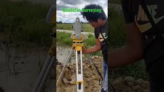
Objectives and Types of Construction Surveys
Enroll to start learning
You’ve not yet enrolled in this course. Please enroll for free to listen to audio lessons, classroom podcasts and take practice test.
Interactive Audio Lesson
Listen to a student-teacher conversation explaining the topic in a relatable way.
Primary Objectives of Construction Surveys
🔒 Unlock Audio Lesson
Sign up and enroll to listen to this audio lesson

Today we're going to learn about the primary objectives of construction surveys. These surveys help us layout engineering works accurately, verifying that the structures are built according to specifications.

What do you mean by layout in this context?
Great question! Layout refers to providing reference points and lines that guide where components of the structure, like columns or walls, should be placed. Can anyone think of another objective?

How do construction surveys verify positions?
They compare the actual placements against the design coordinates. This ensures everything aligns correctly. It’s like having a real-time GPS for building!

And what about monitoring? Why is that important?
Monitoring is crucial for catching any deformations or misalignments during construction. Think of it like a fitness tracker for buildings!

So, recording everything is essential too, right?
Exactly! Documentation maintains accurate as-built records, which are vital for compliance and future reference. To remember the objectives, think of the acronym LVMR: Layout, Verification, Monitoring, and Records.
Types of Construction Surveys
🔒 Unlock Audio Lesson
Sign up and enroll to listen to this audio lesson

Now let's explore the various types of construction surveys. First up, we have route surveys. Can anyone tell me what they're used for?
They help layout roads and railways, right?
Spot on, Student_1! Next, we have building surveys. What aspects do you think they cover?
They focus on foundations and wall placements?
Correct! Building surveys ensure everything is laid out properly for structures. What about bridge and tunnel surveys – any ideas?
They probably check alignment and clearance for those structures.
Yes! Alignments and clearances are critical for safety and functionality. Lastly, we have surveys for hydraulic structures. What do we achieve here?
They would ensure that dams and canals are accurately surveyed.
Exactly! Hydraulic surveys guarantee that essential water management structures are accurately laid out. To sum up, think of the types like RBBH: Route, Building, Bridge, and Hydraulic.
Introduction & Overview
Read summaries of the section's main ideas at different levels of detail.
Quick Overview
Standard
This section outlines the primary objectives of construction surveys, including layout, position verification, monitoring, and documentation. It also categorizes construction surveys into types such as route, building, and hydraulic surveys, each tailored for specific engineering purposes.
Detailed
Objectives and Types of Construction Surveys
Construction surveys are integral to the civil engineering domain, enabling the transition from design to physical structures. The primary objectives of these surveys include:
- Layout of Engineering Works: Establishing critical reference points and lines for construction activities.
- Verification of Positions: Ensuring the accurate placement of structures per design specifications.
- Monitoring and Control: Observing structural behavior to track deformation or misalignment throughout construction.
- Documentation: Maintaining records of as-built conditions for future reference and compliance.
The section also categorizes various types of construction surveys:
- Route Surveys: Support the layout of roadways, railways, or pipelines.
- Building Surveys: Assist in foundation, column, and wall placements.
- Bridge and Tunnel Surveys: Verify alignment and clearance for significant structures.
- Hydraulic Structures Surveys: Ensure the precise functioning of dams, canals, and reservoirs.
Together, these objectives and types form the backbone of effective construction practices, emphasizing precision and reliability.
Youtube Videos


Audio Book
Dive deep into the subject with an immersive audiobook experience.
Primary Objectives of Construction Surveys
Chapter 1 of 2
🔒 Unlock Audio Chapter
Sign up and enroll to access the full audio experience
Chapter Content
• Layout of engineering works: Providing reference points and lines for the execution of construction tasks.
• Verification of positions: Ensuring structures are built according to design coordinates and elevations.
• Monitoring and control: Tracking deformation, settlement, or misalignment during construction.
• Documentation: Maintaining accurate records of as-built conditions.
Detailed Explanation
This section outlines the primary objectives of construction surveys. The first objective is the layout of engineering works, which involves marking reference points and lines to guide construction tasks. The second objective is the verification of positions, meaning that construction teams ensure the structures are built precisely as per the prescribed design coordinates and elevations. The third objective is monitoring and control, where surveys help in tracking any deformation, settlement, or misalignment that may occur during the construction process. Finally, accurate documentation of as-built conditions is crucial for maintaining reliable records that reflect the final structure.
Examples & Analogies
Think of construction surveys as a GPS for a road trip. Just like a GPS guides you to ensure you are on the correct route (layout of engineering works), verifies if you are driving on the intended path (verification of positions), keeps track of any detours or road conditions (monitoring and control), and allows you to look back at your journey and understand where you’ve been (documentation), construction surveys serve similar roles in ensuring structures are built accurately.
Types of Construction Surveys
Chapter 2 of 2
🔒 Unlock Audio Chapter
Sign up and enroll to access the full audio experience
Chapter Content
• Route Surveys: For roadways, railways, pipelines.
• Building Surveys: For foundation, column, and wall placement.
• Bridge and Tunnel Surveys: For alignment and clearance verification.
• Hydraulic Structures Surveys: For dams, canals, reservoirs.
Detailed Explanation
In this chunk, we examine various types of construction surveys. Route surveys are focused on transportation infrastructures such as roadways, railways, and pipelines, ensuring they are established at the correct locations. Building surveys pertain to the precise placement of foundations, columns, and walls in buildings, which are crucial for overall structural integrity. Bridge and tunnel surveys are specialized for checking the alignment and clearance of these structures to ensure safety and functionality. Lastly, hydraulic structures surveys concentrate on dams, canals, and reservoirs, focusing on their spatial characteristics and hydraulic functionality.
Examples & Analogies
Imagine planning a large concert in a park. Route surveys would be like mapping out the best pathways for attendees to enter and exit safely. Building surveys would ensure that the stage is set up correctly on the ground, with the right height and sturdiness. For any tunnels leading to backstage areas (like in large festivals), you’d want to double-check their width and height to ensure equipment can move through easily. Finally, for a waterfall feature that could be part of the event, hydraulic structure surveys make sure its dam is constructed to handle the water flow properly, preventing any overflow.
Key Concepts
-
Layout of Engineering Works: Providing reference points and lines for construction activities.
-
Verification of Positions: Ensuring structures are built according to design specifications.
-
Monitoring and Control: Tracking deformation and misalignment during construction.
-
Documentation: Maintaining records of as-built conditions for compliance.
-
Types of Surveys: Including route surveys, building surveys, bridge and tunnel surveys, and hydraulic structure surveys.
Examples & Applications
Construction survey for highway projects involves route surveys to determine the alignment of the roadway accurately.
Building surveys are essential for ensuring that the foundations and columns are placed as specified in the architectural design.
Memory Aids
Interactive tools to help you remember key concepts
Rhymes
For every build, we lay and check, positions and data, all to perfect.
Stories
Imagine a mapmaker, who always needs a reliable guide, to create roads, match buildings, and ensure the towns can thrive.
Memory Tools
Remember LVMR for laying down the construction plan: Layout, Verification, Monitoring, Records.
Acronyms
Use RBBH to recall the types
Route
Building
Bridge
Hydraulic.
Flash Cards
Glossary
- Construction Survey
A survey that provides spatial data and layout information necessary for construction projects.
- Layout
The act of marking reference points and lines for building tasks.
- Verification of Positions
The process of confirming structures' accuracy against design specifications.
- Monitoring
Tracking deformations, settlements, or misalignments during construction.
- Documentation
Maintaining records of the as-built conditions of structures.
- Route Survey
Surveys that support the planning and layout of roadways, railways, and pipelines.
- Building Survey
Surveys focused on the positioning of foundations, columns, and walls.
- Bridge and Tunnel Surveys
Surveys verifying alignments and clearances for bridges and tunnels.
- Hydraulic Structures Surveys
Surveys that ensure the accurate layout and functioning of dams, canals, and reservoirs.
Reference links
Supplementary resources to enhance your learning experience.