
Future Trends in Construction Surveying
Enroll to start learning
You’ve not yet enrolled in this course. Please enroll for free to listen to audio lessons, classroom podcasts and take practice test.
Interactive Audio Lesson
Listen to a student-teacher conversation explaining the topic in a relatable way.
Artificial Intelligence in Construction Surveying
🔒 Unlock Audio Lesson
Sign up and enroll to listen to this audio lesson

Today, we will explore how Artificial Intelligence is transforming construction surveying. AI can help in three major ways: automatic error detection, object recognition in point clouds, and predictive analytics for structural movements. Can anyone explain what ‘point clouds’ mean?

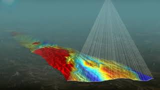
Isn't a point cloud a collection of data points in space that represents a 3D shape or surface?
Exactly! Great explanation! Point clouds are generated from laser scans or photogrammetry. Now, how do you think predictive analytics can benefit construction projects?

Predictive analytics can help us anticipate problems before they occur, like structural failures or misalignments?
Right! AI helps construction teams make informed, data-driven decisions. Let’s move on to cloud-based collaborative surveying.

How does cloud collaboration work in this context?
Cloud technology allows engineers and architects to share survey data in real-time, enhancing communication and coordination on complex projects.

So that means everyone can see changes instantly?
Precisely! To wrap up, remember that AI can vastly improve our error detection and analysis capabilities.
Augmented Reality (AR) in Surveying
🔒 Unlock Audio Lesson
Sign up and enroll to listen to this audio lesson

Now let’s dive into Augmented Reality. Why do you all think using AR might be beneficial in construction surveying?
It could allow us to see 3D models superimposed on the actual site, right?
That's correct! This helps with alignment checks and clash identification. Imagine checking a design’s placement using AR goggles with real-time data overlay!
That sounds very useful for improving communication among teams!
Exactly! Clear visualizations can greatly enhance understanding. Can anyone think of a scenario where AR would save time on a project?
Before we start building, AR could show us potential issues, reducing rework later!
Yes! Less rework means lower costs and faster project completion. Lastly, let’s look at the Internet of Things in our next session.
Internet of Things (IoT) in Surveying
🔒 Unlock Audio Lesson
Sign up and enroll to listen to this audio lesson
Now, who can explain how IoT integrates into construction surveying?
IoT uses sensors to collect data from structures, like how they are performing over time.
Exactly! IoT monitors aspects such as strain and vibrations. Why is this data critical?
It’s essential for ensuring that the structure is safe and identifying any potential issues early!
Correct! The real-time feedback helps teams react swiftly. Also, how can this data integrate with GIS?
Probably by creating visual dashboards where we can see how the structure performs in real-time?
Exactly! When GIS integrates with IoT, it allows for effective monitoring of infrastructure health. Remember, IoT enhances our capabilities significantly!
Introduction & Overview
Read summaries of the section's main ideas at different levels of detail.
Quick Overview
Standard
The future of construction surveying is heavily influenced by technological advancements such as Artificial Intelligence, cloud-based collaboration, augmented reality for field visualization, and the Internet of Things. These innovations promise enhanced precision, real-time data access, and improved structural monitoring.
Detailed
Future Trends in Construction Surveying
The future of construction surveying is moving towards integrating advanced technologies that enhance the efficiency and accuracy of survey operations.
15.16.1 Artificial Intelligence and Machine Learning
AI is becoming increasingly crucial in construction surveying. Its applications include:
- Automatic error detection: Identifying anomalies during surveying processes.
- Object recognition in point clouds: Enhancing the precision of 3D models by recognizing various structure elements.
- Predictive analytics for structural movement: Forecasting potential issues before they arise, allowing for proactive measures.
15.16.2 Cloud-Based Collaborative Surveying
Cloud technology allows real-time data sharing across teams. This improves communication among engineers, architects, and project managers, streamlining the workflow, particularly in complex, multi-agency infrastructure projects.
15.16.3 Augmented Reality (AR) for Field Visualization
AR technology enables surveyors and engineers to overlay digital models onto the physical environment. This helps in:
- Checking alignment: Ensures that design models are correctly placed concerning the construction site.
- Identifying clashes: Spotting potential issues in layout before physical construction occurs.
- Communicating plans: Visual aids improve understanding among on-site teams and stakeholders.
15.16.4 Internet of Things (IoT) in Surveying
IoT devices are revolutionizing the monitoring of structures. Sensors can provide real-time data on:
- Strain and vibration: Essential in assessing the integrity of large infrastructure.
- Settlement indicators: Alerting teams to any shifts that could compromise safety.
These data streams can be integrated with Geographic Information Systems (GIS) dashboards for live monitoring of infrastructure health, ensuring that the structures remain safe over time.
Youtube Videos


![What is MSc Geoinformatics course? – [Hindi] – Quick Support](https://img.youtube.com/vi/QC6cEfNk1aQ/mqdefault.jpg)


Audio Book
Dive deep into the subject with an immersive audiobook experience.
Artificial Intelligence and Machine Learning
Chapter 1 of 4
🔒 Unlock Audio Chapter
Sign up and enroll to access the full audio experience
Chapter Content
AI models used for automatic error detection, object recognition in point clouds, and predictive analytics for structural movement.
Detailed Explanation
Artificial Intelligence (AI) and Machine Learning (ML) are transforming construction surveying by making it more efficient and accurate. AI models can automatically find errors in survey data, which helps in reducing human mistakes. They can also recognize various objects in point clouds, a type of data collection that captures the shape and features of physical objects. Additionally, these technologies can analyze movements in structures over time, predicting potential issues before they occur. This means that construction projects can be better planned and monitored, leading to safer and more reliable structures.
Examples & Analogies
Think of AI in construction as a watchful assistant. Imagine you're putting together a puzzle. Your assistant not only helps you find the right pieces but also tells you if two pieces don't fit together properly. Similarly, AI ensures that all the surveying data aligns correctly and alerts engineers about potential problems with structural stability before any actual construction begins.
Cloud-Based Collaborative Surveying
Chapter 2 of 4
🔒 Unlock Audio Chapter
Sign up and enroll to access the full audio experience
Chapter Content
Survey data uploaded in real-time for remote access by engineers, architects, and project managers. Enhances coordination, especially in multi-agency infrastructure projects.
Detailed Explanation
Cloud-based collaborative surveying enables survey data to be uploaded to the cloud as it is collected, making it available for access by different stakeholders, such as engineers, architects, and project managers, from anywhere. This immediate access to data improves coordination among various teams working on a construction project. In multi-agency projects, where different organizations collaborate, this system helps ensure everyone is on the same page, reducing miscommunication and delays.
Examples & Analogies
Imagine you're working on a school group project. If every member can instantly share their research notes and ideas in a shared online document, everyone can contribute more effectively. Similarly, cloud-based surveying allows construction teams to keep everyone updated and informed in real-time, making collaboration smoother and quicker.
Augmented Reality (AR) for Field Visualization
Chapter 3 of 4
🔒 Unlock Audio Chapter
Sign up and enroll to access the full audio experience
Chapter Content
Overlaying design models on the real environment through AR headsets or mobile devices. Assists in checking alignment, identifying clashes, and communicating plans on-site.
Detailed Explanation
Augmented Reality (AR) technology allows engineers and construction workers to visualize 3D models of designs overlaid onto the actual construction site using headsets or mobile devices. This visualization helps teams ensure that elements are correctly aligned and no clashes occur between different parts of the structure. By seeing the design overlaid on the site, they can communicate ideas and plans more effectively, making adjustments before physical work begins.
Examples & Analogies
Think of AR as using a special pair of glasses that allows you to see a virtual version of a building superimposed on the empty lot where it will be built. It’s like playing a video game where you can see the game world right in your living room, so you can easily find where things go and fix any problems before the construction starts.
Internet of Things (IoT) in Surveying
Chapter 4 of 4
🔒 Unlock Audio Chapter
Sign up and enroll to access the full audio experience
Chapter Content
Sensors embedded in structures transmit real-time data on strain, vibration, and settlement. Combined with GIS dashboards for live monitoring of infrastructure health.
Detailed Explanation
The Internet of Things (IoT) involves using integrated sensors in construction projects that continuously collect and transmit data related to the structural health of a building—such as strain, vibration, and settlement. This real-time data can then be visualized on Geographic Information Systems (GIS) dashboards, allowing project managers and engineers to monitor the condition of structures instantly and make informed decisions about maintenance or repairs if needed.
Examples & Analogies
Consider IoT in construction like having a fitness tracker for your building. Just like a fitness tracker monitors your heart rate and steps in real-time, IoT sensors report on how well the building is doing. If anything seems off, just like you would check your health if the tracker signals a problem, engineers can take action to prevent major issues.
Key Concepts
-
Artificial Intelligence: A technology simulating human intelligence to enhance surveying accuracy.
-
Cloud-Based Collaboration: Real-time sharing of data that allows efficient project management.
-
Augmented Reality: Technology that overlays digital information on the physical world for better decision-making.
-
Internet of Things: A system of interconnected devices that provide real-time monitoring and data collection.
Examples & Applications
AI models can analyze survey data and detect errors in real time, significantly reducing rework in construction projects.
Using cloud-based platforms, multiple stakeholders can access updated survey data, ensuring everyone is on the same page with project specifications.
Memory Aids
Interactive tools to help you remember key concepts
Rhymes
In surveying with AI, mistakes are a lie, as it detects in the blink of an eye.
Stories
Imagine a team of engineers using AR goggles on site, effortlessly reviewing designs while they work, spotting issues before they arise.
Acronyms
Remember 'CIA' for the future trends
Cloud
IoT
AI
and AR enhance the surveying field.
Use 'CARGO' to remember cloud, augmented reality, GNSS, and IoT - the future tools in surveying.
Flash Cards
Glossary
- Artificial Intelligence (AI)
Simulates human intelligence in machines, enabling functions like error detection and predictive analysis.
- Point Cloud
A set of data points in space representing a 3D object, used for detailed analysis and modeling.
- CloudBased Collaboration
Real-time sharing and access to data via cloud technology, improving project communication.
- Augmented Reality (AR)
An interactive experience where digital information is overlaid on the real world, enhancing visualization.
- Internet of Things (IoT)
Network of interconnected devices that collect and exchange data about physical conditions.
Reference links
Supplementary resources to enhance your learning experience.