
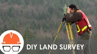
Challenges in Construction Surveying
Enroll to start learning
You’ve not yet enrolled in this course. Please enroll for free to listen to audio lessons, classroom podcasts and take practice test.
Interactive Audio Lesson
Listen to a student-teacher conversation explaining the topic in a relatable way.
Terrain and Accessibility Challenges
🔒 Unlock Audio Lesson
Sign up and enroll to listen to this audio lesson

Let's start by discussing the first challenge in construction surveying: terrain and accessibility. Surveying in challenging terrains like hilly, forested, or waterlogged areas can significantly affect our ability to perform accurate surveys. Can anyone tell me why that might be?

I think it's because it can be harder to reach certain spots or see what's there.
Exactly! Limited physical access and poor line-of-sight can hinder our work. That's where aerial methods and GNSS with correction networks come into play. Does anyone know what GNSS stands for?

Isn't it Global Navigation Satellite Systems?
Correct! So GNSS helps us get accurate locations even when we can't physically access an area. Can someone summarize the implications of terrain on surveying?

Difficult terrains require more advanced methods and can introduce more complications in the survey process.
Well said! Understanding how to navigate these challenges is crucial for successful surveying.
Urban Congestion Issues
🔒 Unlock Audio Lesson
Sign up and enroll to listen to this audio lesson

Now, let's discuss urban congestion. Working in tight spaces with nearby structures can be quite problematic. Why do you think that is?

It might block the view for measurements and make it harder to set up equipment!
That's right! To overcome this, we often use technologies like robotic total stations and reflectorless measurements. Can anyone explain how these technologies help?
Robotic stations can track movements automatically, which means we don't need to be in the way or close to the target.
Exactly! This efficiency is vital in urban projects. Can someone summarize the main idea of urban congestion impact?
Urban congestion makes surveying harder, but technology can help us work around it.
Great summary! Always remember the technological solutions available to us.
Environmental and Climatic Factors
🔒 Unlock Audio Lesson
Sign up and enroll to listen to this audio lesson
Next, let's talk about the environmental and climatic factors affecting surveys. What kinds of weather conditions can impact surveying accuracy?
Rain and fog could make it hard to see or read measurements correctly.
Correct! These conditions can distort measurements and can cause equipment malfunctions. How should we respond to these challenges?
We need to schedule surveys based on weather forecasts.
Exactly! Planning ahead helps avoid disruptions. Can someone recap the difficulties posed by environmental conditions?
Weather can distort readings and impact equipment, so we should account for it in our planning.
Spot on! Understanding environmental effects is key to effective surveying.
Technological Gaps
🔒 Unlock Audio Lesson
Sign up and enroll to listen to this audio lesson
Finally, let’s discuss technological gaps in construction surveying. What issues arise from inadequate training on advanced instruments?
Without proper training, we might not use the equipment to its full potential or could make mistakes.
Exactly! Ongoing training and standardization across practices are essential for effective use of modern tools. Why do you think this consistency is important?
It ensures that everyone is on the same page and can collaborate effectively.
Correct! To summarize, addressing technological gaps through training boosts proficiency and survey accuracy.
Introduction & Overview
Read summaries of the section's main ideas at different levels of detail.
Quick Overview
Standard
Construction surveying encounters several challenges that can impact accuracy and efficiency. These include issues related to difficult terrains, the challenges posed by urban environments, the influence of environmental factors, and the need for ongoing training and adaptation to modern survey technologies.
Detailed
Detailed Summary of Challenges in Construction Surveying
Construction surveying is critical in ensuring accurate execution of civil engineering projects. However, it comes with a myriad of challenges:
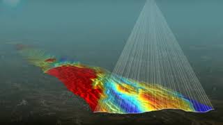
- Terrain and Accessibility: Surveying in hilly, forested, or waterlogged areas complicates physical access and line-of-sight. This can necessitate the use of aerial surveying methods or GNSS with correction networks, which can be more complicated and costly.
- Urban Congestion: Tight working spaces and interference from nearby structures can obscure survey visibility and hinder equipment placement. To mitigate these issues, technologies such as robotic stations and reflectorless measurements are often utilized, enabling surveyors to work more efficiently in congested environments.
- Environmental and Climatic Factors: Weather conditions such as fog, rain, and heat can distort measurements and impact the functioning of surveying equipment. Therefore, survey schedules must be carefully aligned with meteorological data to avoid inaccuracies caused by adverse weather.
- Technological Gaps: A lack of adequate training on advanced surveying instruments can lead to their underutilization. Continuous upskilling and standardization of practices across the industry are necessary to bridge these gaps and improve surveying effectiveness.
Understanding these challenges is essential for improving survey accuracy and project outcomes in construction.
Youtube Videos


Audio Book
Dive deep into the subject with an immersive audiobook experience.
Terrain and Accessibility
Chapter 1 of 4
🔒 Unlock Audio Chapter
Sign up and enroll to access the full audio experience
Chapter Content
• Hilly, forested, or waterlogged areas pose challenges for physical access and line-of-sight.
• Requires use of aerial methods or GNSS with correction networks.
Detailed Explanation
This chunk discusses how challenging terrains, such as hills, forests, and waterlogged areas, impact construction surveying. These environments might make it difficult for surveyors to physically reach certain locations or to obtain a clear line of sight for measurement. To overcome these obstacles, surveyors often rely on advanced technologies such as aerial surveying methods (like drones) or Global Navigation Satellite Systems (GNSS), which can offer accurate data even in difficult settings by utilizing correction networks to enhance measurement precision.
Examples & Analogies
Imagine trying to measure out a plot of land for a new park that's in a dense forest. Walking through the trees can be time-consuming and it’s hard to see what you're measuring without a clear view. Instead, a surveyor might send a drone above the trees to get a bird’s-eye view of the land. Just like how a drone can help in surveying, using satellites can provide essential accurate locations where it's tough to walk.
Urban Congestion
Chapter 2 of 4
🔒 Unlock Audio Chapter
Sign up and enroll to access the full audio experience
Chapter Content
• Tight working spaces and interference from nearby structures impact survey visibility and equipment placement.
• Robotic stations and reflectorless measurements are often employed.
Detailed Explanation
In urban environments, construction sites are often surrounded by other buildings and structures, leading to limited space for survey equipment. This congestion can restrict visibility for surveys and complicate the placement of surveying instruments. To deal with these challenges, modern surveying techniques, such as robotic total stations that can operate without a direct line of sight, and reflectorless measurements, are frequently utilized. These technologies allow surveyors to obtain necessary data even in crowded areas.
Examples & Analogies
Think about surveying for a new building in a busy city. There are other buildings very close by that block the view of the area you need to measure. Instead of moving around bulky equipment and getting frustrated, a surveyor can use a robotic instrument that can measure distances without needing to see what it's measuring directly, similar to how a radar can detect objects even when they're hidden behind walls.
Environmental and Climatic Factors
Chapter 3 of 4
🔒 Unlock Audio Chapter
Sign up and enroll to access the full audio experience
Chapter Content
• Weather conditions (e.g., fog, rain, heat) can distort measurements and affect equipment function.
• Survey schedules must be planned with meteorological data in mind.
Detailed Explanation
Environmental factors play a crucial role in construction surveying. Adverse weather conditions like fog, heavy rain, or extreme temperatures can lead to inaccurate measurements and affect the performance of surveying equipment. Consequently, surveyors must carefully plan their work schedules, often checking the weather forecasts to choose times when conditions are more stable, ensuring they can collect reliable data.
Examples & Analogies
Imagine trying to take a photo of a beautiful landscape, but it's foggy, and you can't see anything. The same concept applies to surveying; if it's rainy, the measurements might not be clear. A good photographer would wait for a sunny day, just as surveyors keep an eye on the weather to pick the best times for accurate work.
Technological Gaps
Chapter 4 of 4
🔒 Unlock Audio Chapter
Sign up and enroll to access the full audio experience
Chapter Content
• Inadequate training in advanced instruments can lead to underutilization.
• Need for upskilling and standardization across industry practices.
Detailed Explanation
The effectiveness of construction surveying can be hindered by technological gaps, primarily stemming from insufficient training in modern tools and instruments. When surveyors do not fully understand how to use advanced technology like robotic total stations or GNSS, they may not be able to utilize these tools to their full potential. This underutilization can lead to inefficiencies and inaccuracies. Establishing comprehensive training programs and standard practices across the industry can help bridge these gaps and improve surveying outcomes.
Examples & Analogies
Think about learning to use a smartphone. If you've never had a chance to learn how to use the apps and features, you might only use it to make calls instead of its full range of capabilities, like navigation and photography. Similarly, surveyors need proper training to harness the full power of advanced surveying technologies to do their jobs effectively.
Key Concepts
-
Terrain and Accessibility: Refers to how physical landscape features affect surveying work.
-
Urban Congestion: Involves challenges in surveying in densely populated areas with limited space.
-
Environmental Factors: Weather conditions that can distort survey measurements and affect tool performance.
-
Technological Gaps: The need for proper training and standardization in the use of modern surveying equipment.
Examples & Applications
In hilly terrains, surveyors might need to employ drones to obtain aerial views, allowing for accurate measurements without physical access.
Urban areas often require the use of robotic total stations to efficiently gather data in tight spaces.
Memory Aids
Interactive tools to help you remember key concepts
Rhymes
In hilly areas, do not fret, aerial methods are your best bet.
Stories
Imagine a surveyor in a bustling city, struggling with heavy traffic. By using robotic total stations, they can collect data quickly without obstructing the busy streets, showing how technology can solve challenges.
Memory Tools
For surveying, remember the acronym 'ATE': A for Accessibility, T for Terrain, and E for Environmental factors.
Acronyms
Remember 'GAP' for the challenges
for GNSS
for Accessibility
and P for Proficiency in technology.
Flash Cards
Glossary
- GNSS
Global Navigation Satellite Systems, a satellite-based system for accurate positioning.
- Robotic Total Station
A surveying instrument that can automatically track a target prism, allowing for enhanced efficiency in data collection.
- Reflectorless Measurements
A surveying method that allows for measurements without the need for a reflective target, useful in congested environments.
Reference links
Supplementary resources to enhance your learning experience.