
Use of Drones and Aerial Surveying
Enroll to start learning
You’ve not yet enrolled in this course. Please enroll for free to listen to audio lessons, classroom podcasts and take practice test.
Interactive Audio Lesson
Listen to a student-teacher conversation explaining the topic in a relatable way.
Introduction to Aerial Photogrammetry
🔒 Unlock Audio Lesson
Sign up and enroll to listen to this audio lesson

Let's begin by discussing aerial photogrammetry. Can anyone tell me what this process entails?

Isn't it about taking pictures from above to create maps?
Exactly! Aerial photogrammetry captures high-resolution images using drones to produce orthomosaic maps and 3D models. These images help in various assessments like cut/fill analysis.

How does it help in monitoring construction progress?
Great question! Regular aerial updates from drones allow for timely identification of any deviations from the construction plans, enabling swift corrective actions. Remember the acronym MAPE – Monitor, Assess, Propose changes, and Execute.

So, it’s like having a bird's eye view of the construction site?
Precisely! This perspective offers enhanced visualization for everyone involved in the project.

So, how does this fit with other technologies like GIS?
Drones integrate smoothly with GIS for spatial analysis by providing accurate and up-to-date data. In conclusion, aerial photogrammetry is a powerful method enhancing both planning and monitoring.
Advantages of Drone-Based Monitoring
🔒 Unlock Audio Lesson
Sign up and enroll to listen to this audio lesson

Now, let’s delve into the advantages of drone-based monitoring. Can anyone share a benefit they might foresee?
I think they could cover large areas quickly, right?
Absolutely! Drones conduct rapid data collection across large areas, which is especially useful in inaccessible sites. They also support seamless integration with various technologies.
Do they help with visual documentation?
Yes! Enhanced site visualization helps stakeholders better understand the project. Can anyone remember the acronym used for the benefits of drone monitoring?
RAISE – Rapid, Accurate, Integrated, Seamless, and Enhanced documentation!
Correct! This acronym helps summarize the key advantages of employing drones.
How often should drones be flown for effective monitoring?
Periodic flights are recommended, allowing consistent updates throughout the construction process. This strengthens oversight and quality control over time.
Introduction & Overview
Read summaries of the section's main ideas at different levels of detail.
Quick Overview
Standard
This section focuses on the applications of drones in construction surveying, discussing aerial photogrammetry, drone-based monitoring, and their advantages. It highlights how drones improve data collection efficiency and site visualization while integrating seamlessly with other surveying technologies.
Detailed
Use of Drones and Aerial Surveying
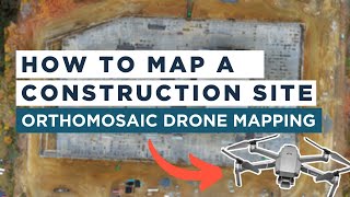
Drones, also known as Unmanned Aerial Vehicles (UAVs), are revolutionizing the field of construction surveying through their ability to capture high-resolution images and generate actionable data. The primary method employed is aerial photogrammetry, which involves the use of UAVs to produce detailed orthomosaic maps and 3D models. This data can be invaluable for tasks such as cut/fill analysis, progress tracking, and volumetric estimations, which are critical in earthworks.
Furthermore, drone-based monitoring allows construction teams to conduct periodic flights over the building site. This capability plays a vital role in keeping track of construction progress and quickly identifying discrepancies from the planned work, thereby promoting proactive adjustments. The integration of thermal imaging technology in drones can be used to assess electrical installations or monitor heat insulation performance, showcasing another layer of utility in construction monitoring.
The advantages of employing drones in construction surveying are numerous: they provide rapid data collection, improve visualization for stakeholders, and ensure that data created can be seamlessly integrated with GIS and BIM platforms. As a result, drones have emerged as essential tools in modern construction surveying, enhancing overall efficiency and accuracy.
Youtube Videos


Audio Book
Dive deep into the subject with an immersive audiobook experience.
Aerial Photogrammetry
Chapter 1 of 3
🔒 Unlock Audio Chapter
Sign up and enroll to access the full audio experience
Chapter Content
• Captures high-resolution images from UAVs to produce orthomosaic maps and 3D models.
• Used for cut/fill analysis, progress tracking, and volumetric estimation in earthworks.
Detailed Explanation
Aerial photogrammetry is a technique where drones (Unmanned Aerial Vehicles or UAVs) are used to take high-resolution photographs of the ground. These images are processed to create detailed maps (orthomosaic maps) and 3D models of the surveyed area. This information is particularly useful for construction and engineering projects, especially for analyzing the amount of material that needs to be moved (cut/fill analysis), tracking the progress of construction, and estimating volumes for excavation and other earthwork tasks.
Examples & Analogies
Imagine you want to build a large sandcastle at the beach. Before you start, you take a series of pictures of the beach from above to see how much sand you have and where the best place to build is. By putting these pictures together, you can create a detailed map of the area and decide exactly how much sand you need to move to create your castle—just like how drones create maps to guide construction projects.
Drone-Based Monitoring
Chapter 2 of 3
🔒 Unlock Audio Chapter
Sign up and enroll to access the full audio experience
Chapter Content
• Periodic flights help monitor construction progress and detect deviations early.
• Thermal imaging drones used in monitoring electrical installations or heat insulation performance.
Detailed Explanation
Drone-based monitoring involves conducting regular flights using drones to capture current images or data of a construction site. This method allows project managers to observe the progress of construction work regularly and quickly identify any deviations from the planned work. Additionally, specialized drones equipped with thermal imaging cameras can assess the performance of electrical systems and check insulation effectiveness by identifying heat loss areas.
Examples & Analogies
Think of a teacher regularly checking on students during a project to ensure they are following the instructions. If a student is going off-track, the teacher can step in and correct things before it becomes a bigger issue. Similarly, drones regularly check on the construction site, allowing teams to catch any mistakes early and keep everything on schedule.
Advantages of Using Drones
Chapter 3 of 3
🔒 Unlock Audio Chapter
Sign up and enroll to access the full audio experience
Chapter Content
• Rapid data collection over large and inaccessible areas.
• Enhanced site visualization and documentation for stakeholders.
• Seamless integration with GIS and BIM platforms.
Detailed Explanation
Drones offer several advantages for construction and surveying. They can quickly gather data from large and difficult-to-reach areas, which would be time-consuming and labor-intensive using traditional methods. The data collected provides improved visibility of the site, which can be crucial for various stakeholders, including project managers and architects, for planning and decision-making. Furthermore, drones can be easily integrated with Geographic Information Systems (GIS) and Building Information Modeling (BIM) platforms for enhanced project coordination and analysis.
Examples & Analogies
Consider how GPS has changed road travel. It allows you to quickly find efficient routes and access maps from anywhere, making it easier to reach destinations. Drones do something similar in construction—they provide quick access to site details and improve communication through visual documentation, making project coordination smoother and more efficient, just like GPS makes traveling less complicated.
Key Concepts
-
Aerial Photogrammetry: Using drones to capture images for mapping and modeling.
-
Drone-Based Monitoring: Utilizing drones to surveil construction progress.
-
Integration: Combining drone data with GIS and BIM for enhanced planning.
Examples & Applications
Drones can create 3D models of a construction site, aiding in project visualization.
Regular drone flights can detect deviations from construction plans early.
Memory Aids
Interactive tools to help you remember key concepts
Rhymes
Drones in the sky, mapping from above, capturing views we all will love.
Stories
Imagine a drone flying high above a busy construction site, snapping pictures to ensure everything aligns just right. It finds errors before they become big, saving time and money with its aerial gig!
Memory Tools
PAVE - Photogrammetry, Assessment, Visualization, Efficiency.
Acronyms
DREAM - Drones Rapidly Enhance Aerial Mapping.
Flash Cards
Glossary
- Aerial Photogrammetry
A technique that uses high-resolution images captured by UAVs to create maps and 3D models.
- Drones (UAVs)
Unmanned Aerial Vehicles used for capturing images and data from above construction sites.
- Thermal Imaging
Technology used in drones to detect heat and assess insulation or electrical installations.
- Integration
The process of combining drone data with other technologies like GIS and BIM.
Reference links
Supplementary resources to enhance your learning experience.