
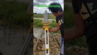
GPS Survey Methods in Civil Engineering
Enroll to start learning
You’ve not yet enrolled in this course. Please enroll for free to listen to audio lessons, classroom podcasts and take practice test.
Interactive Audio Lesson
Listen to a student-teacher conversation explaining the topic in a relatable way.
Overview of GPS Survey Methods
🔒 Unlock Audio Lesson
Sign up and enroll to listen to this audio lesson

Today, we are going to explore various GPS survey methods that civil engineers use. Can anyone tell me why it's important to choose the right method?

To ensure that we get the needed accuracy for our projects!
Exactly! Now, let's dive into our first method: Static GPS Surveying. This method requires prolonged observation at fixed locations. Who can guess the level of accuracy we can achieve with this method?

Is it millimeter to centimeter level?
Correct! This high accuracy is essential for applications like geodetic control surveys. Let's remember this method with the acronym 'S-GO'—Static GPS Observation!
Rapid Static Surveying
🔒 Unlock Audio Lesson
Sign up and enroll to listen to this audio lesson

Moving on, Rapid Static Surveying involves shorter observation times. Can anybody guess how long these observations typically last?

About 10 to 30 minutes?
Yes, precisely! This method yields good accuracy for medium requirements. It's particularly useful for establishing control networks. Does anyone see how this differs from Static GPS?

It’s faster, and we don’t need to observe for such a long time.
Exactly! Now, let’s remember Rapid Static as ‘Quick and Reliable—Q&R’.
Kinematic Surveying and Real-Time Kinematic (RTK) Surveying
🔒 Unlock Audio Lesson
Sign up and enroll to listen to this audio lesson
Next, we have Kinematic Surveying where the receiver moves while collecting data. What projects might this be useful for?
Maybe for road alignment surveys?
Exactly right! This method is great for those applications. Now, how does Real-Time Kinematic (RTK) differ from Kinematic Surveying?
RTK provides real-time corrections, right?
That's correct! RTK offers centimeter-level accuracy almost instantly which is ideal for construction. Let’s remember RTK as 'Ready To Know' since it gives real-time data!
Stop-and-Go Surveying
🔒 Unlock Audio Lesson
Sign up and enroll to listen to this audio lesson
Lastly, let’s talk about Stop-and-Go Surveying. Who can tell me how this method works?
The receiver stops to record positions instead of moving all the time.
Exactly! It’s actually more accurate than continuous kinematic methods and is great for detailed surveys. How can we summarize our learning today?
By remembering the names and key features of each method!
Yes, let's recap: S-GO for Static, Q&R for Rapid Static, and 'Ready To Know' for RTK! Great job everyone!
Introduction & Overview
Read summaries of the section's main ideas at different levels of detail.
Quick Overview
Standard
The section outlines several GPS survey methods including Static GPS, Rapid Static, Kinematic, Real-Time Kinematic (RTK), and Stop-and-Go surveying. Each method is suited for different levels of accuracy and project scopes, illustrating their specific applications in civil engineering tasks such as deformation monitoring and construction layout.
Detailed
GPS Survey Methods in Civil Engineering
In civil engineering, the choice of GPS survey method is crucial and depends on the accuracy requirements, project scope, and environmental conditions. Here are the primary GPS-based methods utilized:
1. Static GPS Surveying
- Involves prolonged observation at fixed locations.
- Provides highly accurate results ranging from millimeter to centimeter levels.
- Data requires post-processing for accuracy, suitable for geodetic control surveys and deformation monitoring.
2. Rapid Static Surveying
- Involves shorter observation periods (10–30 minutes).
- Offers good accuracy for medium-level requirements, efficient for establishing control networks.
3. Kinematic Surveying
- Data collection occurs while the receiver moves, often used in road alignment surveys and utility mapping.
4. Real-Time Kinematic (RTK) Surveying
- Involves a base and rover unit for real-time data correction, providing instantaneous centimeter-level accuracy.
- Ideal for tasks in precision agriculture and construction layout.
5. Stop-and-Go Surveying
- A variation of kinematic where the receiver stops to record positions, achieving more accuracy than continuous kinematic methods.
- Used in detailed surveys and GIS data collection.
Each method caters to specific engineering needs and accuracy levels, making GPS an invaluable tool in civil engineering applications.
Youtube Videos


Audio Book
Dive deep into the subject with an immersive audiobook experience.
Introduction to GPS Survey Methods
Chapter 1 of 6
🔒 Unlock Audio Chapter
Sign up and enroll to access the full audio experience
Chapter Content
The choice of survey method using GPS depends on the desired accuracy, project scope, and environmental conditions. Civil engineers often utilize the following GPS-based methods:
Detailed Explanation
In civil engineering, selecting the right GPS surveying method is crucial for achieving the required accuracy for a project. Factors such as the level of precision needed, the specific goals of the project, and the surrounding environmental conditions must all be considered when choosing a method.
Examples & Analogies
Think of it like choosing a tool for a DIY project. If you need to make precise cuts, you might choose a laser cutter instead of a standard saw. Similarly, in GPS surveying, choosing the right method ensures the best results based on the project’s needs.
Static GPS Surveying
Chapter 2 of 6
🔒 Unlock Audio Chapter
Sign up and enroll to access the full audio experience
Chapter Content
4.11.1 Static GPS Surveying
• Involves prolonged observation at fixed locations
• Highly accurate (millimeter to centimeter level)
• Requires post-processing of data
• Used in geodetic control surveys, deformation monitoring
Detailed Explanation
Static GPS Surveying involves keeping a GPS receiver stationary at a specific location for an extended period of time. This allows for the collection of accurate position data, which is often required in high-precision surveys such as those related to geodesy and monitoring the stability of structures. After data collection, the information is processed to improve accuracy.
Examples & Analogies
Consider taking a long exposure photograph in a dimly lit room. The longer the camera remains still, the clearer and more detailed the photo becomes. Similarly, the longer a GPS receiver remains in one spot, the more accurate the data collected.
Rapid Static Surveying
Chapter 3 of 6
🔒 Unlock Audio Chapter
Sign up and enroll to access the full audio experience
Chapter Content
4.11.2 Rapid Static Surveying
• Shorter observation periods (10–30 minutes)
• Good for medium-accuracy requirements
• Efficient for establishing control networks
Detailed Explanation
Rapid Static Surveying is a method where GPS receivers are stationary for shorter periods, typically between 10 to 30 minutes. This approach is suitable for projects that require moderate accuracy, such as creating control networks, and is considerably faster than traditional static methods.
Examples & Analogies
Imagine setting a timer for a quick cooking task, like boiling water. While you won't achieve the same depth of flavor with a quick dash, you still get a decent result faster. Rapid Static Surveying offers a balance between speed and accuracy, making it an effective choice for many projects.
Kinematic Surveying
Chapter 4 of 6
🔒 Unlock Audio Chapter
Sign up and enroll to access the full audio experience
Chapter Content
4.11.3 Kinematic Surveying
• Receiver moves continuously while collecting data
• Used in road alignment surveys, utility mapping
Detailed Explanation
Kinematic Surveying refers to a method where a GPS receiver is in motion while collecting data. This technique is particularly useful in applications such as road and utility mapping, where surveying along a moving path is necessary to gather position information efficiently.
Examples & Analogies
Think of how GPS works in a car; it provides real-time directions as the vehicle moves. Kinematic Surveying operates under a similar principle, collecting location data in real-time as equipment moves from one point to another.
Real-Time Kinematic (RTK) Surveying
Chapter 5 of 6
🔒 Unlock Audio Chapter
Sign up and enroll to access the full audio experience
Chapter Content
4.11.4 Real-Time Kinematic (RTK) Surveying
• Uses a base and rover with real-time data correction
• Instantaneous centimeter-level accuracy
• Ideal for construction layout, precision agriculture
Detailed Explanation
RTK Surveying utilizes a base station that provides corrections to a moving rover, allowing for immediate and highly accurate position data—often at the centimeter level. This method is widely used in construction and agriculture, where precision is key.
Examples & Analogies
Consider using a high-quality map app that updates your location as you drive, providing turn-by-turn guidance with precise real-time corrections. RTK achieves similar accuracy and immediacy for surveying needs, making it invaluable for precise tasks.
Stop-and-Go Surveying
Chapter 6 of 6
🔒 Unlock Audio Chapter
Sign up and enroll to access the full audio experience
Chapter Content
4.11.5 Stop-and-Go Surveying
• Similar to kinematic but the receiver stops to record positions
• More accurate than continuous kinematic
• Used in detail surveys and GIS data collection
Detailed Explanation
Stop-and-Go Surveying combines elements of kinematic surveying and static methods. In this approach, a GPS receiver records data at specific points after briefly stopping, resulting in greater accuracy than continuous movement. This method is effective for detailed surveys where precision is critical.
Examples & Analogies
Think of a person sketching a detailed city map. Instead of quickly walking through the city, the artist pauses at important landmarks to capture precise details. Stop-and-Go Surveying works in a similar way, emphasizing accuracy over speed by recording position data at specific points.
Key Concepts
-
Static GPS Surveying: Provides high precision by observing fixed locations.
-
Rapid Static Surveying: Offers medium resolution in shorter observation times.
-
Kinematic Surveying: Involves moving receivers for data collection.
-
RTK Surveying: Provides real-time corrections for high accuracy.
-
Stop-and-Go Surveying: Involves stopping to record data for better precision.
Examples & Applications
Static GPS Surveying used for geodetic control surveys yields measurements accurate to millimeters.
Rapid Static Surveying ideal for establishing a control network in emergency responses.
Kinematic Surveying successfully maps utility lines along a new highway.
RTK Surveying ensures precise layout for agricultural fields utilizing real-time adjustments.
Stop-and-Go Surveying conducts detailed GIS data collection for environmental studies.
Memory Aids
Interactive tools to help you remember key concepts
Rhymes
Static stays in one, accuracy’s never done, while Rapid runs quick, control networks to pick.
Stories
Imagine a civil engineer planning a road. First, they set a Static point, then quickly measure with Rapid techniques, marking each path with accuracy, and finally, they plot it all using Kinematic methods as they drive along.
Memory Tools
Remember S, R, K, and S: Static, Rapid, Kinematic, Stop-and-Go.
Acronyms
Use the acronym ‘SKR’ to remember Static, Kinematic, and RTK Surveying methods.
Flash Cards
Glossary
- Static GPS Surveying
A surveying method that involves prolonged observation at fixed locations, allowing for high precision.
- Rapid Static Surveying
A GPS surveying method characterized by shortened observation times, suitable for medium accuracy requirements.
- Kinematic Surveying
A method where the GPS receiver moves continuously, useful for applications such as road alignment surveys.
- RealTime Kinematic (RTK) Surveying
A surveying technique that offers real-time corrections to achieve centimeter-level accuracy.
- StopandGo Surveying
A method similar to kinematic surveying but involves the receiver stopping to record positions, resulting in higher accuracy.
Reference links
Supplementary resources to enhance your learning experience.