
Real-Time Kinematic (RTK) Positioning
Enroll to start learning
You’ve not yet enrolled in this course. Please enroll for free to listen to audio lessons, classroom podcasts and take practice test.
Interactive Audio Lesson
Listen to a student-teacher conversation explaining the topic in a relatable way.
Introduction to RTK Positioning
🔒 Unlock Audio Lesson
Sign up and enroll to listen to this audio lesson

Welcome everyone! Today, we are going to learn about Real-Time Kinematic, or RTK positioning. Can anyone tell me what they think RTK positioning does?

Isn't it something to do with GPS? Like getting more accurate location.
Exactly! RTK positioning is a technique that provides centimeter-level accuracy. It does this by utilizing carrier-phase measurements in real time. Now, can anyone guess how many components are involved in RTK?

Maybe three? Like the base station, rover, and some kind of connection?
That's right! There are three key components: the base station, the rover, and a data link. You're already getting the hang of it! Let's break them down.
Components of RTK Positioning
🔒 Unlock Audio Lesson
Sign up and enroll to listen to this audio lesson

So, let's look at the three components in detail. The first is the base station. What is its purpose?

It stays in one place, right? To send corrections to the rover?
Exactly! The base station knows its position and calculates corrections based on satellite data. Now, what does the rover do?

It moves around, collecting data and using those corrections to find its accurate position.
Correct! The rover relies on the data link to receive real-time correction data. Can anyone name the typical data link used?
I think it’s usually a radio modem?
Right again! Now, let’s summarize the components: Base Station, Rover, and Data Link are essential for effective RTK positioning.
Applications of RTK Positioning
🔒 Unlock Audio Lesson
Sign up and enroll to listen to this audio lesson
Moving on to applications, can anyone think of how RTK positioning could be used in civil engineering?
I guess it would be helpful in land surveying?
Absolutely! RTK is crucial for land surveying, as it enhances accuracy in determining property boundaries. Any other applications?
It might be important for construction too, right? Like making sure everything is lined up correctly.
Exactly! It’s also used in construction staking and deformation monitoring. Great thinking! So, to summarize, RTK is widely applied in surveying, construction, and real-time monitoring.
Review and Key Points
🔒 Unlock Audio Lesson
Sign up and enroll to listen to this audio lesson
Let's review what we've learned about RTK positioning. What are the three components?
Base Station, Rover, and Data Link!
Great! And what level of accuracy does RTK provide?
Centimeter-level accuracy!
Correct! And finally, can anyone name one application of RTK?
It's used for land surveying!
Excellent job, everyone! RTK positioning plays a vital role in achieving precise measurements in engineering.
Introduction & Overview
Read summaries of the section's main ideas at different levels of detail.
Quick Overview
Standard
RTK positioning is a high-precision GNSS technique that uses carrier-phase measurements from a base station and a rover unit to provide real-time positioning with centimeter-level accuracy. It involves key components such as a base station, rover, and a data link, making it essential in applications like land surveying and construction staking.
Detailed
Real-Time Kinematic (RTK) Positioning
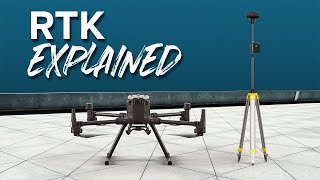
Real-Time Kinematic (RTK) positioning is a technique that enables high-precision location calculations in real time, achieving centimeter-level accuracy. The fundamental principle behind RTK involves carrier-phase measurements, which are derived from the signals sent by satellites. This technique specifically requires a base-rover setup; the base station is fixed at a known location, and the rover moves across the surveyed area, receiving corrections from the base.
Components of RTK
- Base Station: A stationary GPS/GNSS receiver placed at a known location. It calculates its position based on satellite data and sends corrections to the rover.
- Rover: A mobile GPS/GNSS receiver that moves through the area of interest, relying on the correction data from the base station to refine its position.
- Data Link: Typically a radio modem or Bluetooth connection, facilitating communication between the base station and the rover to transmit real-time correction signals.
Applications of RTK
RTK positioning finds extensive application in civil engineering, particularly:
- Land Surveying: Enhancing accuracy in defining property boundaries and other land features.
- Construction Staking: Ensuring precision in the layout of construction projects.
- Deformation Monitoring: Monitoring structural movements in real time.
Overall, RTK positioning is crucial for tasks that demand high accuracy and immediate feedback.
Youtube Videos


Audio Book
Dive deep into the subject with an immersive audiobook experience.
Principle of RTK Positioning
Chapter 1 of 3
🔒 Unlock Audio Chapter
Sign up and enroll to access the full audio experience
Chapter Content
• Uses carrier-phase measurements and base-rover setup
• Provides centimeter-level accuracy in real time
Detailed Explanation
Real-Time Kinematic (RTK) positioning relies on two important elements: carrier-phase measurements and a base-rover configuration. The carrier phase refers to the wave pattern transmitted by satellites, which can be measured more precisely than the time of signal reception. The base-rover setup involves having a stationary 'base' station at a known location that sends corrections to a 'rover' unit moving around. This allows the rover to calculate its position with centimeter-level accuracy in real-time.
Examples & Analogies
Think of RTK like having a highly accurate GPS in a race. The base station is like a coach standing at the starting line with a detailed map. As the runners (rovers) move, the coach provides instant feedback on their precise positions relative to the finish line, allowing them to adjust their paths for the best results.
Components of RTK Positioning
Chapter 2 of 3
🔒 Unlock Audio Chapter
Sign up and enroll to access the full audio experience
Chapter Content
• Base station, rover, data link (e.g., radio modem)
Detailed Explanation
RTK positioning consists of three main components: the base station, the rover, and the data link. The base station is a fixed GPS receiver that knows its exact location and collects satellite data. The rover is a mobile unit that receives the correction signals from the base station to determine its position accurately. The data link, often a radio modem, facilitates the transmission of the correction data from the base to the rover. This setup is essential for achieving the high precision that RTK offers.
Examples & Analogies
Imagine you're at a dance class. The instructor (base station) shows you (the rover) how to perform a move correctly. You follow their guidance through verbal instructions (the data link) to ensure you hit every beat accurately as you learn the choreography.
Applications of RTK Positioning
Chapter 3 of 3
🔒 Unlock Audio Chapter
Sign up and enroll to access the full audio experience
Chapter Content
• Land surveying, construction staking, deformation monitoring
Detailed Explanation
RTK positioning is widely used in various fields due to its high accuracy. In land surveying, it helps determine property boundaries and topographical features with precision. In construction, RTK is crucial for staking out plans where precise alignments of structures are needed. Additionally, it is used in monitoring changes in structures over time (deformation monitoring), ensuring that any shifts can be detected and managed promptly.
Examples & Analogies
Consider RTK in land surveying as using a laser level for building a house. Just as the laser level ensures every wall is perfectly straight, RTK ensures that surveyors can accurately place every boundary and foundation. This way, the house is built exactly where it should be, avoiding future complications.
Key Concepts
-
RTK Positioning: A high-precision GNSS technique offering real-time, centimeter-level accuracy using carrier-phase measurements.
-
Base Station: The fixed GPS receiver providing correction signals to improve rover positioning accuracy.
-
Rover: The moving GPS receiver that uses correction data from the base station.
-
Data Link: The communication system transmitting corrections from the base to the rover.
Examples & Applications
In land surveying, RTK allows for precise mapping of property boundaries, ensuring accurate legal documentation.
In construction projects, RTK is used for laying out foundations, ensuring that structures are positioned as planned.
RTK can monitor the deformation of structures like bridges, providing real-time data to engineers.
Memory Aids
Interactive tools to help you remember key concepts
Rhymes
For accuracy that's great, RTK is your mate, with base, rover, data link, precision's never late.
Stories
Imagine you are a treasure hunter in a field. Your base is a big tree that knows where you stand, sending updates to your treasure map as you move around with your backpack full of tools. That’s RTK!
Memory Tools
Remember 'B-R-D' for RTK: Base, Rover, Data Link.
Acronyms
RTK
Real-Time Kinematic for Real data
True positioning
Kicking inaccuracies away.
Flash Cards
Glossary
- RealTime Kinematic (RTK)
A satellite navigation technique that uses carrier-phase measurements for high-precision positioning in real time.
- Base Station
A fixed receiver that calculates corrections based on satellite signals to enhance the accuracy of rover position.
- Rover
A mobile GPS/GNSS receiver that moves to capture data and rely on corrections from the base station.
- Data Link
The communication channel (often a radio modem) used to transmit correction signals from the base station to the rover.
- CarrierPhase Measurement
A technique that measures the phase of the satellite signals to determine distances with high precision.
Reference links
Supplementary resources to enhance your learning experience.