
Integration of GNSS with Other Survey Technologies
Enroll to start learning
You’ve not yet enrolled in this course. Please enroll for free to listen to audio lessons, classroom podcasts and take practice test.
Interactive Audio Lesson
Listen to a student-teacher conversation explaining the topic in a relatable way.
Integration of GNSS with Total Station
🔒 Unlock Audio Lesson
Sign up and enroll to listen to this audio lesson

Today, we're going to discuss the integration of GNSS with Total Stations. This combination is very powerful for surveying. Can someone tell me what a Total Station does?

A Total Station measures angles and distances to determine precise locations on the ground.
Exactly! When we integrate GNSS, we can achieve even higher accuracy in our site layouts, especially for tasks like closed traverse adjustments. Who can explain what closed traverse adjustments are?

It's a method used in surveying to ensure the points in a traverse form a closed loop, helping to verify accuracy through redundancy.
Great explanation! Remember, the acronym ‘CLOSE’ can help you remember: Coordinate, Location, Overlap, Survey, and Error. This encapsulates the survey goals.

And by using GNSS, we improve the positioning accuracy!
Right! Integrating GNSS and Total Stations allows us to capitalize on the strengths of each technology. Let's summarize: GNSS enhances the accuracy of Total Stations, making tasks like closed traverse adjustments more precise.
GNSS and UAV Integration
🔒 Unlock Audio Lesson
Sign up and enroll to listen to this audio lesson

Now, let's talk about UAVs. Who can describe what they are and their relevance in *surveying*?
UAVs, or drones, are unmanned aircraft that can be controlled remotely. They're used in surveying for aerial mapping.
Exactly! When equipped with GNSS, UAVs can conduct precise aerial surveys. Can anyone name an application of UAVs in civil engineering?
They can be used for volume estimation of stockpiles or terrain modeling.
Perfect! For volume estimation, understanding that ‘VOLUME’ can remind us: Visualize, Observe, Use, Measure, Estimate, and Validate. This can help you remember the steps involved.

I see how using UAVs can save time and provide safer access to challenging areas.
Absolutely! In conclusion, UAVs combined with GNSS allow for rapid and efficient data collection in a variety of civil engineering scenarios.
GNSS and GIS Integration
🔒 Unlock Audio Lesson
Sign up and enroll to listen to this audio lesson
Finally, let's tackle the integration of GNSS with Geographic Information Systems, or GIS. What can you tell me about GIS?
GIS is a system for capturing, storing, analyzing, and managing spatial and geographic data.
Right! When we combine GNSS with GIS, what advantages do we gain, especially in civil engineering?
It helps in asset mapping and urban planning, improving how we manage infrastructure projects.
Excellent point! Think of the mnemonic ‘MAP’ for this integration: Manage, Analyze, and Plan. This emphasizes the cycle of using GIS data effectively with GNSS.
So, it's all about enhancing our understanding with precise geospatial data?
Absolutely! In summary, the integration of GNSS with GIS allows civil engineers to enrich their projects with contextual spatial data, ultimately leading to better decision-making.
Introduction & Overview
Read summaries of the section's main ideas at different levels of detail.
Quick Overview
Standard
Integrating GNSS with various survey technologies, such as Total Stations, UAVs, and GIS, allows for improved precision in civil engineering tasks. This synergy facilitates tasks like closed traverse adjustments, aerial mapping, and geospatial data collection, leading to more efficient project execution and better data management.
Detailed
Detailed Summary
In modern civil engineering and geospatial sciences, the integration of Global Navigation Satellite Systems (GNSS) with other survey technologies is crucial for enhancing efficiency and accuracy in various applications.
Key Integrations:
- GNSS + Total Station: This combination merges global positioning capabilities with the high-local coordinate precision of total stations. It allows for applications such as closed traverse adjustments and high-accuracy site layouts.
- GNSS + UAV (Unmanned Aerial Vehicle): Drones equipped with GNSS capabilities are instrumental in performing aerial surveys. They are widely used for volume estimation, terrain modeling, and monitoring construction progress.
- GNSS + GIS (Geographic Information System): This integration streamlines geospatial data collection and coordinate referencing, supporting various functions in asset mapping, urban planning, and infrastructure management. By utilizing GNSS data, professionals can enhance the contextual understanding of spatial data and improve decision-making in civil engineering projects.
Overall, integrating these technologies facilitates accurate data collection and effective management throughout the lifecycle of civil engineering projects.
Youtube Videos


Audio Book
Dive deep into the subject with an immersive audiobook experience.
GNSS + Total Station
Chapter 1 of 3
🔒 Unlock Audio Chapter
Sign up and enroll to access the full audio experience
Chapter Content
Combines global positioning with local coordinate precision.
Used for closed traverse adjustments and high-accuracy layout.
Detailed Explanation
This chunk discusses the integration of GNSS technology with Total Station instruments. A Total Station is an optical/electronic instrument used in modern surveying that combines the functions of a theodolite (for measuring angles) and an electronic distance measuring device. By integrating GNSS with Total Stations, surveyors can enhance the accuracy and reliability of their measurements.
The global positioning capabilities of GNSS allow surveyors to obtain precise location data from satellites, while the Total Station provides high-resolution local measurements through optical systems. This integration is particularly useful for closed traverse adjustments, where accuracy is paramount, ensuring that all surveyed points conform to a tight geometric framework. Additionally, high-accuracy layout tasks, such as determining precise locations for construction, benefit greatly from this combination.
Examples & Analogies
Imagine surveying a vast plot of land for a new school building. The surveyor uses a Total Station to measure features on the ground very precisely, like angles and distances to existing structures. Meanwhile, GNSS technology helps them pinpoint these measurements against global coordinates so that everything fits perfectly on national maps. This combination ensures that the school building is constructed exactly where planned, reducing costly errors.
GNSS + UAV (Unmanned Aerial Vehicle)
Chapter 2 of 3
🔒 Unlock Audio Chapter
Sign up and enroll to access the full audio experience
Chapter Content
GNSS-equipped drones perform aerial mapping.
Used for volume estimation, terrain modeling, progress monitoring.
Detailed Explanation
This chunk focuses on how GNSS technology enhances the capabilities of UAVs, commonly known as drones. These drones are equipped with GNSS receivers that allow them to accurately determine their position in three-dimensional space while flying over the terrain.
Aerial mapping conducted by GNSS-equipped drones is a revolutionary technique in surveying. It enables large areas to be surveyed quickly and efficiently compared to traditional ground methods. It finds applications in several fields including construction, agriculture, and environmental monitoring. For instance, in volume estimation, drones can fly over a pile of dirt or a construction site, gathering data that helps determine the amount of material on-site. Terrain modeling involves creating three-dimensional representations of the landscape, which is essential for urban planning and infrastructure development. Progress monitoring allows stakeholders to track how much of a construction project has been completed over time using aerial imagery.
Examples & Analogies
Think of a construction manager who needs to assess a new residential neighborhood's progress. Instead of walking through each plot with a tape measure, they fly a drone over the area. This drone, equipped with GNSS, captures precise location data while taking high-resolution pictures. Later, the manager reviews these images to see how much of the project is done—like taking a bird’s-eye view of a giant puzzle to check which pieces have been placed.
GNSS + GIS
Chapter 3 of 3
🔒 Unlock Audio Chapter
Sign up and enroll to access the full audio experience
Chapter Content
Enables geospatial data collection with coordinate referencing.
Supports asset mapping, urban planning, and infrastructure management.
Detailed Explanation
This chunk elaborates on the synergy between GNSS and Geographic Information Systems (GIS). GNSS provides accurate position data that can be utilized within GIS for spatial analysis. GIS is a framework for gathering, managing, and analyzing data that is related to positions on the earth's surface.
By integrating GNSS with GIS, data collection becomes much easier and more accurate. For instance, let's say a city is conducting an asset mapping project to track all its trees. By using GNSS-enabled devices, teams can accurately collect data on the location of each tree, which can then be entered into a GIS database for analysis. Applications include urban planning where decision-makers can visualize how green spaces interact with urban structures, providing essential insights that guide city development.
Examples & Analogies
Picture a city planner who wants to improve public spaces in a neighborhood. They use GNSS-enabled devices to mark the locations of parks, benches, and trees while walking through the area. This data goes into GIS software, where patterns and connections are analyzed easily, helping to design a more enjoyable community. It's like creating a digital map that helps visualize where to place new parks to best serve residents.
Key Concepts
-
Integration of GNSS and Total Station: Enhances positioning accuracy for site layouts.
-
UAVs equipped with GNSS: Allow for efficient aerial mapping and terrain modeling.
-
GIS integration: Facilitates geospatial data collection and management.
Examples & Applications
Using GNSS and Total Station for precise construction site layout adjustments.
Employing UAVs in surveying for quick volume estimates of materials on-site.
Integrating GNSS data in GIS for urban planning to visualize infrastructure better.
Memory Aids
Interactive tools to help you remember key concepts
Rhymes
When you measure with GNSS, your problems are fewer. With Total Stations, your accuracy grows truer.
Stories
Imagine a drone flying over a construction site, it maps the land so engineers can plan right. With GNSS guiding its flight, they visualize their planning just right.
Memory Tools
Remember ‘CLOSE’ for Total Station tasks: Coordinate, Location, Overlap, Survey, Error.
Acronyms
MAP helps with GIS integration
Manage
Analyze
Plan.
Flash Cards
Glossary
- GNSS
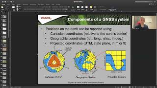
Global Navigation Satellite Systems, a collection of satellite systems providing global positioning, navigation, and timing services.
- Total Station
A surveying instrument used to measure angles, distances, and elevations for precise location determination.
- UAV
Unmanned Aerial Vehicle, commonly known as a drone, used for aerial surveys and data collection.
- GIS
Geographic Information System, software used to capture, manage, and analyze spatial and geographic data.
Reference links
Supplementary resources to enhance your learning experience.