
Classification of Photogrammetry
Enroll to start learning
You’ve not yet enrolled in this course. Please enroll for free to listen to audio lessons, classroom podcasts and take practice test.
Interactive Audio Lesson
Listen to a student-teacher conversation explaining the topic in a relatable way.
Aerial vs. Terrestrial Photogrammetry
🔒 Unlock Audio Lesson
Sign up and enroll to listen to this audio lesson

Today, we'll discuss two primary types of photogrammetry: aerial and terrestrial. Aerial photogrammetry involves capturing images from the air, typically using drones or airplanes, while terrestrial photogrammetry is done closer to the ground. Can anyone tell me why these differences might matter?

I think aerial photogrammetry would be better for larger areas, right?
Exactly, Student_1! Aerial photogrammetry is excellent for covering large regions quickly. Contrast this with terrestrial photogrammetry, which is more suited for detailed work on smaller areas or specific objects. Can anyone provide an example of when we might choose terrestrial over aerial?

Maybe when looking at a building's architecture or details?
Great example, Student_2! Terrestrial methods provide the precision needed for detailed analysis. Remember, think 'larger area' for aerial and 'detailed close-up' for terrestrial. Let's dive into processing methods next.
Processing Methods: Analog, Analytical, and Digital
🔒 Unlock Audio Lesson
Sign up and enroll to listen to this audio lesson

Now, let's classify photogrammetry based on processing methods. We have analog, analytical, and digital photogrammetry. Does anyone know what analog photogrammetry is?

Isn't it the old way using film and stuff?
That's right, Student_3! It utilizes film and optical instruments, which are quite different from today's techniques. Now, who can explain analytical photogrammetry?

It's when we combine analog images with digital computations for better accuracy!
Exactly, Student_4! Analytical methods bridge the gap between traditional and modern approaches. Now, what about digital photogrammetry? Anyone want to take a guess?
I think it uses only digital images and is way more automated?
Spot on! Digital photogrammetry leverages technology for speed and precision. Overall, we can remember: Analog is traditional, Analytical is a hybrid, and Digital is cutting-edge!
Introduction & Overview
Read summaries of the section's main ideas at different levels of detail.
Quick Overview
Standard
This section explores the different classifications of photogrammetry, including aerial and terrestrial photogrammetry based on the platform, as well as analog, analytical, and digital photogrammetry based on processing methods. Each type has unique characteristics and applications in the field.
Detailed
Classification of Photogrammetry
Photogrammetry can be categorized based on two main criteria: the platform used for capturing images and the processing methods employed to analyze these images.
1. Classification Based on Platform
- Aerial Photogrammetry: This involves capturing images from airborne platforms such as drones or aircraft. It is particularly useful for large area coverage and is widely used in topographic mapping, land surveying, and urban planning.
- Terrestrial (Close-range) Photogrammetry: This method captures images from ground-based platforms, including handheld cameras. It is typically employed for detailed measurements and analysis of smaller areas or objects.
2. Classification Based on Processing Methods
- Analog Photogrammetry: The traditional approach using film and optical instruments. This method is now largely outdated but laid the groundwork for modern technologies.
- Analytical Photogrammetry: Combines the use of analog images with digital computations, offering enhanced accuracy and the ability to perform complex analyses.
- Digital Photogrammetry: A contemporary technique that relies entirely on digital images and automated algorithms for extracting three-dimensional information. It represents the future of photogrammetry, enabling more efficient data processing and analysis.
Understanding these classifications is essential for selecting the appropriate methods and tools for specific applications in civil engineering and other fields.
Youtube Videos


Audio Book
Dive deep into the subject with an immersive audiobook experience.
Classification Based on Platform
Chapter 1 of 3
🔒 Unlock Audio Chapter
Sign up and enroll to access the full audio experience
Chapter Content
Based on Platform
- Aerial Photogrammetry: Images are captured from airborne platforms like drones, aircraft.
- Terrestrial (Close-range) Photogrammetry: Images are captured from ground-based platforms or handheld cameras.
Detailed Explanation
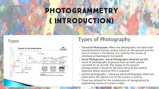
Photogrammetry can be classified based on the type of platform used to capture images. There are two primary categories:
- Aerial Photogrammetry involves capturing images from airborne platforms such as drones or aircraft. This method is useful for large-scale mapping and allows for the collection of data over challenging landscapes.
- Terrestrial Photogrammetry (or Close-range Photogrammetry) is when images are obtained from ground-based platforms or handheld cameras. This method is typically employed for smaller-scale projects, such as capturing detailed features of buildings or archaeological sites.
Examples & Analogies
Imagine you're taking photos of your neighborhood from a drone high in the sky – this is aerial photogrammetry, helpful for creating a large map of your area. Now, think of taking close-up photos of your friend's face at a party – this would be terrestrial photogrammetry, focusing on specific details.
Classification Based on Processing
Chapter 2 of 3
🔒 Unlock Audio Chapter
Sign up and enroll to access the full audio experience
Chapter Content
Based on Processing
- Analog Photogrammetry: Traditional technique using film and optical instruments.
- Analytical Photogrammetry: Combines analog images with digital computation for better accuracy.
- Digital Photogrammetry: Fully computer-based; employs digital images and automated algorithms for extraction of 3D information.
Detailed Explanation
The classification based on processing techniques in photogrammetry helps us understand how data is captured and analyzed:
- Analog Photogrammetry relies on traditional methods, involving film and optical instruments. It's the original way to capture and process images for measurements.
- Analytical Photogrammetry merges analog techniques with digital computation, enhancing measurement accuracy by using computers to analyze captured data.
- Digital Photogrammetry is the most modern approach, where images are completely digitized, and algorithms automate the extraction of three-dimensional (3D) information, making the process faster and more efficient.
Examples & Analogies
Think about how we listen to music. In the past, we had records (analog), then we got CDs (analytical), which improved sound quality. Now, with digital streaming (digital), we can access thousands of songs instantly wherever we are, just like how digital photogrammetry provides immediate access to high-quality spatial data.
Significance of Classification
Chapter 3 of 3
🔒 Unlock Audio Chapter
Sign up and enroll to access the full audio experience
Chapter Content
Significance of Classification
Understanding the classification of photogrammetry is essential for selecting the appropriate method for specific applications and understanding the evolution of techniques in the field.
Detailed Explanation
Classifying photogrammetry helps those in the field understand which techniques or approaches are best suited for their specific tasks. Each classification serves a purpose and is tailored to different types of projects or analyses. For instance, a project needing extensive area coverage may benefit from aerial photogrammetry, while one requiring detailed close-up images will use terrestrial methods. Moreover, being aware of the processing classification allows professionals to choose the right tools and techniques to ensure the accuracy and reliability of their measurements.
Examples & Analogies
Much like choosing the right tool for a job, understanding photogrammetry classifications is crucial. If you're in construction, you wouldn't use a power drill when a hammer is needed. Similarly, knowing whether to use aerial or terrestrial photogrammetry can greatly affect the success of a mapping project.
Key Concepts
-
Aerial Photogrammetry: Capturing images from airborne platforms.
-
Terrestrial Photogrammetry: Capturing images from ground-based platforms.
-
Analog Photogrammetry: Using traditional film-based techniques.
-
Analytical Photogrammetry: Combining analog with digital for accuracy.
-
Digital Photogrammetry: Fully computer-based, utilizing digital images.
Examples & Applications
Aerial photogrammetry is often used for large-scale mapping of regions such as national parks, providing an overview of topography.
Terrestrial photogrammetry is typically employed to document historical buildings in detail for restoration purposes.
Memory Aids
Interactive tools to help you remember key concepts
Rhymes
Aerial views high, capturing the land, while terrestrial shots go close at hand.
Stories
Once a bird, high in the sky, took photos of fields for mapping, oh my! Below, a photographer with a handheld camera, detailed the old buildings with great stamina.
Memory Tools
A for Aerial, T for Terrestrial, A for Analog, D for Digital – a perfect APAD to remember!
Acronyms
APAD
Aerial
Terrestrial
Analog
and Digital - types of photogrammetry!
Flash Cards
Glossary
- Aerial Photogrammetry
Capturing images from airborne platforms like drones or aircraft.
- Terrestrial Photogrammetry
Capturing images from ground-based platforms or handheld cameras.
- Analog Photogrammetry
Traditional technique that uses film and optical instruments for capturing images.
- Analytical Photogrammetry
Combines analog images with digital computations for enhanced accuracy.
- Digital Photogrammetry
Employs digital images and automated algorithms for extracting 3D information.
Reference links
Supplementary resources to enhance your learning experience.