
Ground Control in Photogrammetry
Enroll to start learning
You’ve not yet enrolled in this course. Please enroll for free to listen to audio lessons, classroom podcasts and take practice test.
Interactive Audio Lesson
Listen to a student-teacher conversation explaining the topic in a relatable way.
Introduction to GCPs
🔒 Unlock Audio Lesson
Sign up and enroll to listen to this audio lesson

Today we will discuss ground control points, or GCPs, in photogrammetry. Can anyone tell me what they think GCPs are?

Are they points that help us know where we are in a photograph?

I think they’re for making our maps more accurate.
Exactly! GCPs are reference points with known coordinates that help correct distortions in aerial images, ensuring that both horizontal and vertical accuracy in mapping is maintained. Think of them as anchors that keep our data reliable.

So they help us measure both horizontal and vertical positions?
Correct! There are two types of GCPs: horizontal control for planimetric accuracy and vertical control for elevation accuracy.

Got it! Can you give me an example of where we use these GCPs?
Sure! They are vital in civil engineering projects like topographic mapping and urban planning. Let’s summarize: GCPs are essential for accuracy, classified into horizontal and vertical types.
Establishing GCPs
🔒 Unlock Audio Lesson
Sign up and enroll to listen to this audio lesson

Now that we know what GCPs are, let's talk about how we establish them. What methods do you think we could use?
Maybe GPS or surveying tools?
I think they also use drones for this.
Great ideas! Yes, traditional surveying methods like total stations are commonly used. In addition, we can also use GNSS-enabled methods, such as real-time kinematic positioning, for establishing GCPs quickly and accurately.
What’s that RTK method about?
RTK stands for Real-Time Kinematic. It allows for high-precision positioning using GNSS, helping us achieve centimeter-level accuracy in determining GCPs.
That sounds advanced! So we can have very accurate maps then?
Yes! Accurate GCPs lead to high-quality photogrammetry results which are crucial for reliable mapping and planning.
Significance of GCPs
🔒 Unlock Audio Lesson
Sign up and enroll to listen to this audio lesson
Why do you think GCPs are significant in our projects around civil engineering?
To avoid mistakes in mapping and construction?
And for planning resources better, right?
Exactly! They ensure we have accurate data, which is vital for decisions in urban planning, infrastructure development, and many other areas.
What happens if we don’t have them?
Without GCPs, our data could be significantly off, leading to errors in planning and construction. Thus, the accuracy of GCPs is paramount.
So it’s like a foundation for our data!
Exactly, a solid foundation! And always remember, GCPs ensure our aerial imagery translates accurately to real-world coordinates.
Introduction & Overview
Read summaries of the section's main ideas at different levels of detail.
Quick Overview
Standard
This section discusses the significance of ground control points (GCPs) in photogrammetry, highlighting their types for horizontal and vertical controls, and reviewing the methods used for establishing these points. Understanding GCPs is essential for achieving high precision in mapping and surveying tasks.
Detailed
Ground Control in Photogrammetry
Ground control points (GCPs) are critical for ensuring the accuracy and reliability of photogrammetric mapping. They serve as reference locations with known coordinates, allowing for the correction of errors in aerial images and ensuring the precision of geometric data obtained through photogrammetry. This section outlines the two main types of ground control: horizontal control, which is vital for planimetric accuracy, and vertical control, which is needed for accurate elevation data. Additionally, it covers the methods for establishing GCPs, including traditional surveying techniques using total stations and global navigation satellite systems (GNSS), as well as more advanced methods like real-time kinematic (RTK) positioning. These techniques ensure that GCPs are integrated effectively into photogrammetric workflows, which is fundamental for applications across civil engineering and geo-informatics.
Youtube Videos
Audio Book
Dive deep into the subject with an immersive audiobook experience.
Importance of Ground Control Points (GCPs)
Chapter 1 of 3
🔒 Unlock Audio Chapter
Sign up and enroll to access the full audio experience
Chapter Content
Ground control points (GCPs) are essential to ensure accurate mapping.
Detailed Explanation
Ground Control Points (GCPs) are fixed points on the ground with known geographic coordinates. They serve as reference markers to help ensure that the images obtained from photogrammetry accurately reflect the real-world locations of objects. If the measurements are not anchored to these known points, the resulting data could be misleading, leading to inaccuracies in map-making and measurements.
Examples & Analogies
Think of GCPs as anchor points on a map. If you're trying to draw a treasure map, knowing the exact location of a tree or rock on your map helps you accurately position everything else on it. Without these anchors, your map might lead someone far off the treasure's real location.
Types of Ground Control
Chapter 2 of 3
🔒 Unlock Audio Chapter
Sign up and enroll to access the full audio experience
Chapter Content
8.7.1 Types of Ground Control
• Horizontal Control: For planimetric accuracy.
• Vertical Control: For elevation accuracy.
Detailed Explanation
Ground control can be divided into two types: horizontal control and vertical control. Horizontal control points are focused on ensuring that the measurements of the map accurately represent the layout of objects on a flat surface, which is crucial for navigation and planning. Vertical control points, on the other hand, are concerned with the elevation of those objects; they help in determining how high or low something is relative to sea level or another defined reference point.
Examples & Analogies
Imagine building a multi-story building. Horizontal control points ensure that the foundation is laid correctly and is in line with the city grid, while vertical control points help the construction team know how tall each floor needs to be relative to the ground.
Methods of Establishing GCPs
Chapter 3 of 3
🔒 Unlock Audio Chapter
Sign up and enroll to access the full audio experience
Chapter Content
8.7.2 Methods of Establishing GCPs
• Traditional surveying (total station, GPS).
• GNSS-enabled real-time kinematic (RTK) methods.
Detailed Explanation
There are primarily two methods for establishing Ground Control Points. The traditional surveying method involves using instruments like total stations and GPS equipment to measure the exact locations of GCPs on site. This method is time-tested and reliable. The GNSS-enabled RTK method, on the other hand, uses advanced satellite technology to get real-time highly accurate positions. This method is fast and can be less labor-intensive than traditional methods, especially useful in large areas.
Examples & Analogies
Consider these methods like using a map versus a GPS navigator when driving. Traditional surveying is like following a physical map, where you plot your route based on landmarks. The GNSS RTK method is like having a GPS system that provides real-time updates on your position and directions to your destination, making it quicker and more efficient.
Key Concepts
-
Ground Control Points (GCPs): Reference points to achieve accurate mapping and measurement.
-
Horizontal Control: Ensures accuracy in the XY-plane, aiding in planimetric mapping.
-
Vertical Control: Ensures elevation accuracy in mapping.
-
Traditional Surveying: Techniques, including total stations, used to establish GCPs.
-
GNSS-RTK: Advanced methods for precise positioning of GCPs.
Examples & Applications
In urban planning, GCPs help ensure that new buildings are positioned accurately according to regulations.
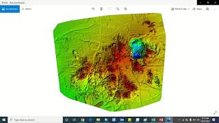
Surveying a mountain area requires GCPs to determine elevation precisely, which influences access and construction.
Memory Aids
Interactive tools to help you remember key concepts
Rhymes
GCPs make mapping neat, keeping our coordinates straight and sweet.
Stories
In a land where maps were once drawn by hand, a wise surveyor found GCPs standing like beacons, guiding the builders to safe grounds.
Memory Tools
Remember GCP: 'Got Coordinates Perfect' for high quality mapping.
Acronyms
GCP - Ground Control Points; guarantee clear coordinates.
Flash Cards
Glossary
- Ground Control Points (GCPs)
Reference points with known coordinates used to improve the accuracy of photogrammetric measurements.
- Horizontal Control
Ground control that ensures planimetric accuracy in mapping.
- Vertical Control
Ground control that ensures elevation accuracy in mapping.
- Total Station
An electronic/optical instrument used in modern surveying.
- GNSS
Global Navigation Satellite System, used for determining precise locations.
- RTK (RealTime Kinematic)
A surveying technique that utilizes GNSS to provide high-precision position data.
Reference links
Supplementary resources to enhance your learning experience.