
3D Visualization and Terrain Modeling
Enroll to start learning
You’ve not yet enrolled in this course. Please enroll for free to listen to audio lessons, classroom podcasts and take practice test.
Interactive Audio Lesson
Listen to a student-teacher conversation explaining the topic in a relatable way.
Digital Elevation Models (DEMs)
🔒 Unlock Audio Lesson
Sign up and enroll to listen to this audio lesson

Today, we will start by discussing Digital Elevation Models, or DEMs. Can anyone tell me what a DEM is?

Is it a model that represents the surface of the Earth?
Exactly! DEMs are crucial for analyzing the topography of the Earth. They capture elevation data and can be derived from stereo-pairs or radar data. Does anyone know some applications of DEMs?

I think they can be used for slope analysis!
Correct! They also help in watershed analysis and assessing land suitability. Remember, you can think of DEMs as a 3D representation of our terrain as they provide valuable insights for civil engineering projects.

Could you give an example of where we've used DEMs?
Certainly! When planning a new road, DEMs help in understanding how the landscape might affect the road's alignment. Let's recap: DEMs represent the terrain, assist in slope and watershed analysis, and are obtained from various satellite techniques.
3D City Models
🔒 Unlock Audio Lesson
Sign up and enroll to listen to this audio lesson

Moving on to 3D city models, what do you think distinguishes these models from simple landscapes?

They include buildings, roads, and other infrastructure in a detailed format, right?
Exactly! 3D city models combine satellite imagery with LiDAR data or photogrammetry. This combination generates realistic representations of urban environments. Why do you think such detailed models are important for urban planning?
So that planners can visualize the impact of new developments and assess things like skyline impacts or utility locations!
Well said! These models are key for visibility analysis and planning utility routes. Just remember, they aid in strategic urban development.
Can they predict traffic patterns too?
Yes! Analyzing potential traffic flow and patterns is one of the significant applications of 3D city models. Great job summarizing their importance!
Viewshed and Line-of-Sight Analysis
🔒 Unlock Audio Lesson
Sign up and enroll to listen to this audio lesson
Lastly, let’s discuss viewshed analysis. Who can tell me what viewshed analysis is used for in civil projects?
I think it helps find the areas that can see a specific point, like a tower?
Exactly! Viewshed analysis determines visibility from certain points, which is essential for planning infrastructure like telecom towers or wind farms. Why is this important?
So that we can ensure coverage and avoid obstructions in designs!
Correct! Additionally, it's crucial in mountainous areas where terrain can block views. Remember, viewshed analysis enhances project efficacy and safety in civil engineering.
So, it helps maximize what we can build without compromising visibility!
Yes! Excellent summary! Viewshed analysis stabilizes the effectiveness of projects by addressing visibility challenges.
Introduction & Overview
Read summaries of the section's main ideas at different levels of detail.
Quick Overview
Standard
3D visualization and terrain modeling are crucial in civil engineering, utilizing Digital Elevation Models (DEMs) for slope analysis, 3D city models for urban simulations, and viewshed analysis for determining visibility in terrain. This segment highlights the methodologies and applications significant for infrastructure development and urban planning.
Detailed
3D Visualization and Terrain Modeling
In the realm of Geo-Informatics, 3D visualization and terrain modeling play an integral role in civil engineering projects. This section explores three primary components:
Digital Elevation Models (DEMs)
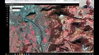
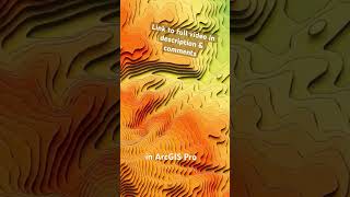
DEMs are critical in representing the earth's surface terrain. They are derived from stereo pairs of satellite imagery or radar data, like SRTM and ASTER. DEMs are extensively used for slope analysis, aspect determination, and watershed analysis, which are crucial in planning and executing civil engineering projects.
3D City Models
Leveraging satellite imagery combined with LiDAR or photogrammetry, 3D city models provide realistic representations of urban environments. These models support various applications, including urban simulations, visibility analysis, skyline studies, and utility planning, enabling more effective urban development.
Viewshed and Line-of-Sight Analysis
Viewshed analysis is essential for understanding visibility and potential visual obstructions in a landscape. This technique finds applications in planning telecom towers, evaluating wind farm siting, and designing infrastructure in hilly areas, ensuring that projects maximize efficiency and safety.
Overall, this section lays the groundwork for understanding how 3D visualization is instrumental in contemporary civil engineering, facilitating informed decision-making and strategic planning.
Youtube Videos


Audio Book
Dive deep into the subject with an immersive audiobook experience.
Digital Elevation Models (DEMs)
Chapter 1 of 3
🔒 Unlock Audio Chapter
Sign up and enroll to access the full audio experience
Chapter Content
• Derived from stereo-pairs or radar data (e.g., SRTM, ASTER, CartoDEM).
• Useful for slope, aspect, and watershed analysis in civil engineering.
Detailed Explanation
Digital Elevation Models (DEMs) are a type of 3D representation of terrain derived from various data sources. Two common sources are stereo-pairs (images taken from two different angles) and radar data, such as those from the Shuttle Radar Topography Mission (SRTM) or ASTER. DEMs are essential in civil engineering for analyzing the slope of the land, determining the direction water will flow (aspect), and examining watershed boundaries for effective land and water management.
Examples & Analogies
Think of DEMs like a 3D map of a mountain range. Just as the contour lines on a topographic map show elevation changes, a DEM provides a digital version that allows engineers to visualize and analyze the physical features of the land, such as identifying areas prone to erosion or where to build drainage systems.
3D City Models
Chapter 2 of 3
🔒 Unlock Audio Chapter
Sign up and enroll to access the full audio experience
Chapter Content
• Satellite imagery combined with LiDAR or photogrammetric techniques can generate realistic 3D cityscapes.
• Applications include urban simulation, visibility analysis, skyline studies, and utility planning.
Detailed Explanation
3D City Models are created by integrating satellite imagery with high-resolution data from techniques such as LiDAR (Light Detection and Ranging) or photogrammetry (the use of photographs to make measurements). These models provide a highly detailed and accurate representation of urban environments. The applications are vast: they can be used for urban simulations, which help in planning new buildings, performing visibility analyses to ensure that structures do not block essential views, studying the skyline for aesthetic planning, and aiding in the planning of infrastructure such as utilities and transportation.
Examples & Analogies
Imagine a video game where players can create their own cities. A 3D city model works in a similar way, giving urban planners a virtual environment to visualize and simulate how real-world changes, like building a new park or highway, will affect an entire city.
Viewshed and Line-of-Sight Analysis
Chapter 3 of 3
🔒 Unlock Audio Chapter
Sign up and enroll to access the full audio experience
Chapter Content
• Crucial for telecom tower planning, wind farm siting, and infrastructure design in hilly regions.
Detailed Explanation
Viewshed and Line-of-Sight Analysis help planners understand which areas can be seen from certain points in the terrain. This analysis is vital when determining the best locations for structures such as telecommunications towers and wind farms, ensuring they reach their intended audience or maximize efficiency. By analyzing the terrain, engineers can also design infrastructure in a way that minimizes visual obstruction and maximizes functionality, especially in hilly or uneven landscapes.
Examples & Analogies
Consider how you would pick a place to put a lookout tower. You wouldn't want to place it in a valley where the view is blocked by mountains. The analysis of viewshed can help determine the best spot where the tower would provide the widest view. Likewise, this technique applies to placing cell towers or wind turbines, ensuring they operate effectively by considering the terrain.
Key Concepts
-
Digital Elevation Models (DEMs): 3D representations of terrain used for civil engineering analysis.
-
3D City Models: Detailed urban representations created from satellite imagery, LiDAR, or photogrammetry.
-
Viewshed Analysis: A technique used to assess visibility from specific points in the landscape.
Examples & Applications
Using DEMs for determining the most suitable location for a wind farm by analyzing the slope and elevation.
Creating a 3D city model to visualize urban development impacts alongside public infrastructure plans.
Memory Aids
Interactive tools to help you remember key concepts
Rhymes
In the hills where waters flow, DEMs will help your knowledge grow.
Stories
Imagine a city planner using a DEM to find the best route for a new road. They look at the ups and downs of the land, choosing the smoothest path for safe travel.
Memory Tools
DVC: Digital Elevation Models, Viewshed analysis, City models - remember these three key components in terrain modeling.
Acronyms
3D = D for Digital, C for City, M for Models - a way to remember what 3D stands for in urban planning.
Flash Cards
Glossary
- Digital Elevation Model (DEM)
A 3D representation of terrain elevation derived from satellite or radar data.
- LiDAR
Light Detection and Ranging, a remote sensing method to examine the surface of the Earth.
- Viewshed Analysis
A technique to assess areas visible from a specific point in space.
- Photogrammetry
The use of photography for surveying and mapping purposes, especially to record surfaces and heights.
Reference links
Supplementary resources to enhance your learning experience.