
Image Acquisition and Preprocessing
Enroll to start learning
You’ve not yet enrolled in this course. Please enroll for free to listen to audio lessons, classroom podcasts and take practice test.
Interactive Audio Lesson
Listen to a student-teacher conversation explaining the topic in a relatable way.
Radiometric Correction
🔒 Unlock Audio Lesson
Sign up and enroll to listen to this audio lesson

Let's start with radiometric correction. Can anyone explain what this process involves?

Isn't it about correcting the brightness values of the image?
Great observation! Radiometric correction adjusts sensor irregularities and atmospheric interference. This process converts raw Digital Numbers into calibrated reflectance values.

Why is this calibration so important?
Without calibration, the data we gather would be unreliable for analysis. Remember the acronym 'CRISP'—Calibrate Radiance for Informed Sensor Processing.

What happens without radiometric correction?
Excellent question! Without it, our analysis could lead to incorrect conclusions about land cover or vegetation health.

So, it influences the accuracy of various applications!
Exactly! Let's summarize: Radiometric correction is essential for calibrating images to ensure accurate environmental and urban assessments.
Geometric Correction
🔒 Unlock Audio Lesson
Sign up and enroll to listen to this audio lesson

Now, let's discuss geometric correction. What do you think this process involves?
It's about aligning images to real-world locations, right?
Exactly! It uses Ground Control Points, or GCPs, to achieve that alignment. Why do you think GCPs are vital in this process?
They help in accurately mapping images to their geographical location!
Correct! Additionally, we employ resampling techniques like nearest neighbor and cubic convolution to refine this alignment. Can anyone think of why we might choose different resampling methods?
Maybe for preserving image quality versus processing speed?
Spot on! Balancing quality and efficiency is crucial. Let's summarize: Geometric correction is essential for accurate image mapping and involves GCPs and various resampling methods.
Atmospheric Correction
🔒 Unlock Audio Lesson
Sign up and enroll to listen to this audio lesson
Next, we’ll explore atmospheric correction. What does this term mean?
It sounds like it’s about dealing with the atmosphere's influence on image quality.
Exactly! Atmospheric correction removes scattering and absorption effects. Methods like Dark Object Subtraction help accomplish this. Who can explain how this method works?
Is it using the fact that dark objects reflect less light to find corrections?
That's correct! This helps to ensure the data reflects more accurate terrestrial information rather than atmospheric interference. Can you think of scenarios where missing this correction might affect results?
In environmental assessments, like checking vegetation health, it could lead to errors.
Absolutely! Atmospheric correction enhances the reliability of our analyses. Let’s recap: Atmospheric correction is critical for enhancing image quality by removing atmospheric effects.
Noise Reduction
🔒 Unlock Audio Lesson
Sign up and enroll to listen to this audio lesson
Finally, we have noise reduction. What do you all think noise refers to in images?
I think it’s the unwanted random variations that distort the image quality.
Exactly! Noise can hinder accurate interpretation. We use filters such as Median and Gaussian to reduce this effect. Why do you think these specific filters are favored?
Maybe because they balance between smoothing out noise and preserving important details?
Spot on! It's important to find that balance. Remember the acronym 'NICE'—Noise Is Challenging to Eliminate. Let’s recap: Noise reduction techniques are crucial in cleaning images for accurate analysis.
Introduction & Overview
Read summaries of the section's main ideas at different levels of detail.
Quick Overview
Standard
In this section, we delve into the steps and techniques necessary for the acquisition and preprocessing of satellite images. It includes methods like radiometric correction for sensor calibration, geometric correction for spatial alignment, atmospheric correction to negate environmental influences, and noise reduction techniques, ensuring the usefulness and accuracy of remote sensing data.
Detailed
Image Acquisition and Preprocessing
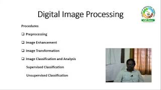
Satellite image processing begins with image acquisition, which captures raw data from remote sensing satellites. The preprocessing stage is crucial, as it prepares these images for analysis and interpretation by correcting various distortions and enhancing image quality. This section outlines the critical preprocessing techniques:
3.2.1 Radiometric Correction
- It addresses sensor irregularities and atmospheric interference, converting raw Digital Numbers (DN) into calibrated reflectance values essential for accurate data analysis.
3.2.2 Geometric Correction
- This process aligns satellite images with real-world coordinates using Ground Control Points (GCPs) and various resampling techniques (e.g., nearest neighbor, bilinear interpolation, cubic convolution).
3.2.3 Atmospheric Correction
- It involves eliminating the effects of atmospheric scattering and absorption with methods like Dark Object Subtraction (DOS) and Fast Line-of-sight Atmospheric Analysis of Spectral Hypercubes (FLAASH).
3.2.4 Noise Reduction
- Techniques such as Median and Gaussian filters are employed to reduce random and systematic noise in imagery, enhancing the clarity and reliability of satellite data.
These preprocessing steps are integral in ensuring that satellite images are usable for applications ranging from urban planning to environmental monitoring.
Youtube Videos


Audio Book
Dive deep into the subject with an immersive audiobook experience.
Radiometric Correction
Chapter 1 of 4
🔒 Unlock Audio Chapter
Sign up and enroll to access the full audio experience
Chapter Content
Radiometric Correction
- Correction of sensor irregularities and atmospheric interference.
- Converts raw Digital Numbers (DN) into calibrated reflectance values.
Detailed Explanation
Radiometric correction is a process used to address variations in the brightness of images that may arise due to sensor irregularities or atmospheric conditions. Sensors on satellites capture sunlight reflecting off the earth's surface, but they can introduce errors. By applying this correction technique, raw images (in Digital Numbers) are adjusted to reflect light measured in a way that can be consistently interpreted as reflectance values. This standardized conversion allows for more accurate comparisons and analyses of satellite images across different times and locations.
Examples & Analogies
Think of radiometric correction like adjusting the colors on a photo after taking it with your phone. Sometimes the lighting isn't perfect, so you adjust the brightness and contrast to make the image look more natural. Similarly, radiometric correction 'tweaks' satellite images to ensure they are consistent and accurate, allowing researchers to analyze changes in land cover over time effectively.
Geometric Correction
Chapter 2 of 4
🔒 Unlock Audio Chapter
Sign up and enroll to access the full audio experience
Chapter Content
Geometric Correction
- Aligns satellite images to real-world coordinates.
- Involves Ground Control Points (GCPs) and resampling techniques such as nearest neighbor, bilinear interpolation, and cubic convolution.
Detailed Explanation
Geometric correction ensures that the satellite images align accurately with geographic coordinates on the Earth’s surface. This is essential because satellite images can be distorted due to the angle of the satellite, the curvature of the Earth, or sensor-related issues. Ground Control Points (GCPs) — known geographic locations that can be identified on both the satellite images and map data — are used to accurately place the image. Resampling techniques, like nearest neighbor or bilinear interpolation, help in precisely mapping these images to their real-world locations without losing important detail or introducing distortion.
Examples & Analogies
Imagine you’re putting together a puzzle where the pieces are slightly warped. You need to stretch or adjust some pieces to fit correctly in their spots. Similarly, geometric correction is like reshaping satellite images so that they correctly align with their real-world counterparts, just like ensuring each puzzle piece fits in the right place.
Atmospheric Correction
Chapter 3 of 4
🔒 Unlock Audio Chapter
Sign up and enroll to access the full audio experience
Chapter Content
Atmospheric Correction
- Eliminates effects of atmospheric scattering and absorption.
- Common methods: Dark Object Subtraction (DOS), Fast Line-of-sight Atmospheric Analysis of Spectral Hypercubes (FLAASH).
Detailed Explanation
Atmospheric correction deals with the distortions caused by the atmosphere when satellite images capture the earth's surface. Factors like air pollution, humidity, and atmospheric gases can scatter light and affect how we perceive colors in images. Techniques such as Dark Object Subtraction (DOS) involve identifying and removing the influence of these atmospheric effects on specific dark parts of an image, while methods like FLAASH use more complex models to account for varying atmospheric conditions across the image. This correction leads to more reliable and accurate interpretations of surface features.
Examples & Analogies
Imagine viewing a beautiful sunset while wearing glasses smeared with smog. The colors look dulled and distorted because of the obstructions in your view. When the smog is cleared, the brilliance of the colors returns. Atmospheric correction is similar; it clears up satellite images so they reflect true colors and details of the earth's surface, enhancing the quality of the data for analysis.
Noise Reduction
Chapter 4 of 4
🔒 Unlock Audio Chapter
Sign up and enroll to access the full audio experience
Chapter Content
Noise Reduction
- Filters used to remove random or systematic noise.
- Spatial filtering techniques like Median, Gaussian, and Low-pass filters are employed.
Detailed Explanation
Noise reduction is essential in satellite imagery since images can contain random noise (unwanted signals or variations) that obscure important details. Various filtering techniques are employed for this purpose. For example, a Median filter replaces each pixel's value with the median value of its neighborhood, effectively removing outliers while preserving edges. Gaussian filters apply a bell-shaped curve to average pixel values, helping to smooth the image. Low-pass filters do similar work by allowing low-frequency signals (smooth areas) and blocking high-frequency signals (noise) to enhance the quality of the imagery.
Examples & Analogies
Think about recording a song in a noisy room. The background noise makes it hard to hear the singer's voice clearly. You would want to use noise reduction techniques in audio editing to isolate the voice and remove the disturbances. In satellite image preprocessing, noise reduction techniques help clear up the image, making the significant features of the landscape easier to identify and analyze.
Key Concepts
-
Radiometric Correction: Process to adjust raw satellite data for accurate reflectance.
-
Geometric Correction: Realigning satellite images to actual geographic locations.
-
Atmospheric Correction: Method for eliminating atmospheric effects influencing satellite imagery.
-
Noise Reduction: Techniques to filter out distortions and improve image clarity.
Examples & Applications
Using radiometric correction to enhance the accuracy of vegetation indices in satellite studies.
Applying geometric correction with GCPs to align satellite images for land-use mapping.
Memory Aids
Interactive tools to help you remember key concepts
Rhymes
Noise no more, make images clear; perfect data is what we cheer!
Stories
A satellite fell into a cloud of fog, its images all unclear. With some friends using the techniques of correction, they made it bright and near!
Memory Tools
R-GAN: Radiometric, Geometric, Atmospheric, and Noise—a step for clear data joy.
Acronyms
CLEAN
Correcting Light
Eliminating Atmospheric Noise.
Flash Cards
Glossary
- Radiometric Correction
The process of correcting sensor irregularities and atmospheric interference to convert raw Digital Numbers into calibrated reflectance values.
- Geometric Correction
Aligning satellite images with real-world coordinates using Ground Control Points and resampling techniques.
- Atmospheric Correction
Eliminating atmospheric effects such as scattering and absorption from satellite imagery to enhance data accuracy.
- Noise Reduction
Techniques employed to filter out random or systematic noise from satellite images to improve clarity.
Reference links
Supplementary resources to enhance your learning experience.