
Integration with Other Surveying Technologies
Enroll to start learning
You’ve not yet enrolled in this course. Please enroll for free to listen to audio lessons, classroom podcasts and take practice test.
Interactive Audio Lesson
Listen to a student-teacher conversation explaining the topic in a relatable way.
GNSS and Total Station Integration
🔒 Unlock Audio Lesson
Sign up and enroll to listen to this audio lesson

Let's start with the integration of GNSS and Total Stations. Why do you think combining these technologies is beneficial?

I suppose it helps improve coordinates accuracy, especially in tough areas.
Exactly! GNSS provides global coordinates, while Total Stations offer precision. In places like urban canyons where satellite visibility is poor, using Total Stations becomes essential. Can anyone explain what urban canyons are?

They're areas where tall buildings block satellite signals!
Great answer! Remember that when we combine GNSS and Total Stations, we overcome the challenges posed by such environments, ensuring accurate survey results. What’s the key benefit of this integration?

It allows for precise measurements in locations that are usually hard to survey.
Correct! Let's summarize: integrating GNSS enhances the accuracy of Total Stations, especially in environments with limited visibility.
GIS Integration
🔒 Unlock Audio Lesson
Sign up and enroll to listen to this audio lesson

Now, let's discuss GIS integration. What do you think makes linking Total Station data with GIS valuable?

It helps in managing and analyzing spatial data better, right?
Yes! By exporting survey data into GIS platforms, we can also include attribute data, like land use or ownership. Can anyone give an example of how this might be useful?
It can help city planners visualize where to develop new infrastructure.
Excellent point! By combining spatial and attribute data, planners can make informed decisions. What do you think the process for exporting data looks like?
I think it involves transferring data from the Total Station to a computer and then importing it into GIS software.
Right on target! To summarize, Total Station data can significantly enhance GIS analysis, providing rich context for spatial decisions.
UAV Integration
🔒 Unlock Audio Lesson
Sign up and enroll to listen to this audio lesson
Let’s wrap up with UAV integration. How do you think using drones with Total Stations benefits surveying?
I believe it allows for capturing large areas quickly and then refining that data.
Exactly. UAVs can gather extensive aerial data, while Total Stations can verify that data on the ground. What are some common uses for this combined approach?
Using drones for mapping and then confirming those maps with reliable ground data!
Great observations! This process is vital for ensuring high-quality data. Let’s summarize: UAVs can enhance the efficiency of data collection. Paired with Total Stations, they ensure accuracy. Does anyone want to add anything?
It’s exciting how technology helps in surveying!
For sure! We’ve covered significant technology integration that improves overall surveying practices.
Introduction & Overview
Read summaries of the section's main ideas at different levels of detail.
Quick Overview
Standard
Integration with other surveying technologies, including GNSS, GIS, and UAVs, enhances the accuracy and efficiency of Total Station surveys. These integrations allow surveyors to combine global positioning capabilities, manage spatial data effectively, and incorporate aerial imagery into ground surveys.
Detailed
Integration with Other Surveying Technologies
The integration of Total Stations with other surveying technologies is pivotal for enhancing the precision and utility of survey data. Key integrations include:
GNSS and Total Station
The combination of Global Navigation Satellite Systems (GNSS) and Total Stations facilitates the acquisition of global coordinates while benefiting from the high precision offered by Total Stations. This integration proves advantageous in environments with limited satellite visibility, such as urban canyons and dense forests.
GIS and Total Station
Data collected from Total Stations can be exported into Geographic Information Systems (GIS). This integration allows surveyors to link attribute data—such as land use, utilities, or ownership—with corresponding spatial data. This becomes invaluable for creating thematic maps and conducting spatial analysis.
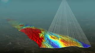
UAV/Drone-Based Surveys
Employing UAVs or drones to gather aerial data has become increasingly popular. Total Station data can be used to geo-reference drone imagery, ensuring the accuracy of aerial maps. Furthermore, ground survey data can be cross-verified with point clouds generated from drones, increasing the integrity of the collected data.
These integrations showcase how modern surveying methods are evolving to incorporate multiple technologies, enabling surveyors to work more efficiently and accurately.
Youtube Videos


Audio Book
Dive deep into the subject with an immersive audiobook experience.
GNSS and Total Station
Chapter 1 of 3
🔒 Unlock Audio Chapter
Sign up and enroll to access the full audio experience
Chapter Content
• Combine GNSS for global coordinates and Total Station for precision.
• Used in areas with limited satellite visibility (urban canyons, forests).
Detailed Explanation
This chunk discusses the integration of Global Navigation Satellite Systems (GNSS) with Total Stations in surveying. GNSS provides global coordinates, which can be less precise when used alone, especially in challenging environments. A Total Station, which measures angles and distances very accurately, can complement GNSS by providing specific local coordinates. This combination is particularly useful in urban environments where buildings might block satellite signals or in forested areas where satellite visibility is limited. By using both technologies together, surveyors can achieve higher accuracy and reliability in their measurements.
Examples & Analogies
Imagine trying to find your location using only a map (GNSS) in a dense city with tall buildings. You might have a general idea of where you are but could be off slightly due to obstructions. Now, if you employ a compass (Total Station) that can give you precise directions based on your immediate surroundings, you can pinpoint your exact location more effectively. This is how GNSS and Total Stations work together to enhance surveying accuracy.
GIS and Total Station
Chapter 2 of 3
🔒 Unlock Audio Chapter
Sign up and enroll to access the full audio experience
Chapter Content
• Export survey data into GIS platforms for thematic mapping.
• Attribute data like land use, utilities, or ownership can be linked to spatial data.
Detailed Explanation
This chunk explains how data collected from Total Stations can be utilized within Geographic Information Systems (GIS). Once survey data is gathered, it can be exported into GIS software, allowing for advanced analysis and visualization. For example, survey data can be linked with other thematic layers in a GIS, such as land use, utility lines, or property ownership. This integration enables planners and engineers to see not just the physical layout but also other relevant contextual information, resulting in more informed decision-making processes regarding land use and development.
Examples & Analogies
Think of GIS as a recipe book. The base ingredients (the physical features surveyed by the Total Station) are vital, but to create a delicious dish, you need additional flavors (like land use and utility data). When you combine the two, you have a complete meal for making decisions about where and how to develop land, manage resources, or visualize surroundings. Just like a chef might adjust a recipe, planners can alter their approaches based on the well-rounded insights provided by this integration.
UAV/Drone-Based Surveys
Chapter 3 of 3
🔒 Unlock Audio Chapter
Sign up and enroll to access the full audio experience
Chapter Content
• Use Total Station data to geo-reference drone imagery.
• Cross-verify UAV point clouds with ground survey data.
Detailed Explanation
This chunk focuses on the role of unmanned aerial vehicles (UAVs), or drones, in surveying when combined with Total Stations. Drones can quickly capture imagery and create 3D point clouds of areas, which are dense sets of points in a three-dimensional space. By using data from Total Stations as a reference, surveyors can ensure that the imagery collected by drones aligns accurately with the actual ground coordinates. This cross-verification is crucial for maintaining the integrity of the survey data and enhancing the accuracy of 3D models created from drone imagery.
Examples & Analogies
Imagine a painter (the UAV) creating a mural on a wall (the land being surveyed). The painter needs a clear baseline reference to ensure proportions and perspectives are correct. The reference line drawn by a ruler (Total Station data) helps the painter position elements accurately. In surveying, using Total Station data with drone imagery ensures that the 3D pictures taken from above are correctly positioned on the actual ground, leading to more reliable and detailed visual representations.
Key Concepts
-
Integration with GNSS: Enhances coordinate precision.
-
GIS Export: Links spatial data with attribute data.
-
UAV Data Validation: Confirms aerial data using ground surveys.
Examples & Applications
Using GNSS and Total Station together to survey in a densely built urban area.
Exporting Total Station data into GIS to visualize public utilities within city maps.
Employing drone footage of a construction site and verifying details with Total Station data.
Memory Aids
Interactive tools to help you remember key concepts
Rhymes
For GNSS, your position's a key, Total Station helps where you cannot see.
Stories
Imagine a city planner using a Total Station in a tall city, working with GIS to plan utilities, while a drone captures the overall area. Together, they ensure accuracy, making the city lively and well-organized.
Acronyms
GUT
GNSS
UAV
and Total Stations for better survey integration.
Flash Cards
Glossary
- GNSS
Global Navigation Satellite Systems, which provide global positioning data.
- GIS
Geographic Information Systems, platforms for managing and analyzing spatial data.
- UAV
Unmanned Aerial Vehicle, commonly known as a drone, used for aerial data collection.
Reference links
Supplementary resources to enhance your learning experience.