
Total Station Survey Procedures – Step-by-Step Field Methodology
Enroll to start learning
You’ve not yet enrolled in this course. Please enroll for free to listen to audio lessons, classroom podcasts and take practice test.
Interactive Audio Lesson
Listen to a student-teacher conversation explaining the topic in a relatable way.
Reconnaissance and Planning
🔒 Unlock Audio Lesson
Sign up and enroll to listen to this audio lesson

Today, we will discuss the first step in the Total Station survey procedures: reconnaissance and planning. This process sets the stage for everything that follows. Can anyone tell me what reconnaissance entails in this context?

It’s about visiting the site and checking control points, right?
Exactly! Planning involves identifying control points, considering line-of-sight, and noting any obstructions. Think of it as laying the groundwork. Why is this important?

It helps ensure we have accurate measurements later on.
Correct! Without proper planning, you risk errors in data collection. Remember the acronym ‘PREP’ for this step: Plan, Recognize, Establish, and Prepare!

What if the site has a lot of obstructions?
Great question! You would need to adjust your control points or survey layout. Always be adaptable.
In summary, reconnaissance is crucial for effective surveys and accuracy. It sets you up for success!
Establishing Control Points
🔒 Unlock Audio Lesson
Sign up and enroll to listen to this audio lesson

Let's move to the second step: establishing control points. What are control points, and why do they matter?

They’re markers that help ensure our measurements are accurate, right?
Exactly! Control points form the backbone of the survey. We fix these positions using durable markers like concrete pillars. Can someone tell me how we determine their coordinates?
Using GPS or previous survey data!
Correct! Remember, accurate control points are fundamental because they minimize errors in our overall data collection. If we don't set them right, everything else is affected!
How do we record these coordinates?
Excellent question! We record them in our survey logs and can also set additional ones using GNSS in critical locations.
In conclusion, establishing control points carefully leads to a successful survey outcome.
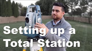
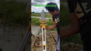
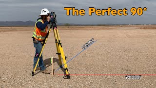
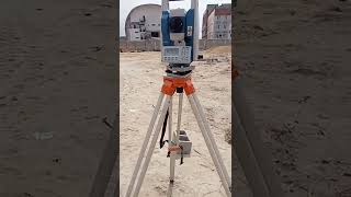
Instrument Station Setup
🔒 Unlock Audio Lesson
Sign up and enroll to listen to this audio lesson
Next, let’s discuss the instrument station setup. What are the key actions to take when setting up a Total Station?
We need to level it over a control point.
Absolutely! Leveling is crucial for accurate measurements. Can anyone explain what resection means?
It’s when you use known coordinates to find an unknown position!
Right! This ensures the instrument is oriented correctly to other known points. Remember the phrase, ‘Center and Level,’ to help you think of these essential steps!
What happens if it’s not leveled right?
Good point! If the instrument isn’t leveled properly, all measurements could be off. Ensuring stability at this stage is key!
In summary, careful setup of the instrument is vital for reliable survey data.
Observation and Data Collection
🔒 Unlock Audio Lesson
Sign up and enroll to listen to this audio lesson
Now, let’s look at observation and data collection. What types of data do we typically collect?
Angles and distances, right?
Exactly! We also use specific codings for features like trees and walls to organize our data. Why is it important to standardize this coding?
It helps future reference and analysis to be more straightforward.
Correct! Organizing data leads to efficiency in processing later. Remember the mnemonic ‘CODE’ for this: Capture, Organize, Document, and Evaluate.
How do we decide between auto-mode and manual mode?
Great question! Auto-mode is often preferred for ease, but manual mode is essential when precise detail points are required. Always choose based on the situation!
To summarize, accurate and organized data collection is critical to our survey's integrity.
Daily Field Checks
🔒 Unlock Audio Lesson
Sign up and enroll to listen to this audio lesson
Finally, let’s discuss daily field checks. Why do you think these checks are essential?
To make sure our previous data is accurate!
Exactly! Multiple measurements can help verify our data. It’s vital for maintaining data integrity. Can anyone recall what prism constants might refer to?
It relates to the specific adjustments made for the reflectors?
Exactly right! Checking these constants ensures that the calculations remain precise. Mnemonic ‘CHECK’ can help remember: Confirm, Hasten, Evaluate, Correct, Keep!
What happens if we find an error?
Good thinking! If discrepancies arise, you must correct them immediately to prevent compounding errors. In summary, regular checks safeguard the reliability of the entire survey process.
Introduction & Overview
Read summaries of the section's main ideas at different levels of detail.
Quick Overview
Standard
In this section, the Total Station survey procedures are detailed, starting with reconnaissance and planning, establishing control points, proper instrument setup, and culminating in observations and data collection followed by daily field checks. Each step is essential for ensuring accuracy and reliability in surveys.
Detailed
Detailed Summary of Total Station Survey Procedures
This section presents a comprehensive guide to performing Total Station surveys, essential for obtaining accurate geographical data in civil engineering projects. The procedure is structured into several phases:
1. Reconnaissance and Planning
Surveyors need to visit the site to identify suitable control points, consider the line-of-sight, and locate potential obstructions that could hinder measurements. This phase is crucial for establishing a survey control network, which can include both new and existing geodetic control stations. Planning also involves determining the data collection route, the number of stations to set up, and the types of data required.
2. Establishing Control Points
After planning, surveyors must fix permanent control markers, such as concrete pillars or pegs, at key locations. Initial coordinates for these control points can be recorded using GNSS or derived from previous survey data.
3. Instrument Station Setup
The Total Station must be placed and leveled over a control point, ensuring precise measurements. Instrument orientation is achieved by referencing known coordinates or performing a resection based on observed points.
4. Observation and Data Collection
During this phase, standard coding practices for topographic features are employed—this includes identifying trees, walls, or drains. Data can be collected in the auto-mode or manual prism mode depending on the terrain. If detail points are involved, it is necessary to record offset distances and notes regarding various object types.
5. Daily Field Checks
To ascertain the accuracy of the gathered data, surveyors must perform repeat measurements and verify various conditions, such as checking prism constants, atmospheric settings, and any potential zero errors. This routine ensures integrity and minimizes the chance of inadvertent errors throughout the survey process.
Following these systematic steps allows surveyors to execute their tasks with precision, ensuring that data collected supports the foundational aspects of subsequent civil engineering and geospatial analysis projects.
Youtube Videos


Audio Book
Dive deep into the subject with an immersive audiobook experience.
Reconnaissance and Planning
Chapter 1 of 5
🔒 Unlock Audio Chapter
Sign up and enroll to access the full audio experience
Chapter Content
Visit the site to identify control points, line-of-sight, and obstructions.
Establish a survey control network or use existing geodetic control stations.
Plan data collection route, number of stations, and data types.
Detailed Explanation
Before starting a Total Station survey, it's important to conduct reconnaissance. This involves visiting the survey site to identify crucial details such as control points that will anchor your measurements, assess the line-of-sight for clear visibility, and identify any obstructions that could interfere with your measurements. You also need to establish a control network, which can involve placing permanent markers or relying on existing geodetic control points. Finally, you should plan your data collection route, which includes deciding how many stations you will set up and what specific types of data you will collect.
Examples & Analogies
Think of reconnaissance and planning like preparing for a road trip. Before you hit the road, you’d want to check your route for traffic jams (obstructions), know where your stops (control points) are, and decide how often you want to refuel (data collection stations). This preparation ensures that your trip goes smoothly and efficiently.
Establishing Control Points
Chapter 2 of 5
🔒 Unlock Audio Chapter
Sign up and enroll to access the full audio experience
Chapter Content
Fix permanent control markers (e.g., concrete pillars, pegs).
Record initial coordinates, or set using GPS or previous survey data.
Detailed Explanation
Establishing control points is a critical step in conducting a Total Station survey. After identifying your control points during reconnaissance, the next step is to fix these points securely, often using materials like concrete pillars or survey pegs. These markers will serve as reference points for all measurements taken throughout the survey. It's also essential to record the initial coordinates of these control points, which can be set using GPS technology or based on data from previous surveys to ensure accuracy.
Examples & Analogies
Imagine planting flags in the ground during a treasure hunt. Each flag represents a point you will measure from; they need to be secure so that as you navigate toward each one, you can trust they haven’t moved. Similarly, control points provide stable reference locations for your survey measurements.
Instrument Station Setup
Chapter 3 of 5
🔒 Unlock Audio Chapter
Sign up and enroll to access the full audio experience
Chapter Content
Place and level the Total Station over a control point.
Perform instrument orientation using known coordinates or resection.
Detailed Explanation
The setup of the Total Station is crucial to ensure that measurements are accurate. First, you’ll place the Total Station directly over a control point you’ve established. It's essential to level the instrument precisely to eliminate any tilt, which can lead to measurement errors. After leveling, you will need to orient the Total Station using known coordinates or a method called resection, which aligns the instrument to existing locations in the survey.
Examples & Analogies
Setting up the Total Station can be compared to setting the compass before hiking. Just as you would ensure your compass is level and calibrated before beginning your hike to navigate correctly, the Total Station must be set up accurately to guide your measurements.
Observation and Data Collection
Chapter 4 of 5
🔒 Unlock Audio Chapter
Sign up and enroll to access the full audio experience
Chapter Content
Use standard coding for topographic features (trees, walls, drains).
Collect data in auto-mode or manual prism mode based on terrain.
For detail points, record offset distances, object types, and notes.
Detailed Explanation
When you begin the data collection phase, it’s important to use a standard coding system to efficiently classify and identify different topographic features such as trees, walls, and drains. Depending on the terrain's characteristics, you can collect data using either an automatic mode, which streamlines the process, or a manual prism mode for more control. For detailed points, it’s crucial to note offset distances from the control point, the types of objects observed, and any additional notes to provide context for the data collected.
Examples & Analogies
Think of data collection like writing down a shopping list while at the grocery store. You categorize items (topographic features) into sections, decide whether to use the self-checkout (auto-mode) or traditional checkout (manual mode), and take notes on sales or special items so you can remember them later.
Daily Field Checks
Chapter 5 of 5
🔒 Unlock Audio Chapter
Sign up and enroll to access the full audio experience
Chapter Content
Perform repeat measurements for verification.
Check prism constants, atmospheric settings, and zero errors.
Detailed Explanation
To ensure the accuracy of your survey, conducting daily field checks is vital. This involves taking repeat measurements of the same points to verify consistency and reliability. You'll also check important settings within the Total Station, such as prism constants (which can vary by conditions), atmospheric settings (to account for changes in conditions), and zero errors (which checks if the instrument is correctly zeroed out). Regular checks evade potential errors in your overall data collection.
Examples & Analogies
Consider daily field checks like a quality control check in a bakery. Just as bakers may frequently taste their products to ensure they’re consistent in quality and flavor, surveyors regularly verify their measurements to validate their results.
Key Concepts
-
Reconnaissance: The initial surveying stage where control points and obstructions are identified.
-
Control Points: Fixed markers that ensure measurements are accurate throughout the survey.
-
Instrument Setup: Properly leveling and orienting the Total Station to ensure precise data collection.
-
Data Collection: Gathering accurate measurements using standardized coding techniques.
-
Daily Checks: Regular verifications during fieldwork to maintain data accuracy.
Examples & Applications
A surveyor identifies control points on a construction site and notes that a tall tree obscures the line of sight to a known point, requiring adjustments.
Using GPS, the surveyor establishes a control point by marking it with a concrete pillar and records its coordinates.
Memory Aids
Interactive tools to help you remember key concepts
Rhymes
In the field, don’t roam, plan your path and make it home!
Stories
Once a surveyor ventured into the forest, only to find tree branches blocking his view. He established control points on higher ground and marked them carefully to ensure a correct survey.
Memory Tools
Remember ‘C.O.D.E’ for organized data: Capture, Organize, Document, Evaluate.
Acronyms
For setting up, remember 'C.L.O' - Center, Level, Orient!
Flash Cards
Glossary
- Control Points
Fixed markers used to ensure accurate measurements in surveying.
- Resection
The process of determining the position of a point by referencing known positions.
- Automode
A data collection mode in Total Stations that automatically tracks targets.
- Prism Constants
Adjustments made in instruments to account for errors related to reflectors.
Reference links
Supplementary resources to enhance your learning experience.