
Robotic Surveying and Mapping
Enroll to start learning
You’ve not yet enrolled in this course. Please enroll for free to listen to audio lessons, classroom podcasts and take practice test.
Interactive Audio Lesson
Listen to a student-teacher conversation explaining the topic in a relatable way.
Introduction to Robotic Surveying
🔒 Unlock Audio Lesson
Sign up and enroll to listen to this audio lesson

Today, we're diving into robotic surveying and mapping. Can anyone tell me what they think a drone is used for in this context?

I think drones help take pictures from the sky.
Exactly! Drones are used for capturing high-resolution images and creating detailed 3D maps. This use of photogrammetry is quite revolutionary. Does anyone know the technology that enables drones to measure the distance to the ground or objects?

Is it LiDAR?
Correct! LiDAR stands for Light Detection and Ranging and is essential for creating these high-quality maps. Now, can someone summarize the benefits of using drones for surveying?

Drones are faster and can cover larger areas, making them more efficient.
Well done! They enhance both speed and efficiency in surveying.
Automated Total Stations
🔒 Unlock Audio Lesson
Sign up and enroll to listen to this audio lesson

Now let’s discuss automated total stations. What do you think sets them apart from traditional surveying methods?

I think they can work without someone manually taking notes.
Great point! Automated total stations can perform precise measurements and automatically log data, which reduces human error. Why do you think reducing human error is critical in surveying?
Because accurate measurements are essential for construction and planning.
Exactly! The reliability and efficiency gained from automation in these devices are invaluable to civil engineering projects.
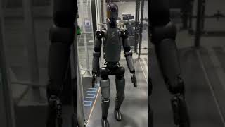
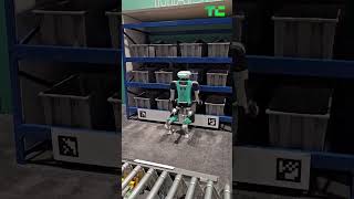
Robotic Rovers in Underground Mapping
🔒 Unlock Audio Lesson
Sign up and enroll to listen to this audio lesson
Lastly, let's explore robotic rovers. Why do you think these robots are important in civil engineering?
They help in mapping underground areas where humans can’t easily go.
Exactly! Robotic rovers are crucial for navigating harsh terrains or tunnels where collecting data manually would be challenging. Can anyone think of a project or scenario where robotic rovers would be particularly useful?
In tunnel construction projects!
Great example! They ensure engineers understand subsurface conditions effectively, which is vital to the safety and planning of construction projects.
Introduction & Overview
Read summaries of the section's main ideas at different levels of detail.
Quick Overview
Standard
Robotic surveying and mapping utilize advanced technologies such as drones for high-resolution imaging and 3D mapping, automated total stations for precise measurements, and robotic rovers for underground exploration. These tools enhance the accuracy and efficiency of surveying tasks in civil engineering.
Detailed
Robotic Surveying and Mapping
In civil engineering, robotic surveying and mapping represent a significant advancement in how terrain and structures are analyzed and documented. Key technologies employed in this field include:
- Drones: Utilized for capturing high-resolution images and creating 3D maps through photogrammetry and LiDAR. Drones significantly improve the speed and accuracy of data collection over large areas compared to traditional methods.
- Automated Total Stations: These instruments perform precise measurements with minimal human input, enhancing the reliability and efficiency of surveying tasks by automating calculations and data recording.
- Robotic Rovers: Employed particularly in tunneling and underground mapping, these robots navigate challenging terrains, gather critical data, and assist in understanding subsurface conditions, which is crucial for various engineering projects.
The integration of these robotic systems marks a pivotal shift from manual surveying methods to automated processes, which enhances data accuracy, saves time, and reduces the risk of human error.
Youtube Videos


Audio Book
Dive deep into the subject with an immersive audiobook experience.
Drones for Surveying
Chapter 1 of 3
🔒 Unlock Audio Chapter
Sign up and enroll to access the full audio experience
Chapter Content
• Drones: Capture high-resolution images and 3D maps using photogrammetry and LiDAR.
Detailed Explanation
Drones are unmanned aerial vehicles equipped with advanced cameras and sensors. They are utilized in surveying and mapping because they can quickly gather high-resolution images of large areas. Using techniques such as photogrammetry and LiDAR (Light Detection and Ranging), these drones can create detailed three-dimensional models of the terrain. Photogrammetry uses overlapping photographs taken from different angles, while LiDAR uses laser light to measure distances to the ground, allowing for precise mapping.
Examples & Analogies
Imagine being a photographer who needs to take pictures of a vast landscape. Instead of walking around taking pictures one at a time, you send a drone up into the sky, which can take many pictures in a short time, covering the entire area efficiently. This is similar to how drones capture comprehensive images for mapping vast areas during a surveying project.
Automated Total Stations
Chapter 2 of 3
🔒 Unlock Audio Chapter
Sign up and enroll to access the full audio experience
Chapter Content
• Automated Total Stations: Perform precise measurements without manual input.
Detailed Explanation
Automated Total Stations are advanced surveying instruments that combine electronic theodolites with distance measuring devices. Unlike traditional methods that require manual input from surveyors for measurements, these stations can automatically collect data such as angles and distances from multiple points on a construction site. They can be remotely controlled, reducing human error and increasing efficiency in collecting accurate measurement data.
Examples & Analogies
Think of it as a high-tech robot that helps builders measure distances without needing anyone to hold measuring tape. Just like a smart assistant that automatically gathers information without needing someone to type it in, Automated Total Stations help surveyors collect data effortlessly and accurately.
Robotic Rovers
Chapter 3 of 3
🔒 Unlock Audio Chapter
Sign up and enroll to access the full audio experience
Chapter Content
• Robotic Rovers: Used in tunneling and underground mapping.
Detailed Explanation
Robotic rovers are specialized vehicles capable of navigating through underground environments such as tunnels. Equipped with various sensors and cameras, these rovers can capture visual data and measure structural integrity without requiring human presence in potentially dangerous or confined spaces. They can also traverse rough terrains where manual surveying would be challenging, making them invaluable for underground mapping projects.
Examples & Analogies
Think of robotic rovers like the Mars rovers that explore the surface of Mars remotely. Just as they collect important data from a planet's surface where humans cannot easily go, these rovers are employed in construction to explore underground areas, ensuring safety while gathering crucial information.
Key Concepts
-
Drones: Used for high-resolution imagery and mapping.
-
Photogrammetry: The technique for creating maps using photographs.
-
LiDAR: An essential tool for distance measurement in mapping.
-
Automated Total Stations: Instruments for accurate and automated surveying.
-
Robotic Rovers: Essential for navigating and mapping underground areas.
Examples & Applications
Using LiDAR-equipped drones to survey large forested areas quickly.
Automated total stations being deployed on a construction site to monitor elevations accurately over time.
Memory Aids
Interactive tools to help you remember key concepts
Rhymes
Drones fly high, they capture the ground, with LiDAR's light, measurements abound!
Stories
Once upon a time in construction land, there were brave drones that flew across the sky. With their cameras, they scanned everything below, making mapping easy, oh what a show!
Memory Tools
DRIVE - Drones, Robots, Images, Vectors, Efficiency in surveying.
Acronyms
DRONE - Digital Ranging Operations Navigate Everywhere.
Flash Cards
Glossary
- Drones
Unmanned aerial vehicles used for capturing images and data.
- Photogrammetry
The art and science of making measurements from photographs.
- LiDAR
Light Detection and Ranging, a method for measuring distances using laser light.
- Automated Total Stations
Instruments that automatically measure and record data during surveying.
- Robotic Rovers
Robots designed to navigate challenging terrains, especially for underground mapping.
Reference links
Supplementary resources to enhance your learning experience.