
Data Manipulation and Analysis
Enroll to start learning
You’ve not yet enrolled in this course. Please enroll for free to listen to audio lessons, classroom podcasts and take practice test.
Interactive Audio Lesson
Listen to a student-teacher conversation explaining the topic in a relatable way.
Spatial Analysis Techniques
🔒 Unlock Audio Lesson
Sign up and enroll to listen to this audio lesson

Today, we are going to discuss some spatial analysis techniques used in GIS, starting with buffering. Can anyone tell me what buffering is?

Isn’t buffering creating a zone around a feature?
Exactly, great job! Buffering helps us analyze the impact of geographic features on their surroundings. For instance, if we buffer a river, we can assess areas at risk of flooding. Can anyone explain why this might be useful?

It helps in planning for flood defenses or notifying residents about evacuation zones!
That's correct! Now, let’s move on to overlay analysis. This involves combining multiple data layers. What could we learn from such an analysis?

We could identify areas where land use and population density intersect, right?
Exactly! Overlay analysis helps in making decisions regarding infrastructure development. Can someone provide another example?

We could overlay terrain data with vegetation to see where forest coverage is at risk.
Perfect! It can also help guide conservation efforts. Remember, these techniques allow for a better understanding of spatial relationships.
Network Analysis
🔒 Unlock Audio Lesson
Sign up and enroll to listen to this audio lesson

Next, let’s explore network analysis. What do you think network analysis entails in GIS?
Is it about analyzing transportation routes?
Exactly! It's focused on understanding how to navigate through networks. Why is this analysis important in urban planning?
It helps in optimizing traffic flow and understanding accessibility!
Very true! It can help design better public transportation routes. Now, moving on to interpolation. Why would we need this technique?
To guess unknown values based on known ones, like estimating rainfall in a region?
Exactly! Interpolation helps fill in data gaps, which is crucial for effective resource management. Always remember that techniques like these help in making data-driven decisions.
Query and Selection
🔒 Unlock Audio Lesson
Sign up and enroll to listen to this audio lesson
Now, let's dive into querying methods. Who can explain how attribute queries work?
They use SQL to filter data based on certain criteria.
Great! Can anyone give an example of how we might use an attribute query?
We could filter all the roads that are wider than a specific size, like 10 feet!
Exactly! Now, what about spatial queries? How do they differ?
Spatial queries filter features based on their location relative to other features!
Right again! An example could be selecting all features within 2 km of a river. Why is this useful for decision-making?
It can help identify flood zones or development areas that might need monitoring.
Smart thinking! Queries enable us to extract precise data from complex datasets, which can greatly inform our planning and analysis.
Summary of Techniques
🔒 Unlock Audio Lesson
Sign up and enroll to listen to this audio lesson
To wrap up, let's summarize what we’ve learned today. What are some of the spatial analysis techniques we covered?
Buffering, overlay analysis, network analysis, and interpolation!
Fantastic! And how do these techniques support decision-making?
They help us analyze spatial data to make informed decisions based on real-world scenarios.
Exactly! And what about querying methods?
They help filter and select data based on attributes or location.
Very well done! Remember, mastering these techniques allows us to harness the full potential of GIS for practical applications.
Introduction & Overview
Read summaries of the section's main ideas at different levels of detail.
Quick Overview
Standard
In this section, we explore various spatial analysis techniques such as buffering, overlay analysis, network analysis, and interpolation, along with querying methods that utilize both attribute and spatial queries to extract meaningful information from GIS data.
Detailed
Detailed Summary
In this section, we delve into the crucial aspects of Data Manipulation and Analysis within Geographic Information Systems (GIS). GIS data manipulation involves various techniques and methodologies designed to interpret and derive insights from spatial and attribute data effectively. The key techniques discussed include:
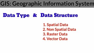
- Spatial Analysis Techniques:
- Buffering: This technique creates zones around specific geographic features, allowing analysis of proximity and influence between features. For instance, creating a buffer zone around a river can help in assessing potential flood impacts on surrounding areas.
- Overlay Analysis: This technique combines two or more data layers to extract new information. For example, overlaying land use maps with population density data can identify areas requiring infrastructure development.
- Network Analysis: This method is vital for understanding transportation systems, where routes, accessibility, and service areas are analyzed based on connected structures like roads and pathways.
- Interpolation: This technique is used to predict unknown values from discrete samples. For example, estimating rainfall levels in a region based on measured data points in specific locations.
- Query and Selection:
- Attribute queries allow users to retrieve specific data using SQL-based queries, helping in filtering features based on attribute conditions (e.g., ‘Select all roads with a width greater than 10 feet’).
- Spatial queries allow for the selection of features based on their geographic location (e.g., ‘Select all features within 2 km of a river’).
These techniques underscore the importance of data manipulation in GIS to facilitate informed decision-making and effective resource management.
Youtube Videos


Audio Book
Dive deep into the subject with an immersive audiobook experience.
Spatial Analysis Techniques
Chapter 1 of 2
🔒 Unlock Audio Chapter
Sign up and enroll to access the full audio experience
Chapter Content
• Buffering: Creating zones around features.
• Overlay Analysis: Combining two or more layers to derive new data.
• Network Analysis: Analyzing routes, accessibility, service areas.
• Interpolation: Estimating unknown values from known data points.
Detailed Explanation
Spatial analysis involves different techniques to manipulate and examine geographic data.
- Buffering creates zones around geographic features (like rivers or roads). This is useful for understanding influences, like how far pollution from a river might extend.
- Overlay Analysis involves layering multiple data sets on top of each other to generate new insights, such as overlaying land use with environmental data to assess compatibility.
- Network Analysis looks at paths and routes. For instance, it can help determine quickest routes for emergency services, factor in traffic, and identify service areas.
- Interpolation estimates values at unsampled locations based on values from surrounding known points, such as predicting rainfall in locations where no data is available.
Examples & Analogies
Imagine you're planning a new park next to a river. You use buffering to see how far the park should extend from the river to protect against flooding. Then, you can overlay park space with population density data to decide the best location. Network analysis could help determine the best access roads, while interpolation can predict how many visitors might come from nearby neighborhoods.
Query and Selection
Chapter 2 of 2
🔒 Unlock Audio Chapter
Sign up and enroll to access the full audio experience
Chapter Content
• Attribute queries (SQL-based) and spatial queries (e.g., "Select features within 2 km of a river").
Detailed Explanation
Querying allows users to select specific data from large datasets in GIS.
- Attribute Queries use SQL (Structured Query Language) syntax to filter data based on certain attributes, such as finding all parks with picnic facilities.
- Spatial Queries focus on the geographic relationships between features, such as selecting all trees that are within a certain distance from a river, which can help in environmental assessments.
Examples & Analogies
Think about using a filter for your online shopping. If you're looking for shoes for a specific occasion, you might filter by size, color, or brand. Similarly, in GIS, a spatial query lets you find features based on their location, like all the parks that are 1 km from a school, which could be essential for planning community events.
Key Concepts
-
Spatial Analysis Techniques: Methods used to extract meaningful insights from spatial data.
-
Buffering: A specific technique for creating zones around features.
-
Overlay Analysis: A technique that combines layers for deeper analysis.
-
Interpolation: Estimating unknown values based on known points.
-
Network Analysis: Important for analyzing transportation and utility networks.
-
Query Methods: Methods of filtering and selecting data based on specific criteria.
Examples & Applications
Using buffering to assess flood impact areas around a river.
Implementing overlay analysis between land use and population density layers.
Employing interpolation techniques to fill data gaps in rainfall data.
Memory Aids
Interactive tools to help you remember key concepts
Rhymes
Buffer zones we create, to protect and to relate.
Stories
A city planner, Jack, used overlay analysis to layer population data over land use maps, uncovering hidden opportunities for new parks and schools!
Memory Tools
B.O.N.I: Buffering, Overlay Analysis, Network analysis, Interpolation – remember these techniques for spatial analysis!
Acronyms
Q.S. for Queries and Selection
Quick Search for finding data in GIS!
Flash Cards
Glossary
- Buffering
Creating zones around geographical features for analysis.
- Overlay Analysis
Combining multiple data layers to derive new information.
- Network Analysis
Analyzing transportation or utility networks for optimal routing and accessibility.
- Interpolation
Estimating unknown values based on known data points.
- Attribute Query
Retrieving specific data using conditions based on attributes.
- Spatial Query
Selecting features based on their geographic locations.
Reference links
Supplementary resources to enhance your learning experience.