
Integration with Other Technologies
Enroll to start learning
You’ve not yet enrolled in this course. Please enroll for free to listen to audio lessons, classroom podcasts and take practice test.
Interactive Audio Lesson
Listen to a student-teacher conversation explaining the topic in a relatable way.
GIS and Remote Sensing
🔒 Unlock Audio Lesson
Sign up and enroll to listen to this audio lesson

Today, we're talking about how GIS integrates with remote sensing. Can anyone tell me what remote sensing is?

Isn't it taking measurements or images from satellites or aircraft?
Exactly! Remote sensing allows us to gather raster data like land cover. How do you think this integration can be useful?

We could monitor environmental changes over time.
Correct! This is particularly valuable for urban planning and disaster management. Remember the acronym CRISP: Change Recognition in Spatial Patterns. This can help us remember the importance of change detection.

Got it! We need to track changes accurately.
Right, and that leads us to our next topic: GIS and GPS. What's the role of GPS in GIS?
GIS and GPS
🔒 Unlock Audio Lesson
Sign up and enroll to listen to this audio lesson

So, who can explain the function of GPS in the context of GIS?

GPS provides precise location data, right?
Absolutely! By combining GIS with GPS, we can achieve real-time tracking of assets. How does this benefit civil engineering projects?
It helps manage logistics better and improves data accuracy.
Great point! Let's remember the mnemonic GPS: Geolocation Precision Systems. This highlights how GPS supports precise location management.
That makes sense! It really aids in decision-making.
Right! Finally, let’s discuss another technology: Building Information Modeling or BIM.
GIS and Building Information Modeling (BIM)
🔒 Unlock Audio Lesson
Sign up and enroll to listen to this audio lesson
How does GIS integration with BIM enhance infrastructure projects?
It allows for better 3D visualization and spatial analysis.
Correct! GIS enriches BIM with geographical data. Why is this crucial for urban planning?
It helps in smart city planning by integrating physical structures with their environmental context.
Absolutely! Let's keep in mind the acronym GIS-BIM: Geographic Integration for Smart Building Information Management. This emphasizes the importance of their collaboration.
So, the integration helps with better lifecycle management too!
Exactly! In summary, we've seen how GIS's integration with remote sensing, GPS, and BIM enhances our capabilities in civil engineering. It all boils down to making informed decisions based on accurate data.
Introduction & Overview
Read summaries of the section's main ideas at different levels of detail.
Quick Overview
Standard
This segment of the chapter elaborates on the integration of GIS with remote sensing, GPS, and Building Information Modeling (BIM). Each integration enhances the capabilities of GIS, allowing for dynamic data visualization, real-time tracking, and 3D spatial analysis, which are essential for informed decision-making in civil engineering projects.
Detailed
Integration with Other Technologies
The integration of GIS with various technologies enhances its capabilities and expands its applications within civil engineering.
GIS and Remote Sensing
Remote sensing provides up-to-date raster data, such as land cover and environmental changes. By integrating GIS with remote sensing, users can perform dynamic monitoring and detect changes over time with greater accuracy. This synergy is particularly useful for environmental assessments, urban planning, and disaster response.
GIS and GPS
GPS technology offers precise location data, enabling accurate positioning and navigation. The integration of GIS and GPS is vital for real-time tracking of assets and personnel, which aids in effective fleet management and logistics operations. This combination allows for improved data accuracy and helps in timely decision-making in various infrastructure projects.
GIS and Building Information Modeling (BIM)
The integration of GIS with BIM facilitates superior 3D visualization and spatial analysis of infrastructure projects. GIS can enrich BIM with geographical data, allowing urban planners and engineers to devise smarter city solutions by considering both physical structures and their environmental context. This is crucial for lifecycle management, urban development, and infrastructure planning.
Youtube Videos


Audio Book
Dive deep into the subject with an immersive audiobook experience.
GIS and Remote Sensing
Chapter 1 of 3
🔒 Unlock Audio Chapter
Sign up and enroll to access the full audio experience
Chapter Content
Remote sensing provides up-to-date raster data (e.g., land cover).
Integration allows for dynamic monitoring and change detection.
Detailed Explanation
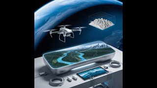
This chunk discusses how GIS can integrate with remote sensing technologies. Remote sensing involves gathering data from satellites or aerial sensors to obtain information about the Earth's surface. In the context of GIS, this data is used to create detailed maps of land cover, such as forests, urban areas, and water bodies. The integration of these technologies allows for continuous monitoring of environmental changes, like deforestation or urban expansion, which can greatly assist in planning and decision-making.
Examples & Analogies
Imagine using a drone equipped with a camera to capture images of a forest over time. By comparing these images using GIS, we can detect changes in the forest's size or health. This is similar to watching time-lapse videos that show how a city grows over years — we can see how things change and plan actions accordingly.
GIS and GPS
Chapter 2 of 3
🔒 Unlock Audio Chapter
Sign up and enroll to access the full audio experience
Chapter Content
GPS provides accurate location coordinates.
Real-time tracking and navigation systems (e.g., fleet management).
Detailed Explanation
In this chunk, we explore the relationship between GIS and GPS (Global Positioning System). GPS technology allows us to determine exact coordinates (latitude and longitude) of a location on Earth. When GIS integrates with GPS, it enhances various applications, such as real-time vehicle tracking and navigation. For example, delivery trucks can be monitored to optimize routes, reduce fuel consumption, and provide accurate delivery times.
Examples & Analogies
Think of using a GPS app on your smartphone to find the quickest route to a restaurant. Just like the app helps you find directions, GIS integrated with GPS helps businesses track their vehicles on the road, making sure they arrive on time and reduce traffic delays.
GIS and Building Information Modeling (BIM)
Chapter 3 of 3
🔒 Unlock Audio Chapter
Sign up and enroll to access the full audio experience
Chapter Content
Integration enables 3D visualization and spatial analysis of infrastructure.
Useful for smart city planning and lifecycle management.
Detailed Explanation
This chunk highlights how GIS can work with Building Information Modeling (BIM). BIM is a digital representation of physical and functional characteristics of a building. When GIS is integrated with BIM, it allows for better 3D visualization of infrastructure and spatial analysis. This integration supports smart city planning, where various infrastructures are designed to work together efficiently over their lifecycle, from construction to maintenance.
Examples & Analogies
Imagine planning a new city block where buildings, parks, and roads are designed together in a 3D model. Integration of GIS with BIM is like having a detailed blueprint and map working together — you can see how each part fits in the bigger picture and make informed decisions to create a functional space for people.
Key Concepts
-
GIS-Remote Sensing Integration: Combines raster data from remote sensing for dynamic monitoring and environmental assessments.
-
GPS in GIS: Provides accurate locational data for real-time tracking and logistics in civil engineering.
-
GIS-BIM Relationship: Enhances urban planning and infrastructure management through 3D visualization and spatial analysis.
Examples & Applications
Using remote sensing to track deforestation rates over time for environmental monitoring.
Implementing GPS technology in fleet management systems for accurate vehicle tracking.
Memory Aids
Interactive tools to help you remember key concepts
Rhymes
Remote sensing sees from the sky, in GIS, data flies high!
Stories
In a city where buildings touched the sky, engineers used GIS and BIM to see how structures can lie. With GPS tracking, they ensured routes were clear, making urban planning without fear.
Memory Tools
Remember CRISP for remote sensing's role: Change Recognition in Spatial Patterns.
Acronyms
Use GPS to remember Geolocation Precision Systems for tracking assets.
Flash Cards
Glossary
- Remote Sensing
The acquisition of information about an object or phenomenon without making physical contact, often using satellite or aerial imagery.
- GPS
Global Positioning System; a satellite-based navigation system that allows users to determine their exact location on Earth.
- Building Information Modeling (BIM)
A digital representation of physical and functional characteristics of a facility that enhances decision-making throughout a project's lifecycle.
Reference links
Supplementary resources to enhance your learning experience.