
Mobile GIS and Crowdsourced Mapping
Enroll to start learning
You’ve not yet enrolled in this course. Please enroll for free to listen to audio lessons, classroom podcasts and take practice test.
Interactive Audio Lesson
Listen to a student-teacher conversation explaining the topic in a relatable way.
Introduction to Mobile GIS
🔒 Unlock Audio Lesson
Sign up and enroll to listen to this audio lesson

Today, we're going to explore Mobile GIS. Who can tell me what Mobile GIS is?

Is it about using mobile phones for GIS tasks?
Exactly! Mobile GIS uses smartphones, tablets, or handheld GPS devices to collect and access GIS data on-site. What kind of applications can you think of for this technology?

Perhaps for checking the condition of roads or inspecting buildings?
Absolutely! Infrastructure inspection and environmental surveys are significant applications. Remember the acronym PIED: Planning, Inspection, Environmental surveys, and Data access, which encompasses key areas where Mobile GIS is applied.

What are some examples of mobile GIS applications?
Great question! Apps like Collector for ArcGIS and QField for QGIS allow users to collect and edit spatial data in real-time. Can anyone think of a situation when real-time data access is vital?

In emergencies, like natural disasters!
Right! Real-time data can assist in disaster management by providing quick updates.
So, in summary, Mobile GIS enables on-the-go access to GIS data through mobile devices, which is critical for timely decision-making.
Crowdsourcing in GIS
🔒 Unlock Audio Lesson
Sign up and enroll to listen to this audio lesson

Now let's transition into crowdsourced mapping. What do you think 'crowdsourcing' means?
Is it when many people contribute information to one project?
Yes! Crowdsourcing involves contributions from a wide range of individuals to enrich GIS databases. Why do you think this is important?
It could enhance accuracy and keep data up-to-date.
Exactly! Platforms like OpenStreetMap allow volunteers to map and edit geographic information collaboratively. Can anyone provide an example of when crowdsourced mapping has been particularly beneficial?
During the COVID-19 pandemic, people mapped healthcare resources!
Right on target! Crowdsourcing played a key role in quickly updating vital information. Remember the phrase 'People Power,' which signifies how collective efforts can lead to significant enhancements in geographic data.
In summary, crowdsourced mapping taps into community contributions for updating essential geographic information, thereby improving data accuracy and availability.
Introduction & Overview
Read summaries of the section's main ideas at different levels of detail.
Quick Overview
Standard
Mobile GIS involves using handheld devices to collect and access geographic data on-site, facilitating tasks like infrastructure inspections and environmental surveys. Crowdsourced mapping, exemplified by platforms such as OpenStreetMap, harnesses community efforts to collaboratively update vital geographic information, enhancing data accuracy and relevance in real-time scenarios.
Detailed
Mobile GIS and Crowdsourced Mapping
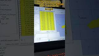
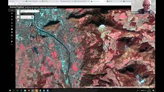
Mobile GIS refers to advancements in geography information systems that enable the collection and access of geographic data through mobile devices, such as smartphones and tablets. This technology is particularly useful for on-site data gathering in various fields, including infrastructure inspection, environmental assessments, land parcel mapping, and other spatial analysis tasks. Applications like Collector for ArcGIS, QField for QGIS, and Mappt allow users to interactively collect and edit spatial data in real-time.
On the other hand, crowdsourced mapping capitalizes on the collective efforts of volunteers to contribute to geographic databases. Platforms such as OpenStreetMap (OSM) exemplify this approach, wherein users can collaboratively map and edit geographic data, significantly augmenting the information available about road networks, buildings, and areas affected by disasters. Crowdsourcing is especially impactful in times of crisis, such as during the COVID-19 pandemic, where individuals mapped resources, and post-earthquake situations that required rapid data updates. The ability to gather data from diverse contributions can lead to richer, more accurate datasets that can be utilized in decision-making processes.
Youtube Videos


Audio Book
Dive deep into the subject with an immersive audiobook experience.
Mobile GIS Overview
Chapter 1 of 2
🔒 Unlock Audio Chapter
Sign up and enroll to access the full audio experience
Chapter Content
• Involves using smartphones, tablets, or handheld GPS devices to collect, update, and access GIS data on-site.
• Useful for infrastructure inspection, environmental surveys, land parcel mapping, etc.
• Apps: Collector for ArcGIS, QField (for QGIS), Mappt.
Detailed Explanation
Mobile GIS refers to the use of mobile devices such as smartphones and tablets, as well as handheld GPS devices, to gather and engage with geographic data while in the field. This means that instead of just analyzing data in an office environment, users can collect new information, update existing datasets, and access spatial data directly from their mobile devices, wherever they are. This capability enhances the efficiency and accuracy of data collection for various applications, including inspecting infrastructure, conducting environmental surveys, and mapping land parcels. Some popular apps for mobile GIS include 'Collector for ArcGIS,' 'QField' for QGIS, and 'Mappt.'
Examples & Analogies
Imagine you're an environmental scientist conducting a survey of a local ecosystem. Instead of having to take notes on paper and then transfer that data to a computer later, you can use your smartphone to input your observations directly into a GIS app as you walk through the area. This not only saves time but also reduces the chances of mistakes during data transfer. It's like having a portable office at your fingertips.
Crowdsourcing in GIS
Chapter 2 of 2
🔒 Unlock Audio Chapter
Sign up and enroll to access the full audio experience
Chapter Content
• Platforms like OpenStreetMap (OSM) allow volunteers to map and edit geographic data collaboratively.
• Valuable in updating road networks, buildings, and disaster-hit areas.
• Example: Mapping COVID-19 resources or post-earthquake damage in real time.
Detailed Explanation
Crowdsourcing in GIS refers to the practice of gathering geographic information from a large group of people, often through online platforms. One prominent example is OpenStreetMap (OSM), where volunteers can contribute by mapping and editing geographic data collaboratively. This method is particularly beneficial for keeping road networks, building locations, and other spatial data current. During emergencies, crowdsourcing can be vital; for instance, volunteers can quickly map resources available for COVID-19 testing or update the layout of an area affected by an earthquake to assess damage and assist in recovery efforts.
Examples & Analogies
Think of a community coming together to paint a mural. Each person contributes their own unique skills to create a larger picture. In the same way, many individuals can contribute small bits of geographic data on platforms like OpenStreetMap, resulting in a comprehensive and up-to-date map. This collaborative approach allows for real-time updates, making it possible for users in a community to access crucial information when they need it most, like finding the nearest hospital during a crisis.
Key Concepts
-
Mobile GIS: Technology enabling geographic data collection and access using mobile devices.
-
Crowdsourcing: Method of gathering information from a large group of people for enhancing data accuracy.
-
OpenStreetMap: A platform that allows users to collaboratively map and update geographic information.
Examples & Applications
Mobile GIS applications assist in real-time data collection for environmental studies, such as monitoring wildlife habitats.
Crowdsourced mapping helps emergency responders quickly access information about disaster-affected areas.
Memory Aids
Interactive tools to help you remember key concepts
Rhymes
Mobile GIS on the go, data collection in the flow.
Stories
Imagine a community where neighbors work together to ensure everyone knows where the nearest hospital is during a disaster—this is crowdsourced mapping at its best!
Memory Tools
Remember 'MAP' for Mobile GIS: Mobile devices, Access on-site, and Participation through apps.
Acronyms
CROWDS for Crowdsourced Mapping
Collective Resource for Others’ World Data Sharing.
Flash Cards
Glossary
- Mobile GIS
A system that enables the collection, updating, and access of geographic data using mobile devices.
- Crowdsourcing
An approach to collecting information from a large group of people, particularly via the internet.
- OpenStreetMap (OSM)
A collaborative mapping platform where users contribute geographical information.
Reference links
Supplementary resources to enhance your learning experience.