
Definition and Components of GIS
Enroll to start learning
You’ve not yet enrolled in this course. Please enroll for free to listen to audio lessons, classroom podcasts and take practice test.
Interactive Audio Lesson
Listen to a student-teacher conversation explaining the topic in a relatable way.
Understanding GIS
🔒 Unlock Audio Lesson
Sign up and enroll to listen to this audio lesson

Today, we are diving into the definition of GIS. A Geographic Information System, or GIS, is fundamentally a system designed to handle geographic data, right? It allows us to capture, store, manipulate, and analyze this data efficiently. What do you think is the importance of having such a system?

I think it helps in understanding spatial relationships between different features!
Exactly! It supports informed decision-making in areas like urban planning and environmental monitoring. Can anyone name a core component of GIS?

Maybe the software part? Like ArcGIS or QGIS?
Great point! Software forms an essential part of GIS, allowing us to visualize and analyze the data effectively.
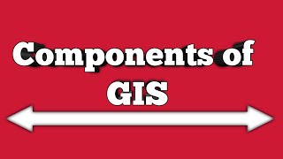
Components of GIS
🔒 Unlock Audio Lesson
Sign up and enroll to listen to this audio lesson

Now that we know what GIS is, let’s discuss its components. Can anyone recall what hardware is needed for GIS?

I believe it includes computers and GPS devices, right?
Exactly! Hardware includes devices like computers, servers, and GPS systems. Each component plays a critical role in the GIS framework. What about the data aspect? What types do we have?

There’s spatial data like maps and non-spatial data, which are attributes related to those maps!
Spot on! Understanding both types of data helps us analyze geographical relationships better.
Importance of GIS in Civil Engineering
🔒 Unlock Audio Lesson
Sign up and enroll to listen to this audio lesson
Finally, let’s connect GIS to civil engineering. Why do you think GIS is crucial in this field?
It helps with planning infrastructure and makes monitoring easier!
Yes! GIS allows engineers to support decision-making with real-world spatial data, which is crucial for projects like urban planning or transportation development.
What about the procedures? How do they fit into the picture?
Good question! Procedures ensure we collect and analyze data efficiently, which is vital for maintaining accurate project standards. To sum up, the components of a GIS—hardware, software, data, people, and procedures—work harmoniously to aid effective spatial analysis.
Introduction & Overview
Read summaries of the section's main ideas at different levels of detail.
Quick Overview
Standard
A Geographical Information System (GIS) integrates hardware, software, and geographic data for effective capturing, analyzing, and presenting spatial information. Its core components include hardware like servers and GPS devices, specialized software, both spatial and non-spatial data, skilled personnel, and established procedures to facilitate its operations.
Detailed
Introduction to GIS
A Geographical Information System (GIS) is defined as an organized collection of computer hardware, software, geographic data, and personnel designed to efficiently capture, store, update, manipulate, analyze, and display all forms of geographically referenced information.
Core Components of GIS
- Hardware: This includes the necessary devices such as computers, servers, GPS devices, scanners, and plotters essential for running GIS applications and data capturing.
- Software: Specialized applications like ArcGIS, QGIS, and ERDAS Imagine enable users to analyze and visualize geospatial data effectively.
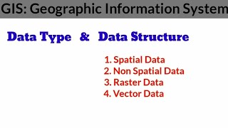
- Data: GIS relies on various data forms including spatial data, which encompasses geographical entities such as maps and satellite images, and non-spatial data that consists of attributes related to these geographical features.
- People: Skilled personnel, including GIS analysts, database managers, and software developers, are crucial for managing and interpreting GIS data.
- Procedures: Well-defined protocols are essential for data collection, analysis, storage, and dissemination, ensuring that the GIS processes are efficient and effective.
In civil engineering, GIS is a vital tool that aids in planning, designing, managing, and monitoring infrastructure projects.
Youtube Videos


Audio Book
Dive deep into the subject with an immersive audiobook experience.
Definition of GIS
Chapter 1 of 2
🔒 Unlock Audio Chapter
Sign up and enroll to access the full audio experience
Chapter Content
A GIS is defined as an organized collection of computer hardware, software, geographic data, and personnel designed to efficiently capture, store, update, manipulate, analyze, and display all forms of geographically referenced information.
Detailed Explanation
GIS stands for Geographic Information System. It is essentially a system that combines various technologies to help us manage geographical data. This includes using specific computer hardware (like servers and GPS devices), software applications that are specifically designed for GIS (like ArcGIS or QGIS), and the geographic data itself, which can be maps or satellite images. The personnel involved are the experts who maintain and use these systems, such as GIS analysts or software developers. Altogether, they work to gather data about locations on Earth, analyze it, and create visual representations that help us understand patterns or make decisions based on geographical information.
Examples & Analogies
Think of GIS as a toolbox for a construction worker. Just like a toolbox contains various tools (hammers, saws, screwdrivers) that each serve specific purposes, GIS combines hardware, software, data, and skilled people to build a detailed 'map' of our world. This 'map' can help us understand where things are, how they relate to one another, and how to plan for the future.
Components of GIS
Chapter 2 of 2
🔒 Unlock Audio Chapter
Sign up and enroll to access the full audio experience
Chapter Content
GIS is comprised of the following major components:
• Hardware: Computers, servers, GPS devices, scanners, plotters.
• Software: GIS-specific applications like ArcGIS, QGIS, ERDAS Imagine.
• Data: Spatial (maps, satellite images) and non-spatial (attributes) data.
• People: GIS analysts, database managers, software developers.
• Procedures: Protocols for data collection, analysis, storage, and dissemination.
Detailed Explanation
The major components of GIS can be grouped into five categories: hardware, software, data, people, and procedures. Firstly, hardware consists of the physical devices needed to run GIS, which include computers and tools like GPS devices that help collect data. Secondly, software refers to specialized applications designed for GIS tasks, which enable data manipulation and analysis. The data itself falls into two types: spatial data that tells us where things are (like maps) and non-spatial data that gives characteristics of those locations (like population statistics). Thirdly, people are the experts who operate these systems; they analyze and interpret the data. Lastly, procedures define the methods or protocols for how data is collected, analyzed, stored, and shared.
Examples & Analogies
Imagine you're organizing a library. The hardware is the library building and furniture, the software is the cataloging system that helps you keep track of books, the data includes the actual books and information about them, the people are the librarians who help visitors find the books, and the procedures are the rules you follow for checking books in and out. Just like the library needs all these pieces working together, a GIS needs its components to function effectively.
Key Concepts
-
GIS: A computer-based system for managing geographical data.
-
Components of GIS: Comprises hardware, software, data, personnel, and procedures.
-
Spatial Data: Includes geographic features and their locations.
-
Non-Spatial Data: Attributes related to spatial features.
Examples & Applications
GIS can be used to manage urban development projects efficiently.
Environmental monitoring with GIS helps identify pollution sources and assess their impacts.
Memory Aids
Interactive tools to help you remember key concepts
Rhymes
GIS is key for location and form, managing data is is its norm.
Stories
Think of GIS as a city's brain, processing data to alleviate pain from urban issues, big and small, helping planners answer the call.
Memory Tools
HSDPP - Hardware, Software, Data, People, Procedures. Remember to relate these in order!
Acronyms
G-MaPP - Geographic Information System
Managing
Analyzing
Presenting
Planning.
Flash Cards
Glossary
- GIS
A Geographical Information System, a framework for gathering, managing, and analyzing spatial and geographic data.
- Hardware
Physical technological tools like computers, servers, and GPS devices used in GIS.
- Software
Applications and programs like ArcGIS and QGIS that facilitate GIS functionalities.
- Spatial Data
Data that represents the location and shape of geographic features.
- NonSpatial Data
Data that describes characteristics of spatial features, such as names or types.
- Procedures
Established methods for collecting, analyzing, storing, and disseminating GIS data.
- Personnel
Trained individuals who operate and manage GIS systems, including analysts and developers.
Reference links
Supplementary resources to enhance your learning experience.