
Environmental Impact Assessment (EIA)
Enroll to start learning
You’ve not yet enrolled in this course. Please enroll for free to listen to audio lessons, classroom podcasts and take practice test.
Interactive Audio Lesson
Listen to a student-teacher conversation explaining the topic in a relatable way.
Introduction to EIA and its Importance
🔒 Unlock Audio Lesson
Sign up and enroll to listen to this audio lesson

Welcome class! Today, we will start our discussion on Environmental Impact Assessment, or EIA. Can anyone explain what EIA is?

Isn't it about assessing environmental effects before starting construction?
Absolutely! EIA helps identify potential ecological disturbances before a project begins, ensuring we consider environmental sustainability. Can anyone think of why this is important?

It helps protect wildlife habitats and minimizes pollution, right?
Exactly! Protecting ecosystems and public health is critical. We can remember the acronym EIA as 'Evaluate Impact Always'.

What tools do engineers use during EIA?
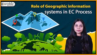
Great question! Tools like remote sensing and GIS are vital. Remote sensing captures satellite images that show environmental conditions before and after projects.

How do we analyze those images?
We can use GIS modeling for that! GIS helps us create maps for buffer analysis, pollution dispersion, and visual impact assessments.
To summarize, EIA helps us evaluate environmental impacts, facilitating sustainable decisions in civil engineering.
Techniques in EIA: Remote Sensing and GIS
🔒 Unlock Audio Lesson
Sign up and enroll to listen to this audio lesson

In our previous session, we discussed the basics of EIA. Now, let's dive deeper into the techniques used in EIA. What role do you think remote sensing plays?
It provides the images we need to analyze pre-and post-project environments?
Correct! Remote sensing gives us valuable data, helping visualize changes. And how about GIS?
It helps us create detailed maps and perform analyses?
Exactly! With GIS, we can perform buffer analysis around sensitive areas. For instance, if a project is near a wetland, we can create buffers that protect those ecosystems.
What about pollutant dispersion maps? How do they work?
Pollutant dispersion maps show how contaminants might spread from a construction site. We can use GIS to visualize this, helping decision-makers understand potential impacts.
To conclude, remote sensing provides the imagery, while GIS enables effective analysis and visualization for EIA.
Impact Assessments and Regulatory Compliance
🔒 Unlock Audio Lesson
Sign up and enroll to listen to this audio lesson
Let’s now discuss the regulatory aspect of EIA. Why do you think it is important for projects to comply with environmental regulations?
To avoid legal issues and ensure community safety!
Exactly! Compliance helps avoid fines and promotes community trust. Does anyone know any legislation related to EIA?
I think many countries have their EIA acts for environmental protection.
Yes, that's correct! These acts ensure proper procedure is followed. What do we highlight during an EIA process to the stakeholders?
The potential impacts and measures taken to mitigate negative effects.
Really good point! Stakeholder engagement is essential for transparency and public involvement. Remember, EIA is as much about community impact as it is about environmental impact.
In summary, EIA not only fulfills legal obligations but also supports informed decision-making and fosters sustainable development.
Introduction & Overview
Read summaries of the section's main ideas at different levels of detail.
Quick Overview
Standard
This section discusses the significance of Environmental Impact Assessment (EIA) in civil engineering, highlighting the roles of remote sensing in analyzing pre- and post-project satellite imagery for environmental changes. It emphasizes the integration of Geographic Information Systems (GIS) for modeling sensitive areas and assessing potential impacts from construction activities.
Detailed
Environmental Impact Assessment (EIA)
Environmental Impact Assessment (EIA) is a crucial process in civil engineering that helps analyze the environmental implications associated with projects. In this section, we explore:
Key Points Covered
- Role of Remote Sensing: Remote sensing technologies are vital for capturing pre- and post-construction satellite images. These images help assess environmental changes resulting from construction activities, such as terrain alterations, vegetation loss, and water body disruptions.
- GIS Modeling in EIA: Geographic Information Systems (GIS) enhance the EIA process through various modeling techniques:
- Buffer Analysis: Creation of buffer zones around ecologically sensitive areas to protect habitat and promote environmental compliance.
- Pollutant Dispersion Maps: Overlay maps to model the dispersion of pollutants from construction sites, providing insights into potential impacts on air and water quality.
- Visibility and Noise Impact Zones: Assessing visual and noise impacts to determine how construction will affect the surrounding landscape and communities.
Significance in Civil Engineering
EIA is increasingly becoming a regulatory requirement, ensuring that projects comply with environmental standards and contribute to sustainable development goals.
Youtube Videos


Audio Book
Dive deep into the subject with an immersive audiobook experience.
Role of Remote Sensing
Chapter 1 of 2
🔒 Unlock Audio Chapter
Sign up and enroll to access the full audio experience
Chapter Content
Pre- and post-project satellite images help assess environmental changes due to construction activities.
Detailed Explanation
Remote sensing involves using satellite technology to capture images of the Earth. In Environmental Impact Assessments (EIA), these images are crucial. Before a construction project starts, satellite images are taken to document the existing environmental conditions. After the project is completed, more images are captured, allowing engineers and environmentalists to analyze changes such as deforestation, water body alterations, and urban expansion. This comparative analysis helps identify the impact of construction activities on the environment.
Examples & Analogies
Think of remote sensing like taking a photo of a garden before and after you build a patio in it. The first photo shows how the garden looked naturally, while the second photo lets you see how the patio changed the space. Similarly, satellites provide a 'before' and 'after' view of the land affected by construction.
GIS Modeling in EIA
Chapter 2 of 2
🔒 Unlock Audio Chapter
Sign up and enroll to access the full audio experience
Chapter Content
• Buffer analysis around ecologically sensitive areas
• Overlay of pollutant dispersion maps
• Visibility and noise impact zones
Detailed Explanation
Geographic Information Systems (GIS) are powerful tools that enable detailed modeling and analysis necessary for EIA. The use of buffer analysis helps identify areas around ecologically sensitive regions that could be impacted by construction activities, ensuring these zones are adequately protected. Overlaying pollutant dispersion maps allows planners to see how contaminants, such as those from construction dust or runoff, might spread in the environment. Additionally, assessing visibility and noise impact zones helps understand how projects might disrupt wildlife habitats or local communities, allowing for better planning to mitigate these effects.
Examples & Analogies
Imagine you're planning a concert near a school. Using GIS would be like laying out a map to see how loud the music would be heard in different areas around the school and how far away you should build a sound barrier to keep the kids safe from noise pollution. Just like this concert, construction near sensitive areas requires similar planning to ensure the environment and community are protected.
Key Concepts
-
EIA: Environmental Impact Assessment is crucial for evaluating the impacts of construction projects on the environment.
-
Remote Sensing: Provides the image data needed for analyzing environmental changes pre- and post-construction.
-
GIS Modeling: Supports environmental assessments through various analytical techniques, ensuring thorough evaluation of proposed projects.
-
Buffer Zones: Areas designated to protect ecological sensitive regions, managed using GIS for effective impact mitigation.
-
Pollutant Dispersion: Understanding and modeling how pollutants might spread from projects to assess environmental risks.
Examples & Applications
Using satellite imagery to assess deforestation in a project area before construction.
Applying GIS to create a buffer zone around a waterbody to monitor potential contamination from construction runoff.
Memory Aids
Interactive tools to help you remember key concepts
Rhymes
EIA, before you start, check the environment, it's smart!
Stories
Imagine a builder named Bob who ignored environmental signs. After his project, wildlife vanished and water got polluted. His lesson? Always assess before you build!
Memory Tools
Remember 'EIA' as 'Evaluate, Implement, Assess' to reflect the stages of environmental consideration.
Acronyms
Use the acronym 'GIB' for GIS
Geographic Information Buffer
highlighting its importance in impact assessment.
Flash Cards
Glossary
- Environmental Impact Assessment (EIA)
A systematic process to evaluate the environmental consequences of proposed development projects before they proceed.
- Remote Sensing
The acquisition of information about an object or phenomenon without making physical contact, primarily through satellite or aerial imagery.
- Geographic Information System (GIS)
A system designed to capture, store, manipulate, analyze, manage, and present spatial or geographic data.
- Buffer Analysis
A GIS technique used to create zones of a specified distance around geographic features, often used to assess impacts on sensitive areas.
- Pollutant Dispersion Map
A visual representation used to illustrate how pollutants are expected to spread from a source, useful in assessing environmental impacts.
Reference links
Supplementary resources to enhance your learning experience.