
Watershed and Drainage Analysis
Enroll to start learning
You’ve not yet enrolled in this course. Please enroll for free to listen to audio lessons, classroom podcasts and take practice test.
Interactive Audio Lesson
Listen to a student-teacher conversation explaining the topic in a relatable way.
Hydrological Modeling with GIS
🔒 Unlock Audio Lesson
Sign up and enroll to listen to this audio lesson

Today, we'll explore hydrological modeling using GIS. Can anyone tell me what hydrological modeling is?

Is it about how water moves through different systems in a watershed?
Exactly, great answer! Hydrological modeling helps us understand the flow of water within a watershed. It allows us to identify catchment areas, map flow direction, and even plan structures such as check dams. Any thoughts on what tools we might use for this?

I think tools like ArcHydro and HEC-HMS are used for that.
Correct! Both ArcHydro and HEC-HMS are powerful for analyzing these aspects. Remember, 'ArcHydro' can be thought of as the 'ARC' that helps us bridge the gap between data and model. Can anyone explain what 'flow accumulation' means in this context?

It likely means summing up all water flow that reaches a point?
That's spot on! Flow accumulation tells us where water will gather, which is vital for preventing erosion. Let's summarize: We can model watersheds to identify areas of flow, plan structures, and simulate scenarios for effective drainage management.
Floodplain Mapping
🔒 Unlock Audio Lesson
Sign up and enroll to listen to this audio lesson

Next, let's discuss floodplain mapping. Why do you think it's critical in civil engineering projects?

I guess it helps identify areas at risk of flooding?
Absolutely! Floodplain mapping is essential for identifying flood-prone zones. By using remote sensing and historical data, we can create better infrastructure plans. Can anyone think of an example where this could be useful?
Maybe when planning new buildings or structures?
Exactly right! Infrastructure resilience is key in flood-prone areas. Remember the mnemonic 'FIND' — Flood Identification Necessitates Data. In this case, data is historical and current environmental data. Now, can anyone summarize what we just learned?
We learned that floodplain mapping helps us identify risks and plan better infrastructure to reduce flood impact!
Well done! That's an essential takeaway for today's lesson.
Introduction & Overview
Read summaries of the section's main ideas at different levels of detail.
Quick Overview
Standard
The section highlights the role of GIS in hydrological modeling to understand catchment areas and stream networks, as well as the importance of floodplain mapping in infrastructure resilience. By employing tools like ArcHydro and analyzing remote sensing data, civil engineers are equipped to plan effective drainage systems and predict flood-prone areas.
Detailed
Watershed and Drainage Analysis
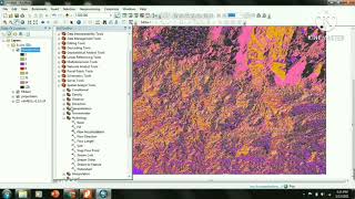
In civil engineering, understanding watersheds and drainage systems is vital for effective water management and infrastructure resilience. Watersheds are areas where all precipitation collects and drains into a common outlet, such as a river or lake. To analyze watersheds, civil engineers utilize Geographic Information Systems (GIS) alongside Digital Elevation Models (DEMs) to map out catchment areas and stream networks.
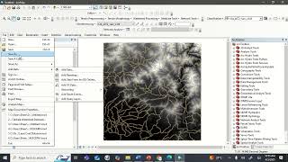
11.4.1 Hydrological Modeling with GIS
Hydrological modeling involves simulations of the movement of water through the environment. Engineers can use the following techniques to enhance this modeling:
- Identifying Watersheds and Sub-Watersheds: GIS tools allow for precise delineation of catchment areas essential for managing water flow.
- Mapping Flow Accumulation and Direction: Understanding how water accumulates and flows is key to preventing erosion and planning stormwater management solutions.
- Planning Check Dams, Reservoirs, and Drainage Paths: Effective water management requires thoughtful planning of infrastructure to manage excess water during rain events.
Through tools like ArcHydro or HEC-HMS, engineers can simulate rainfall-runoff scenarios and evaluate the effectiveness of drainage designs, enhancing urban planning and risk management approaches.
11.4.2 Floodplain Mapping
Floodplain mapping is integral to identifying areas susceptible to flooding. By integrating remote sensing and historical data, engineers can:
- Delineate Flood-Prone Zones: This helps in creating safer infrastructure plans and mitigating risks to property and human life.
- Infrastructure Resilience Planning: Understanding flood risks allows for the construction of buildings and structures that can withstand flooding or are designed to avoid flood-prone areas.
In summary, the integration of GIS technology in watershed and drainage analysis empowers civil engineers to make informed decisions to manage water sustainably and reduce flood risks effectively.
Youtube Videos


Audio Book
Dive deep into the subject with an immersive audiobook experience.
Hydrological Modeling with GIS
Chapter 1 of 2
🔒 Unlock Audio Chapter
Sign up and enroll to access the full audio experience
Chapter Content
Civil engineers model catchment areas and stream networks using DEMs. Tools like ArcHydro or HEC-HMS help in:
- Identifying watersheds and sub-watersheds
- Mapping flow accumulation and direction
- Planning check dams, reservoirs, and drainage paths
Detailed Explanation
In this chunk, we discuss how civil engineers use Geographic Information Systems (GIS) alongside Digital Elevation Models (DEMs) to analyze water flow and drainage in specific areas known as catchment areas. Catchment areas are regions where all the water that falls as rain or melts off snow drains into the same waterbody.
Using GIS tools like ArcHydro or HEC-HMS enables engineers to:
1. Identify watersheds and sub-watersheds: This means they can delineate large areas that contribute water to rivers or lakes and smaller areas within them that also funnel water.
2. Map flow accumulation and direction: They can visualize how rainwater flows across the terrain, identifying where water will gather and how it will move downstream.
3. Plan infrastructure: By understanding where water flows, engineers can strategically place check dams (structures that slow down water flow), reservoirs (for water storage), and drainage paths to manage water effectively and mitigate flooding risks.
Examples & Analogies
Imagine a giant funnel (the catchment area) collecting rainwater from your neighborhood. The engineers use GIS to map out how water trickles down the funnel to a central point (like a lake). By knowing where the water goes, they can build barriers like small hills (check dams) to slow the water down and prevent it from flooding your street.
Floodplain Mapping
Chapter 2 of 2
🔒 Unlock Audio Chapter
Sign up and enroll to access the full audio experience
Chapter Content
Remote sensing and historical data help delineate flood-prone zones for infrastructure resilience planning.
Detailed Explanation
Floodplain mapping is crucial because it helps engineers identify areas that are at risk of flooding, which is especially important for infrastructure planning. In this chunk, we learn that remote sensing (which uses satellite imagery and aerial photography) combined with historical flood data allows engineers to visualize flood-prone areas accurately.
This practice helps in creating maps that show:
- Flood-prone zones: Specific areas that are likely to experience flooding based on previous events and terrain characteristics.
- Infrastructure resilience planning: Knowing where floods are likely to occur, engineers can design roads, buildings, and bridges that are not only able to withstand potential flood conditions but also minimize damage to the community and environment during flood events.
Examples & Analogies
Think of floodplain mapping as creating a map for a treasure hunt, but instead of treasure, the map shows where potential floods could hit next. If you knew where the 'flood treasure' was likely to sweep across, you could place your valuables (like buildings and roads) on higher ground to keep them safe from the flood waters.
Key Concepts
-
Hydrological Modeling: The simulation of water movement through environments, critical for effective watershed management.
-
GIS in Watershed Analysis: Geographic Information Systems are essential tools for visualizing and managing spatial data in hydrology.
-
Floodplain Mapping: The process used to identify areas susceptible to flooding, essential for infrastructure planning.
Examples & Applications
Mapping flood-prone areas using historical rainfall data and GIS insights can help design stormwater systems.
Utilizing DEMs to evaluate drainage paths and identify suitable locations for check dams.
Memory Aids
Interactive tools to help you remember key concepts
Rhymes
In the watershed, where the water flows, Is where we model, and analyze the lows.
Stories
Imagine a river that feeds a small town. Engineers, using GIS, map the highs and lows, planning for floods that can come unexpectedly.
Memory Tools
Remember ‘H-FP’ for Hydrology and Floodplain. It emphasizes two main concepts we discussed today.
Acronyms
FIND (Flood Identification Necessitates Data) helps recall the importance of data in mapping flood-prone areas.
Flash Cards
Glossary
- Watershed
An area of land where all precipitation collects and drains into a common outlet.
- Digital Elevation Models (DEMs)
Three-dimensional representations of the terrain that help in analyzing elevation and topography.
- ArcHydro
A GIS tool designed for modeling hydrology and watershed processes.
- HECHMS
Hydrologic modeling software used for simulating the precipitation-runoff processes of watershed systems.
- Floodplain Mapping
The process of delineating areas likely to be flooded based on historical and current data.
Reference links
Supplementary resources to enhance your learning experience.