
Use of Drones and Imaging
Enroll to start learning
You’ve not yet enrolled in this course. Please enroll for free to listen to audio lessons, classroom podcasts and take practice test.
Interactive Audio Lesson
Listen to a student-teacher conversation explaining the topic in a relatable way.
Introduction to Drones in Compaction
🔒 Unlock Audio Lesson
Sign up and enroll to listen to this audio lesson

Today we’re going to explore how drones can revolutionize soil compaction processes in construction. Drones provide visual mapping capabilities that help assess soil conditions and uniformity.

Can you explain how drones actually help in mapping?
Great question! Drones can capture high-resolution images from above, giving us a comprehensive view of the compaction coverage across a site. We use these images to identify areas that may need more compaction.

So, is this faster than traditional methods?
Exactly! Drones can cover large areas quickly, which saves time and enhances overall efficiency.

What about accuracy in these images?
The images captured are high-resolution, allowing us to assess each section of the compaction accurately. This precision improves the quality of our work.
To summarize, drones enhance soil compaction assessments by providing quick and accurate visual data of the site.
Assessing Uniformity with Imaging Technology
🔒 Unlock Audio Lesson
Sign up and enroll to listen to this audio lesson

Let’s delve deeper into how imaging technology aids in assessing uniformity during soil compaction.

What do you mean by uniformity in compaction?
Uniformity means that the compaction is applied evenly across the entire area, which is crucial for structural integrity.
How does imaging technology help with this?
Imaging provides detailed visuals that allow us to spot inconsistencies in compaction coverage immediately. We can analyze images to identify areas needing more attention.
Are there specific tools we use with imaging?
Yes, some software tools work with drone imagery to help analyze and assess the uniformity, showcasing areas of concern ready for intervention.
In summary, imaging technology plays a vital role in ensuring uniform compaction, enhancing the overall quality of construction.
Introduction & Overview
Read summaries of the section's main ideas at different levels of detail.
Quick Overview
Standard
This section discusses the application of drones and imaging in soil compaction processes, particularly their role in visual mapping and site assessment. These technologies enhance the efficiency and accuracy of compaction work by providing comprehensive visual data on compaction coverage and uniformity.
Detailed
Use of Drones and Imaging
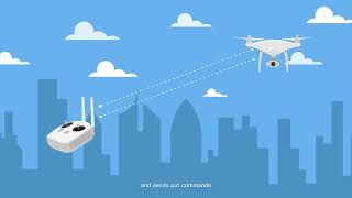
In recent advancements related to soil compaction techniques, the use of drones and imaging technology has garnered significant attention for their potential to enhance efficiency and accuracy. Drones are deployed for visual mapping of construction sites, providing a comprehensive overhead view which is crucial for assessing the uniformity and coverage of soil compaction efforts. This capability allows engineers and project managers to visualize areas that may require additional compaction treatment, thus ensuring a more uniform and stable base for pavement structures. The integration of imaging technology facilitates a detailed analysis of compaction coverage across large areas, providing data that would be difficult to gather using traditional methods. By leveraging these advanced tools, engineers can make more informed decisions and optimize compaction processes, leading to improved structural integrity in highway and pavement construction.
Youtube Videos


Audio Book
Dive deep into the subject with an immersive audiobook experience.
Visual Mapping of Compaction Coverage
Chapter 1 of 2
🔒 Unlock Audio Chapter
Sign up and enroll to access the full audio experience
Chapter Content
• Visual mapping of compaction coverage.
Detailed Explanation
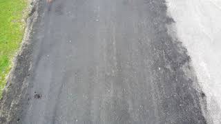
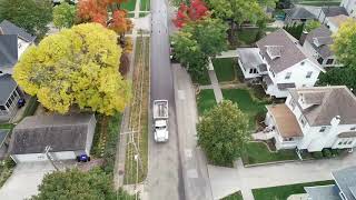
This chunk discusses the use of drones to create visual maps that show where soil compaction has taken place on a construction site. By flying over the area, drones capture images from various angles, allowing engineers and construction teams to see which areas have been compacted adequately and which areas may require additional attention.
Examples & Analogies
Imagine hosting a large outdoor event at a park. Before guests arrive, you want to ensure the grass is evenly trimmed and any muddy spots are addressed. You might take a drone to survey the entire area from above, ensuring every part is ready for guests. Similarly, drones in construction help survey the land, ensuring soil compaction is uniformly applied.
Assessment of Uniformity Across the Site
Chapter 2 of 2
🔒 Unlock Audio Chapter
Sign up and enroll to access the full audio experience
Chapter Content
• Assessment of uniformity across the site.
Detailed Explanation
This piece explains how drones are not only useful for checking where compaction has occurred but also for assessing whether the compaction is uniform across the entire area. Uneven compaction can lead to future structural issues, such as settling or cracking. By analyzing the drone images, engineers can identify any inconsistencies in soil density across the site.
Examples & Analogies
Think about baking a cake: if one side is much thicker than the other, it may not cook evenly, leading to a cake that collapses on one side. In construction, ensuring uniform compaction is like ensuring the cake batter is evenly spread in the pan to cook thoroughly. Drones help visualize these differences, allowing corrective actions.
Key Concepts
-
Drones: Unmanned aerial vehicles used for capturing site imagery and data.
-
Visual Mapping: The practice of producing visual data for surveying and analysis.
-
Uniformity: Achieving even compaction levels across a site for structural integrity.
Examples & Applications
Example of drone imagery showing non-uniform compaction areas, allowing for targeted remediation.
Use of imaging software to analyze drone-captured data to ensure consistent soil densities.
Memory Aids
Interactive tools to help you remember key concepts
Rhymes
To see what’s compacted right or wrong, use drones to map and make it strong.
Stories
Imagine a construction site where workers use drones to survey the land, spotting areas where the soil is not compacted well, leading them to fix it before laying the road.
Memory Tools
D.U.V: Drones for Uniform Visual mapping.
Acronyms
U.C.S
Uniformity in Compaction Stability.
Flash Cards
Glossary
- Drones
Unmanned aerial vehicles used for various purposes including surveying and mapping construction sites.
- Visual Mapping
The process of creating imagery of a site to represent its physical and structural features for analysis.
- Uniformity
The consistency of compaction applied across a construction site, critical for structural stability.
Reference links
Supplementary resources to enhance your learning experience.